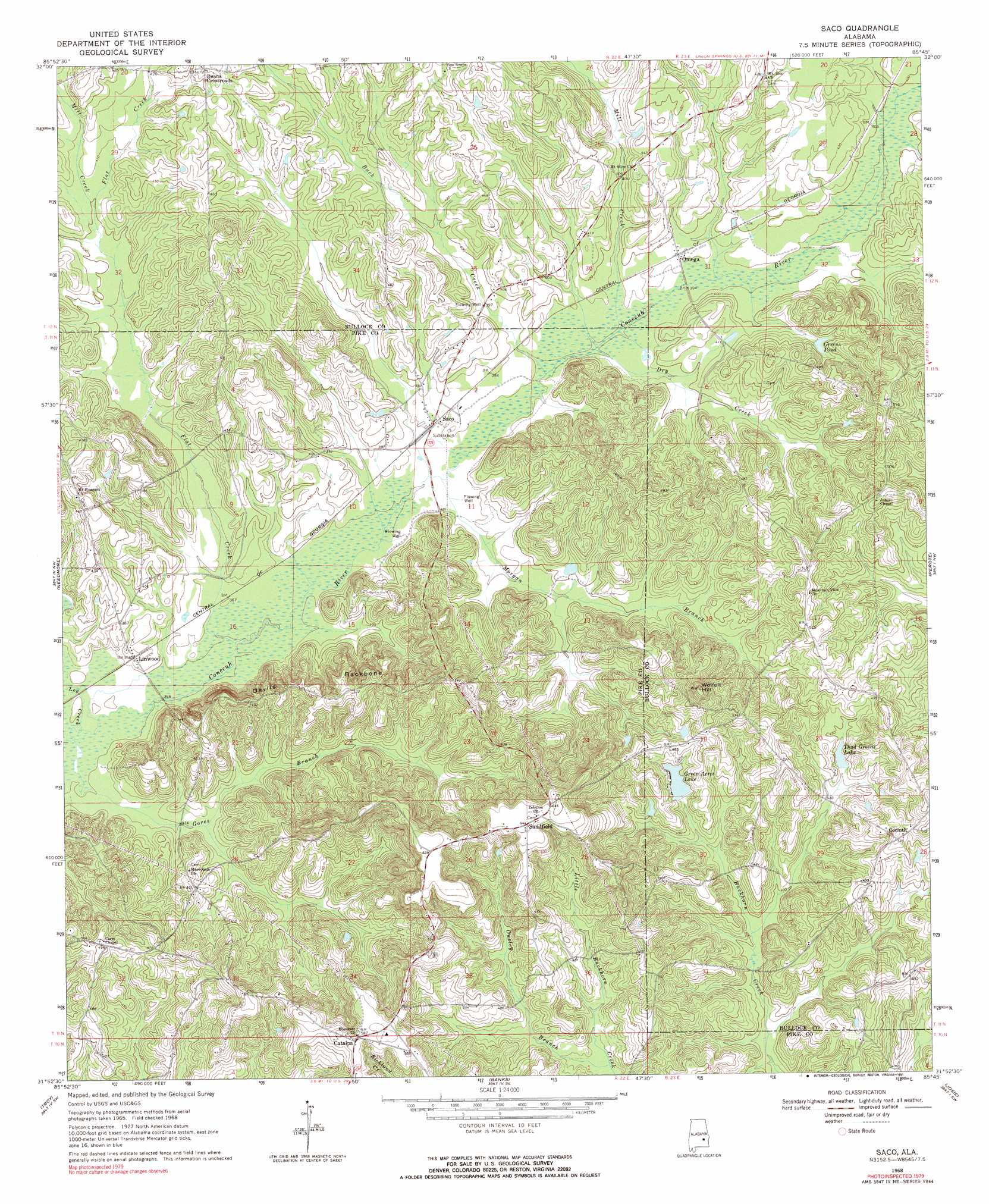
Saco Topo Map Alabama
To zoom in, hover over the map of Saco
USGS Topo Quad 31085h7 - 1:24,000 scale
| Topo Map Name: | Saco |
| USGS Topo Quad ID: | 31085h7 |
| Print Size: | ca. 21 1/4" wide x 27" high |
| Southeast Coordinates: | 31.875° N latitude / 85.75° W longitude |
| Map Center Coordinates: | 31.9375° N latitude / 85.8125° W longitude |
| U.S. State: | AL |
| Filename: | o31085h7.jpg |
| Download Map JPG Image: | Saco topo map 1:24,000 scale |
| Map Type: | Topographic |
| Topo Series: | 7.5´ |
| Map Scale: | 1:24,000 |
| Source of Map Images: | United States Geological Survey (USGS) |
| Alternate Map Versions: |
Saco AL 1968, updated 1971 Download PDF Buy paper map Saco AL 1968, updated 1991 Download PDF Buy paper map Saco AL 2011 Download PDF Buy paper map Saco AL 2014 Download PDF Buy paper map |
1:24,000 Topo Quads surrounding Saco
Teasleys Mill |
Fitzpatrick |
Thompson |
Union Springs |
Roba |
Pine Level |
China Grove |
Almeria |
Aberfoil |
Midway |
Ansley |
Needmore |
Saco |
Perote |
Mount Andrew |
Youngblood |
Troy |
Banks |
Josie |
Louisville |
Goshen |
Brundidge Nw |
Brundidge |
Elamville |
Clio |
> Back to 31085e1 at 1:100,000 scale
> Back to 31084a1 at 1:250,000 scale
> Back to U.S. Topo Maps home
Saco topo map: Gazetteer
Saco: Dams
Green Dam elevation 135m 442′Troy Rod and Gun Club elevation 135m 442′
Saco: Populated Places
Beans Crossroads elevation 143m 469′Catalpa elevation 178m 583′
Colina elevation 122m 400′
Corinth elevation 162m 531′
Ezell elevation 153m 501′
Linwood elevation 115m 377′
Omega elevation 119m 390′
Saco elevation 116m 380′
Sandfield elevation 195m 639′
Sellers Crossroads elevation 157m 515′
Saco: Reservoirs
Green Acres Lake elevation 134m 439′Greens Pond elevation 131m 429′
Thad Greens Lake elevation 133m 436′
Saco: Ridges
Devils Backbone elevation 158m 518′Saco: Streams
Buck Creek elevation 115m 377′Dry Creek elevation 116m 380′
Flat Creek elevation 110m 360′
Gores Branch elevation 107m 351′
Log Creek elevation 108m 354′
Mill Creek elevation 122m 400′
Mill Creek elevation 116m 380′
Morgan Branch elevation 113m 370′
Ousley Branch elevation 124m 406′
Saco: Summits
Wolfpit Hill elevation 197m 646′Saco digital topo map on disk
Buy this Saco topo map showing relief, roads, GPS coordinates and other geographical features, as a high-resolution digital map file on DVD:
Gulf Coast (LA, MS, AL, FL) & Southwestern Georgia
Buy digital topo maps: Gulf Coast (LA, MS, AL, FL) & Southwestern Georgia
 & Southwestern Georgia map DVD")