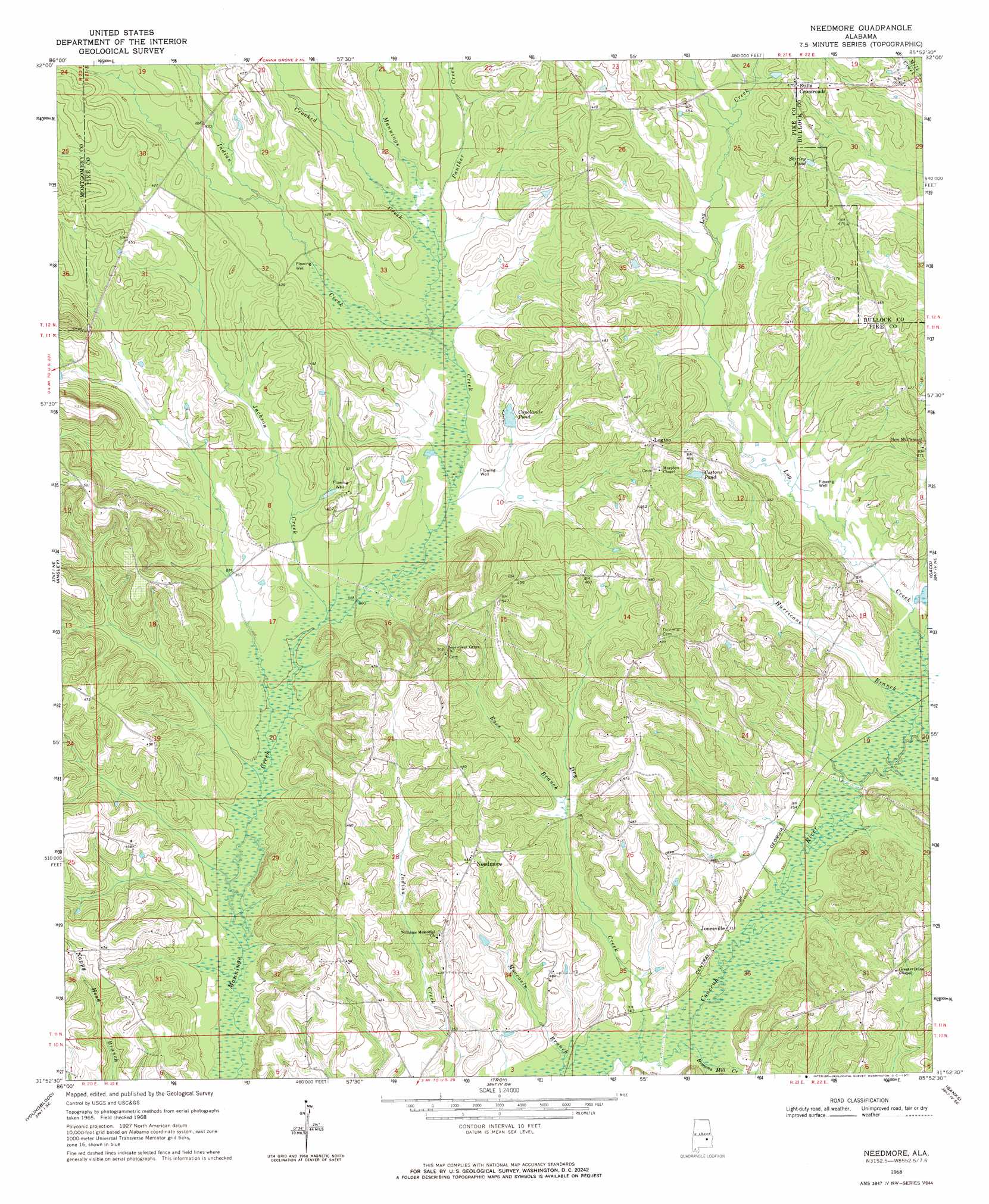
Needmore Topo Map Alabama
To zoom in, hover over the map of Needmore
USGS Topo Quad 31085h8 - 1:24,000 scale
| Topo Map Name: | Needmore |
| USGS Topo Quad ID: | 31085h8 |
| Print Size: | ca. 21 1/4" wide x 27" high |
| Southeast Coordinates: | 31.875° N latitude / 85.875° W longitude |
| Map Center Coordinates: | 31.9375° N latitude / 85.9375° W longitude |
| U.S. State: | AL |
| Filename: | o31085h8.jpg |
| Download Map JPG Image: | Needmore topo map 1:24,000 scale |
| Map Type: | Topographic |
| Topo Series: | 7.5´ |
| Map Scale: | 1:24,000 |
| Source of Map Images: | United States Geological Survey (USGS) |
| Alternate Map Versions: |
Needmore AL 1968, updated 1971 Download PDF Buy paper map Needmore AL 2011 Download PDF Buy paper map Needmore AL 2014 Download PDF Buy paper map |
1:24,000 Topo Quads surrounding Needmore
Davis Crossroads |
Teasleys Mill |
Fitzpatrick |
Thompson |
Union Springs |
Ramer |
Pine Level |
China Grove |
Almeria |
Aberfoil |
Grady |
Ansley |
Needmore |
Saco |
Perote |
Petrey |
Youngblood |
Troy |
Banks |
Josie |
Glenwood |
Goshen |
Brundidge Nw |
Brundidge |
Elamville |
> Back to 31085e1 at 1:100,000 scale
> Back to 31084a1 at 1:250,000 scale
> Back to U.S. Topo Maps home
Needmore topo map: Gazetteer
Needmore: Dams
Henderson Lake Dam elevation 122m 400′Needmore: Populated Places
Jonesville elevation 108m 354′Lewis elevation 142m 465′
Logton elevation 144m 472′
Needmore elevation 140m 459′
Stills Crossroads elevation 142m 465′
Needmore: Post Offices
Fryers Branch Post Office (historical) elevation 110m 360′Needmore: Reservoirs
Copelands Pond elevation 119m 390′Costons Pond elevation 131m 429′
Shirley Pond elevation 141m 462′
Needmore: Streams
Browns Mill Creek elevation 103m 337′Crooked Creek elevation 117m 383′
Dry Creek elevation 103m 337′
Hurricane Branch elevation 107m 351′
Indian Creek elevation 116m 380′
Jackson Creek elevation 108m 354′
Panther Creek elevation 117m 383′
Ross Branch elevation 114m 374′
Needmore digital topo map on disk
Buy this Needmore topo map showing relief, roads, GPS coordinates and other geographical features, as a high-resolution digital map file on DVD:
Gulf Coast (LA, MS, AL, FL) & Southwestern Georgia
Buy digital topo maps: Gulf Coast (LA, MS, AL, FL) & Southwestern Georgia
 & Southwestern Georgia map DVD")