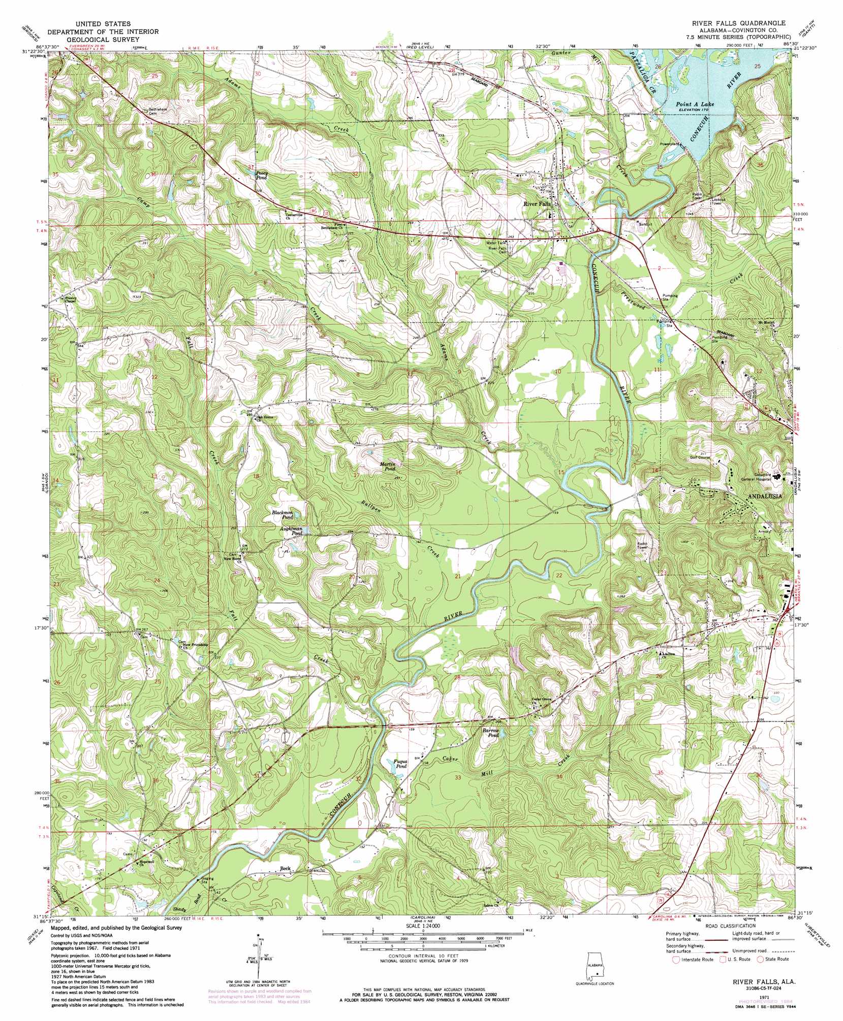
River Falls Topo Map Alabama
To zoom in, hover over the map of River Falls
USGS Topo Quad 31086c5 - 1:24,000 scale
| Topo Map Name: | River Falls |
| USGS Topo Quad ID: | 31086c5 |
| Print Size: | ca. 21 1/4" wide x 27" high |
| Southeast Coordinates: | 31.25° N latitude / 86.5° W longitude |
| Map Center Coordinates: | 31.3125° N latitude / 86.5625° W longitude |
| U.S. State: | AL |
| Filename: | o31086c5.jpg |
| Download Map JPG Image: | River Falls topo map 1:24,000 scale |
| Map Type: | Topographic |
| Topo Series: | 7.5´ |
| Map Scale: | 1:24,000 |
| Source of Map Images: | United States Geological Survey (USGS) |
| Alternate Map Versions: |
River Falls AL 1971, updated 1973 Download PDF Buy paper map River Falls AL 1971, updated 1984 Download PDF Buy paper map River Falls AL 2011 Download PDF Buy paper map River Falls AL 2014 Download PDF Buy paper map |
1:24,000 Topo Quads surrounding River Falls
Garland |
Mckenzie |
Industry |
Leon |
Brantley |
Old Town |
Brooks |
Red Level |
Gantt |
Dozier |
Brooklyn |
Loango |
River Falls |
Andalusia |
Opp West |
Damascus |
Dixie |
Carolina |
Libertyville |
Onycha |
Parker Springs |
Bradley |
Wing |
Watkins Bridge |
Florala |
> Back to 31086a1 at 1:100,000 scale
> Back to 31086a1 at 1:250,000 scale
> Back to U.S. Topo Maps home
River Falls topo map: Gazetteer
River Falls: Dams
Point A Dam elevation 52m 170′River Falls: Lakes
Aughtman Pond elevation 65m 213′River Falls: Populated Places
Beck elevation 46m 150′River Falls elevation 61m 200′
River Falls: Post Offices
River Falls Post Office elevation 59m 193′River Falls: Reservoirs
Barrow Pond elevation 67m 219′Blackmon Pond elevation 68m 223′
Fuqua Pond elevation 45m 147′
Martin Pond elevation 63m 206′
Posey Pond elevation 87m 285′
River Falls: Streams
Adams Creek elevation 39m 127′Bullpen Creek elevation 35m 114′
Camp Creek elevation 45m 147′
Coker Mill Creek elevation 35m 114′
Fall Creek elevation 35m 114′
Gunter Mill Creek elevation 41m 134′
Patsaliga Creek elevation 52m 170′
Prestwood Creek elevation 39m 127′
Shady Bend Creek elevation 37m 121′
River Falls digital topo map on disk
Buy this River Falls topo map showing relief, roads, GPS coordinates and other geographical features, as a high-resolution digital map file on DVD:
Gulf Coast (LA, MS, AL, FL) & Southwestern Georgia
Buy digital topo maps: Gulf Coast (LA, MS, AL, FL) & Southwestern Georgia
 & Southwestern Georgia map DVD")