Red Level Topo Map Alabama
To zoom in, hover over the map of Red Level
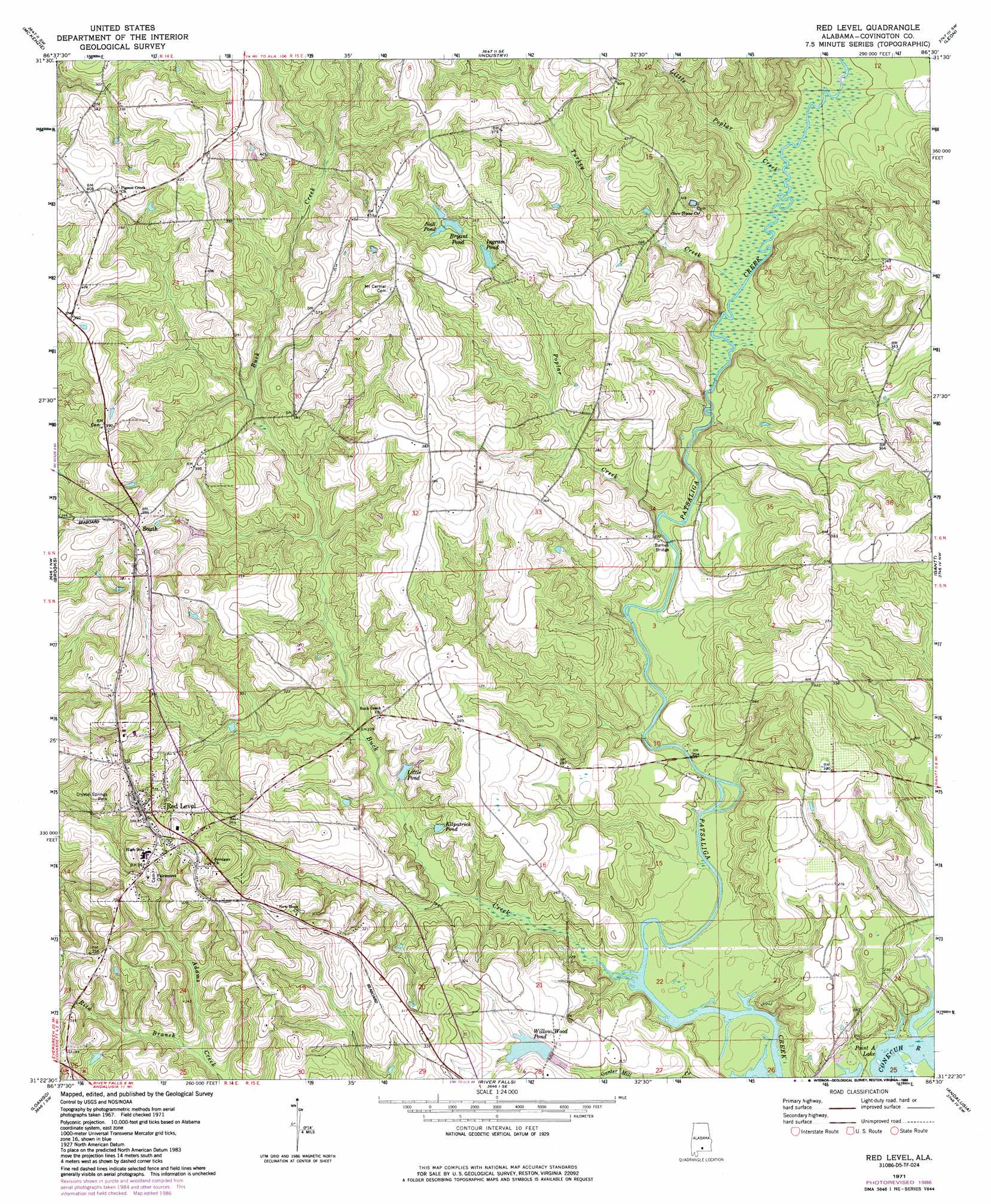
USGS Topo Quad 31086d5 - 1:24,000 scale
| Topo Map Name: | Red Level |
| USGS Topo Quad ID: | 31086d5 |
| Print Size: | ca. 21 1/4" wide x 27" high |
| Southeast Coordinates: | 31.375° N latitude / 86.5° W longitude |
| Map Center Coordinates: | 31.4375° N latitude / 86.5625° W longitude |
| U.S. State: | AL |
| Filename: | o31086d5.jpg |
| Download Map JPG Image: | Red Level topo map 1:24,000 scale |
| Map Type: | Topographic |
| Topo Series: | 7.5´ |
| Map Scale: | 1:24,000 |
| Source of Map Images: | United States Geological Survey (USGS) |
| Alternate Map Versions: |
Red Level AL 1971, updated 1973 Download PDF Buy paper map Red Level AL 1971, updated 1986 Download PDF Buy paper map Red Level AL 2011 Download PDF Buy paper map Red Level AL 2014 Download PDF Buy paper map |
1:24,000 Topo Quads surrounding Red Level
Georgiana West |
Georgiana East |
Pigeon Creek |
Moodys Crossroads |
Luverne |
Garland |
Mckenzie |
Industry |
Leon |
Brantley |
Old Town |
Brooks |
Red Level |
Gantt |
Dozier |
Brooklyn |
Loango |
River Falls |
Andalusia |
Opp West |
Damascus |
Dixie |
Carolina |
Libertyville |
Onycha |
> Back to 31086a1 at 1:100,000 scale
> Back to 31086a1 at 1:250,000 scale
> Back to U.S. Topo Maps home
Red Level topo map: Gazetteer
Red Level: Bridges
Barnes Bridge elevation 57m 187′Red Level: Dams
James Ingram Lake Dam elevation 97m 318′James Ingram Lake Dam elevation 91m 298′
W C Huggins Dam elevation 78m 255′
Red Level: Parks
Crystal Springs Park elevation 83m 272′Red Level: Populated Places
Red Level elevation 108m 354′Rhump elevation 112m 367′
Red Level: Reservoirs
Bryant Pond elevation 105m 344′Ingram Pond elevation 98m 321′
Ingram Pond Number Two elevation 91m 298′
Kilpatrick Pond elevation 73m 239′
Little Pond elevation 71m 232′
Nall Pond elevation 107m 351′
Willow Wood Pond elevation 79m 259′
Red Level: Streams
Buck Creek elevation 52m 170′Little Poplar Creek elevation 61m 200′
Poplar Creek elevation 57m 187′
Rita Branch elevation 77m 252′
Turkey Creek elevation 60m 196′
Red Level digital topo map on disk
Buy this Red Level topo map showing relief, roads, GPS coordinates and other geographical features, as a high-resolution digital map file on DVD:
Gulf Coast (LA, MS, AL, FL) & Southwestern Georgia
Buy digital topo maps: Gulf Coast (LA, MS, AL, FL) & Southwestern Georgia
 & Southwestern Georgia map DVD")