Brantley Topo Map Alabama
To zoom in, hover over the map of Brantley
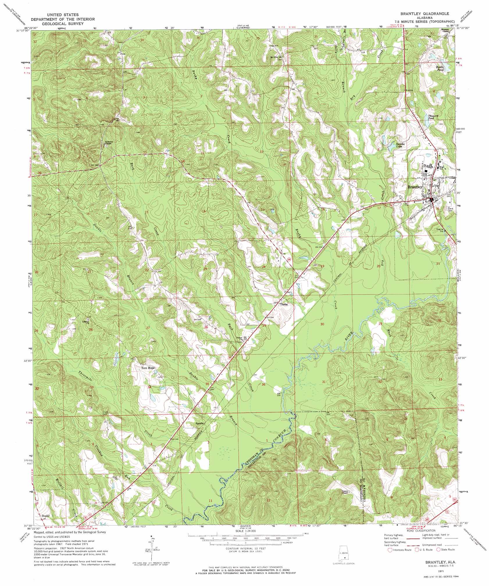
USGS Topo Quad 31086e3 - 1:24,000 scale
| Topo Map Name: | Brantley |
| USGS Topo Quad ID: | 31086e3 |
| Print Size: | ca. 21 1/4" wide x 27" high |
| Southeast Coordinates: | 31.5° N latitude / 86.25° W longitude |
| Map Center Coordinates: | 31.5625° N latitude / 86.3125° W longitude |
| U.S. State: | AL |
| Filename: | o31086e3.jpg |
| Download Map JPG Image: | Brantley topo map 1:24,000 scale |
| Map Type: | Topographic |
| Topo Series: | 7.5´ |
| Map Scale: | 1:24,000 |
| Source of Map Images: | United States Geological Survey (USGS) |
| Alternate Map Versions: |
Brantley AL 1971, updated 1973 Download PDF Buy paper map Brantley AL 2011 Download PDF Buy paper map Brantley AL 2014 Download PDF Buy paper map |
1:24,000 Topo Quads surrounding Brantley
Greenville East |
Honoraville |
Fullers Crossroads |
Petrey |
Youngblood |
Pigeon Creek |
Moodys Crossroads |
Luverne |
Glenwood |
Goshen |
Industry |
Leon |
Brantley |
Bullock |
Bluff Springs |
Red Level |
Gantt |
Dozier |
Danleys Crossroads |
Elba |
River Falls |
Andalusia |
Opp West |
Opp East |
Ino |
> Back to 31086e1 at 1:100,000 scale
> Back to 31086a1 at 1:250,000 scale
> Back to U.S. Topo Maps home
Brantley topo map: Gazetteer
Brantley: Dams
Bailey Dam elevation 119m 390′Bryce Smith Dam elevation 90m 295′
Clark Lake Dam elevation 80m 262′
L D Thaggard Dam elevation 89m 291′
Brantley: Parks
Brantley Stadium elevation 92m 301′Brantley: Populated Places
Brantley elevation 90m 295′New Hope elevation 104m 341′
Theba elevation 88m 288′
Brantley: Reservoirs
Bealls Pond elevation 103m 337′Clark Lake elevation 80m 262′
Smiths Lake elevation 82m 269′
Thagard Pond elevation 92m 301′
Brantley: Streams
Buck Creek elevation 67m 219′Bushy Creek elevation 70m 229′
Crooked Run Creek elevation 64m 209′
Double Branch elevation 67m 219′
Dry Creek elevation 70m 229′
Muck Creek elevation 68m 223′
Sally Branch elevation 81m 265′
Shinglepile Branch elevation 85m 278′
Threemile Creek elevation 66m 216′
Brantley digital topo map on disk
Buy this Brantley topo map showing relief, roads, GPS coordinates and other geographical features, as a high-resolution digital map file on DVD:
Gulf Coast (LA, MS, AL, FL) & Southwestern Georgia
Buy digital topo maps: Gulf Coast (LA, MS, AL, FL) & Southwestern Georgia
 & Southwestern Georgia map DVD")