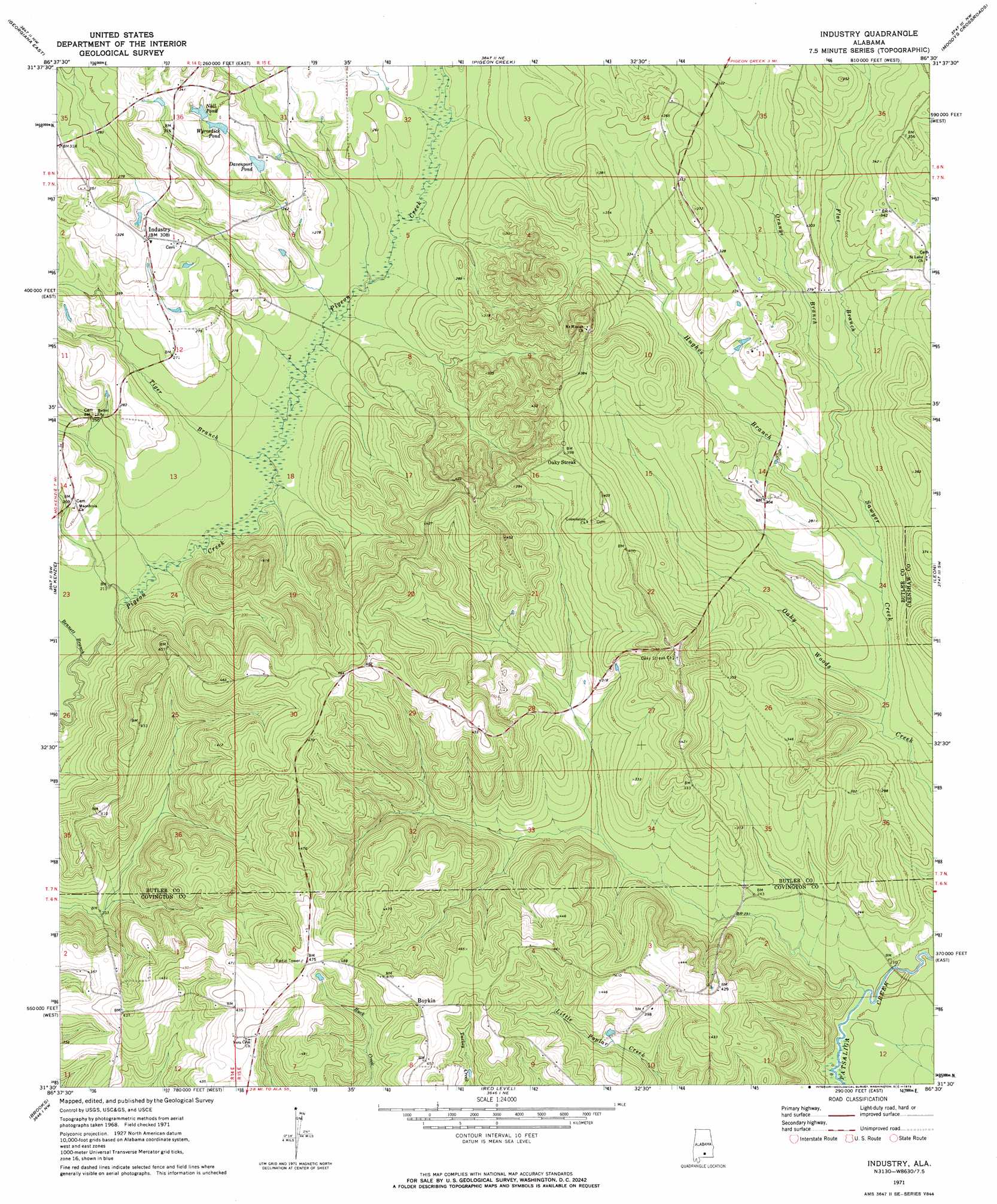
Industry Topo Map Alabama
To zoom in, hover over the map of Industry
USGS Topo Quad 31086e5 - 1:24,000 scale
| Topo Map Name: | Industry |
| USGS Topo Quad ID: | 31086e5 |
| Print Size: | ca. 21 1/4" wide x 27" high |
| Southeast Coordinates: | 31.5° N latitude / 86.5° W longitude |
| Map Center Coordinates: | 31.5625° N latitude / 86.5625° W longitude |
| U.S. State: | AL |
| Filename: | o31086e5.jpg |
| Download Map JPG Image: | Industry topo map 1:24,000 scale |
| Map Type: | Topographic |
| Topo Series: | 7.5´ |
| Map Scale: | 1:24,000 |
| Source of Map Images: | United States Geological Survey (USGS) |
| Alternate Map Versions: |
Industry AL 1971, updated 1973 Download PDF Buy paper map Industry AL 2011 Download PDF Buy paper map Industry AL 2014 Download PDF Buy paper map |
1:24,000 Topo Quads surrounding Industry
Forest Home |
Greenville West |
Greenville East |
Honoraville |
Fullers Crossroads |
Georgiana West |
Georgiana East |
Pigeon Creek |
Moodys Crossroads |
Luverne |
Garland |
Mckenzie |
Industry |
Leon |
Brantley |
Old Town |
Brooks |
Red Level |
Gantt |
Dozier |
Brooklyn |
Loango |
River Falls |
Andalusia |
Opp West |
> Back to 31086e1 at 1:100,000 scale
> Back to 31086a1 at 1:250,000 scale
> Back to U.S. Topo Maps home
Industry topo map: Gazetteer
Industry: Dams
Wyrosdick Pond Dam elevation 85m 278′Industry: Populated Places
Boykin elevation 143m 469′Industry elevation 95m 311′
Oaky Streak elevation 113m 370′
Vera Cruz (historical) elevation 133m 436′
Industry: Post Offices
Middleton Post Office (historical) elevation 120m 393′Industry: Reservoirs
Davenport Pond elevation 83m 272′Nall Pond elevation 91m 298′
Wyrosdick Pond elevation 85m 278′
Industry: Streams
Bennett Branch elevation 61m 200′Flat Branch elevation 77m 252′
Hughes Branch elevation 71m 232′
Orange Branch elevation 77m 252′
Sawyer Creek elevation 69m 226′
Tiger Branch elevation 64m 209′
Industry digital topo map on disk
Buy this Industry topo map showing relief, roads, GPS coordinates and other geographical features, as a high-resolution digital map file on DVD:
Gulf Coast (LA, MS, AL, FL) & Southwestern Georgia
Buy digital topo maps: Gulf Coast (LA, MS, AL, FL) & Southwestern Georgia
 & Southwestern Georgia map DVD")