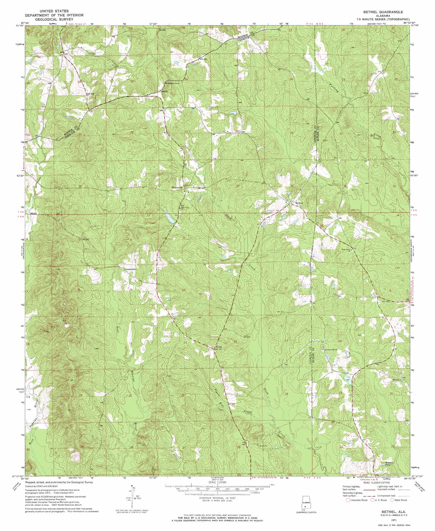
Bethel Topo Map Alabama
To zoom in, hover over the map of Bethel
USGS Topo Quad 31086f8 - 1:24,000 scale
| Topo Map Name: | Bethel |
| USGS Topo Quad ID: | 31086f8 |
| Print Size: | ca. 21 1/4" wide x 27" high |
| Southeast Coordinates: | 31.625° N latitude / 86.875° W longitude |
| Map Center Coordinates: | 31.6875° N latitude / 86.9375° W longitude |
| U.S. State: | AL |
| Filename: | o31086f8.jpg |
| Download Map JPG Image: | Bethel topo map 1:24,000 scale |
| Map Type: | Topographic |
| Topo Series: | 7.5´ |
| Map Scale: | 1:24,000 |
| Source of Map Images: | United States Geological Survey (USGS) |
| Alternate Map Versions: |
Bethel AL 1971, updated 1974 Download PDF Buy paper map Bethel AL 2011 Download PDF Buy paper map Bethel AL 2014 Download PDF Buy paper map |
1:24,000 Topo Quads surrounding Bethel
Rosebud |
Oak Hill |
Pine Apple North |
Ridgeville |
Fort Dale |
Nadawah |
Mcwilliams |
Pine Apple South |
Forest Home |
Greenville West |
Beatrice |
Skinnerton |
Bethel |
Georgiana West |
Georgiana East |
Burnt Corn |
China |
Lyeffion |
Garland |
Mckenzie |
Repton |
Belleville |
Evergreen |
Old Town |
Brooks |
> Back to 31086e1 at 1:100,000 scale
> Back to 31086a1 at 1:250,000 scale
> Back to U.S. Topo Maps home
Bethel topo map: Gazetteer
Bethel: Dams
Alvin Mixon Dam elevation 105m 344′Bethel: Lakes
Bennett Pond elevation 81m 265′Bethel: Populated Places
Bethel elevation 115m 377′Commerce elevation 115m 377′
Deans elevation 109m 357′
Mixonville elevation 110m 360′
Bethel: Post Offices
Milo Post Office (historical) elevation 107m 351′Sepulga Post Office (historical) elevation 95m 311′
Bethel: Reservoirs
Alvin Mixon Lake elevation 105m 344′Bethel: Streams
Horse Branch elevation 82m 269′Little Duck Creek elevation 84m 275′
Tigett Mill Creek elevation 79m 259′
Bethel digital topo map on disk
Buy this Bethel topo map showing relief, roads, GPS coordinates and other geographical features, as a high-resolution digital map file on DVD:
Gulf Coast (LA, MS, AL, FL) & Southwestern Georgia
Buy digital topo maps: Gulf Coast (LA, MS, AL, FL) & Southwestern Georgia
 & Southwestern Georgia map DVD")