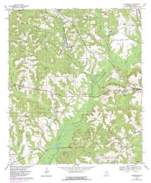
Youngblood Topo Map Alabama
To zoom in, hover over the map of Youngblood
USGS Topo Quad 31086g1 - 1:24,000 scale
| Topo Map Name: | Youngblood |
| USGS Topo Quad ID: | 31086g1 |
| Print Size: | ca. 21 1/4" wide x 27" high |
| Southeast Coordinates: | 31.75° N latitude / 86° W longitude |
| Map Center Coordinates: | 31.8125° N latitude / 86.0625° W longitude |
| U.S. State: | AL |
| Filename: | o31086g1.jpg |
| Download Map JPG Image: | Youngblood topo map 1:24,000 scale |
| Map Type: | Topographic |
| Topo Series: | 7.5´ |
| Map Scale: | 1:24,000 |
| Source of Map Images: | United States Geological Survey (USGS) |
| Alternate Map Versions: |
Youngblood AL 1968, updated 1970 Download PDF Buy paper map Youngblood AL 1968, updated 1981 Download PDF Buy paper map Youngblood AL 2011 Download PDF Buy paper map Youngblood AL 2014 Download PDF Buy paper map |
1:24,000 Topo Quads surrounding Youngblood
> Back to 31086e1 at 1:100,000 scale
> Back to 31086a1 at 1:250,000 scale
> Back to U.S. Topo Maps home
Youngblood topo map: Gazetteer
Youngblood: Airports
Troy Municipal Airport elevation 119m 390′Youngblood: Bridges
Fishtrap Bridge elevation 95m 311′Youngblood: Dams
Milton Carter Dam elevation 100m 328′Youngblood Dam elevation 104m 341′
Youngblood: Populated Places
Allred elevation 148m 485′Good Hope elevation 128m 419′
Hephzibah elevation 162m 531′
Lees Park elevation 114m 374′
Meadow Grove elevation 163m 534′
River Ridge elevation 126m 413′
Town and Country Estates elevation 150m 492′
Youngblood elevation 111m 364′
Youngblood: Reservoirs
Carters Pond elevation 97m 318′Lake Haven elevation 107m 351′
Whaleys Pond elevation 137m 449′
Youngblood Lake elevation 104m 341′
Youngblood: Streams
Beeman Creek elevation 97m 318′Boyds Mill Creek elevation 106m 347′
Double Branch elevation 93m 305′
Indian Creek elevation 90m 295′
Jordan Creek elevation 96m 314′
Messick Branch elevation 106m 347′
Mill Creek elevation 95m 311′
Pearson Branch elevation 109m 357′
Thunder Spring Creek elevation 91m 298′
Youngblood Creek elevation 95m 311′
Youngblood digital topo map on disk
Buy this Youngblood topo map showing relief, roads, GPS coordinates and other geographical features, as a high-resolution digital map file on DVD:
Gulf Coast (LA, MS, AL, FL) & Southwestern Georgia
Buy digital topo maps: Gulf Coast (LA, MS, AL, FL) & Southwestern Georgia


