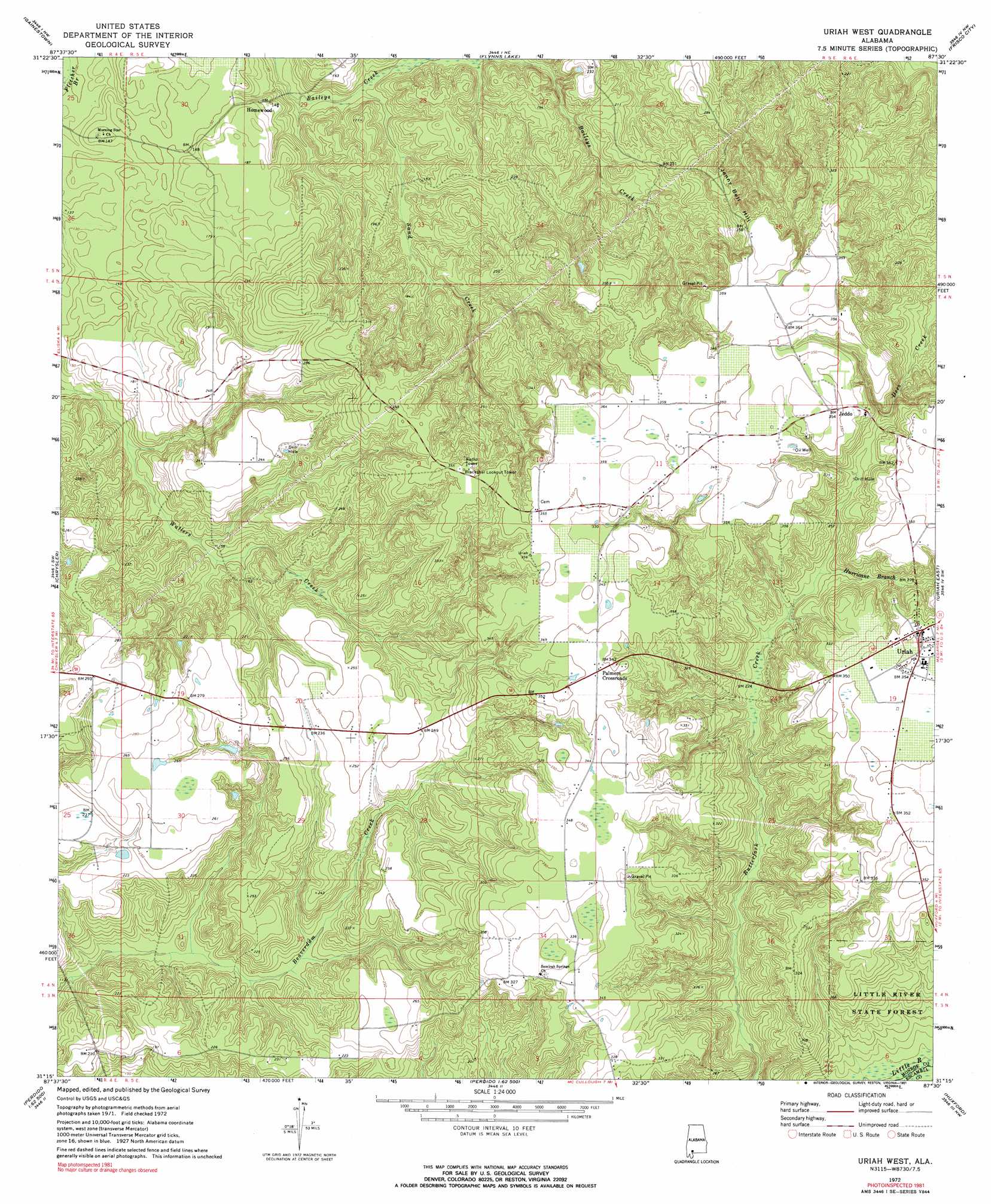
Uriah West Topo Map Alabama
To zoom in, hover over the map of Uriah West
USGS Topo Quad 31087c5 - 1:24,000 scale
| Topo Map Name: | Uriah West |
| USGS Topo Quad ID: | 31087c5 |
| Print Size: | ca. 21 1/4" wide x 27" high |
| Southeast Coordinates: | 31.25° N latitude / 87.5° W longitude |
| Map Center Coordinates: | 31.3125° N latitude / 87.5625° W longitude |
| U.S. State: | AL |
| Filename: | o31087c5.jpg |
| Download Map JPG Image: | Uriah West topo map 1:24,000 scale |
| Map Type: | Topographic |
| Topo Series: | 7.5´ |
| Map Scale: | 1:24,000 |
| Source of Map Images: | United States Geological Survey (USGS) |
| Alternate Map Versions: |
Uriah West AL 1972, updated 1974 Download PDF Buy paper map Uriah West AL 1972, updated 1991 Download PDF Buy paper map Uriah West AL 2011 Download PDF Buy paper map Uriah West AL 2014 Download PDF Buy paper map |
1:24,000 Topo Quads surrounding Uriah West
Walker Springs |
Suggsville |
Claiborne |
Mexia |
Monroeville |
Choctaw Bluff |
Gainestown |
Flynns Lake |
Frisco City |
Excel |
Carlton |
Chrysler |
Uriah West |
Uriah East |
Frisco City Se |
Tensaw |
Blacksher |
Mccullough |
Huxford |
Barnett Crossroads |
Vaughn |
Perdido |
Freemanville |
Atmore |
Flomaton |
> Back to 31087a1 at 1:100,000 scale
> Back to 31086a1 at 1:250,000 scale
> Back to U.S. Topo Maps home
Uriah West topo map: Gazetteer
Uriah West: Oilfields
Uriah Oil Field elevation 97m 318′Wallers Creek Oil Field elevation 92m 301′
Uriah West: Populated Places
Homewood elevation 49m 160′Jeddo elevation 108m 354′
Palmers Crossroads elevation 107m 351′
Uriah elevation 107m 351′
Uriah West: Streams
Hurricane Branch elevation 71m 232′Sand Creek elevation 30m 98′
Uriah West: Summits
Jenny Bell Hill elevation 109m 357′Uriah West digital topo map on disk
Buy this Uriah West topo map showing relief, roads, GPS coordinates and other geographical features, as a high-resolution digital map file on DVD:
Gulf Coast (LA, MS, AL, FL) & Southwestern Georgia
Buy digital topo maps: Gulf Coast (LA, MS, AL, FL) & Southwestern Georgia
 & Southwestern Georgia map DVD")