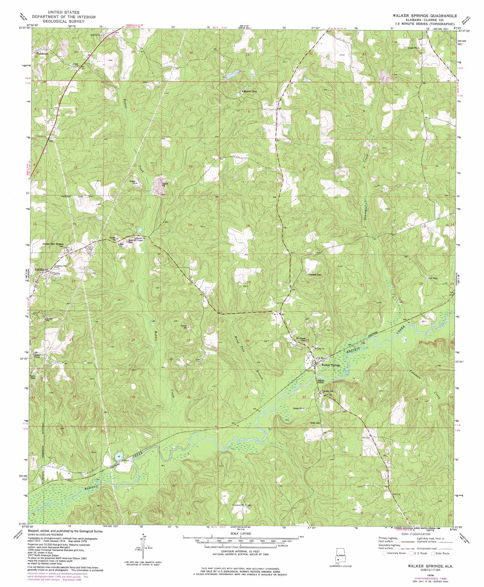
Walker Springs Topo Map Alabama
To zoom in, hover over the map of Walker Springs
USGS Topo Quad 31087e7 - 1:24,000 scale
| Topo Map Name: | Walker Springs |
| USGS Topo Quad ID: | 31087e7 |
| Print Size: | ca. 21 1/4" wide x 27" high |
| Southeast Coordinates: | 31.5° N latitude / 87.75° W longitude |
| Map Center Coordinates: | 31.5625° N latitude / 87.8125° W longitude |
| U.S. State: | AL |
| Filename: | o31087e7.jpg |
| Download Map JPG Image: | Walker Springs topo map 1:24,000 scale |
| Map Type: | Topographic |
| Topo Series: | 7.5´ |
| Map Scale: | 1:24,000 |
| Source of Map Images: | United States Geological Survey (USGS) |
| Alternate Map Versions: |
Walker Springs AL 1978, updated 1986 Download PDF Buy paper map Walker Springs AL 2011 Download PDF Buy paper map Walker Springs AL 2014 Download PDF Buy paper map |
1:24,000 Topo Quads surrounding Walker Springs
Coffeeville |
Mcentyre |
Fulton West |
Fulton East |
Lower Peach Tree |
Tattlersville |
Winn |
Grove Hill |
Whatley |
Chance |
Saint Stephens |
Jackson |
Walker Springs |
Suggsville |
Claiborne |
Wagarville |
Prestwick |
Choctaw Bluff |
Gainestown |
Flynns Lake |
Mcintosh |
Gin House Island |
Carlton |
Chrysler |
Uriah West |
> Back to 31087e1 at 1:100,000 scale
> Back to 31086a1 at 1:250,000 scale
> Back to U.S. Topo Maps home
Walker Springs topo map: Gazetteer
Walker Springs: Dams
Maubila Boy Scout Lake Dam elevation 76m 249′Walker Springs: Lakes
Lake Daddy Jim Spring elevation 41m 134′Walker Springs: Populated Places
Walker Springs elevation 24m 78′Walker Springs: Reservoirs
Maubila Boy Scout Lake elevation 76m 249′Walker Springs: Streams
Coleman Creek elevation 23m 75′Hand Pole Branch elevation 20m 65′
Rabbit Creek elevation 15m 49′
Simmons Creek elevation 24m 78′
Walker Springs digital topo map on disk
Buy this Walker Springs topo map showing relief, roads, GPS coordinates and other geographical features, as a high-resolution digital map file on DVD:
Gulf Coast (LA, MS, AL, FL) & Southwestern Georgia
Buy digital topo maps: Gulf Coast (LA, MS, AL, FL) & Southwestern Georgia
 & Southwestern Georgia map DVD")