Skinnerton Topo Map Alabama
To zoom in, hover over the map of Skinnerton
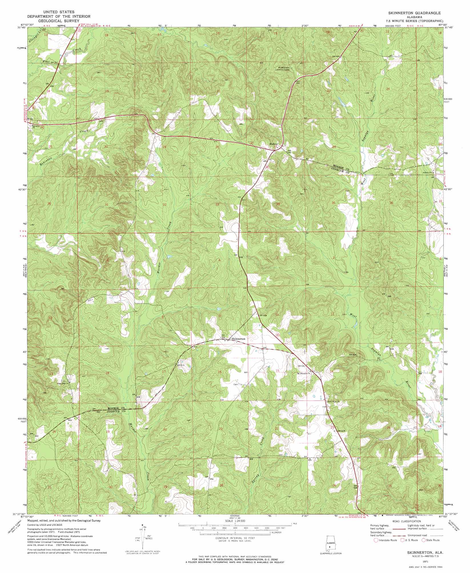
USGS Topo Quad 31087f1 - 1:24,000 scale
| Topo Map Name: | Skinnerton |
| USGS Topo Quad ID: | 31087f1 |
| Print Size: | ca. 21 1/4" wide x 27" high |
| Southeast Coordinates: | 31.625° N latitude / 87° W longitude |
| Map Center Coordinates: | 31.6875° N latitude / 87.0625° W longitude |
| U.S. State: | AL |
| Filename: | o31087f1.jpg |
| Download Map JPG Image: | Skinnerton topo map 1:24,000 scale |
| Map Type: | Topographic |
| Topo Series: | 7.5´ |
| Map Scale: | 1:24,000 |
| Source of Map Images: | United States Geological Survey (USGS) |
| Alternate Map Versions: |
Skinnerton AL 1971, updated 1974 Download PDF Buy paper map Skinnerton AL 1971, updated 1974 Download PDF Buy paper map Skinnerton AL 2011 Download PDF Buy paper map Skinnerton AL 2014 Download PDF Buy paper map |
1:24,000 Topo Quads surrounding Skinnerton
Camden South |
Rosebud |
Oak Hill |
Pine Apple North |
Ridgeville |
Vredenburgh |
Nadawah |
Mcwilliams |
Pine Apple South |
Forest Home |
Natchez |
Beatrice |
Skinnerton |
Bethel |
Georgiana West |
Monroeville |
Burnt Corn |
China |
Lyeffion |
Garland |
Excel |
Repton |
Belleville |
Evergreen |
Old Town |
> Back to 31087e1 at 1:100,000 scale
> Back to 31086a1 at 1:250,000 scale
> Back to U.S. Topo Maps home
Skinnerton topo map: Gazetteer
Skinnerton: Populated Places
Midway elevation 171m 561′Skinnerton elevation 161m 528′
Skinnerton digital topo map on disk
Buy this Skinnerton topo map showing relief, roads, GPS coordinates and other geographical features, as a high-resolution digital map file on DVD:
Gulf Coast (LA, MS, AL, FL) & Southwestern Georgia
Buy digital topo maps: Gulf Coast (LA, MS, AL, FL) & Southwestern Georgia
 & Southwestern Georgia map DVD")