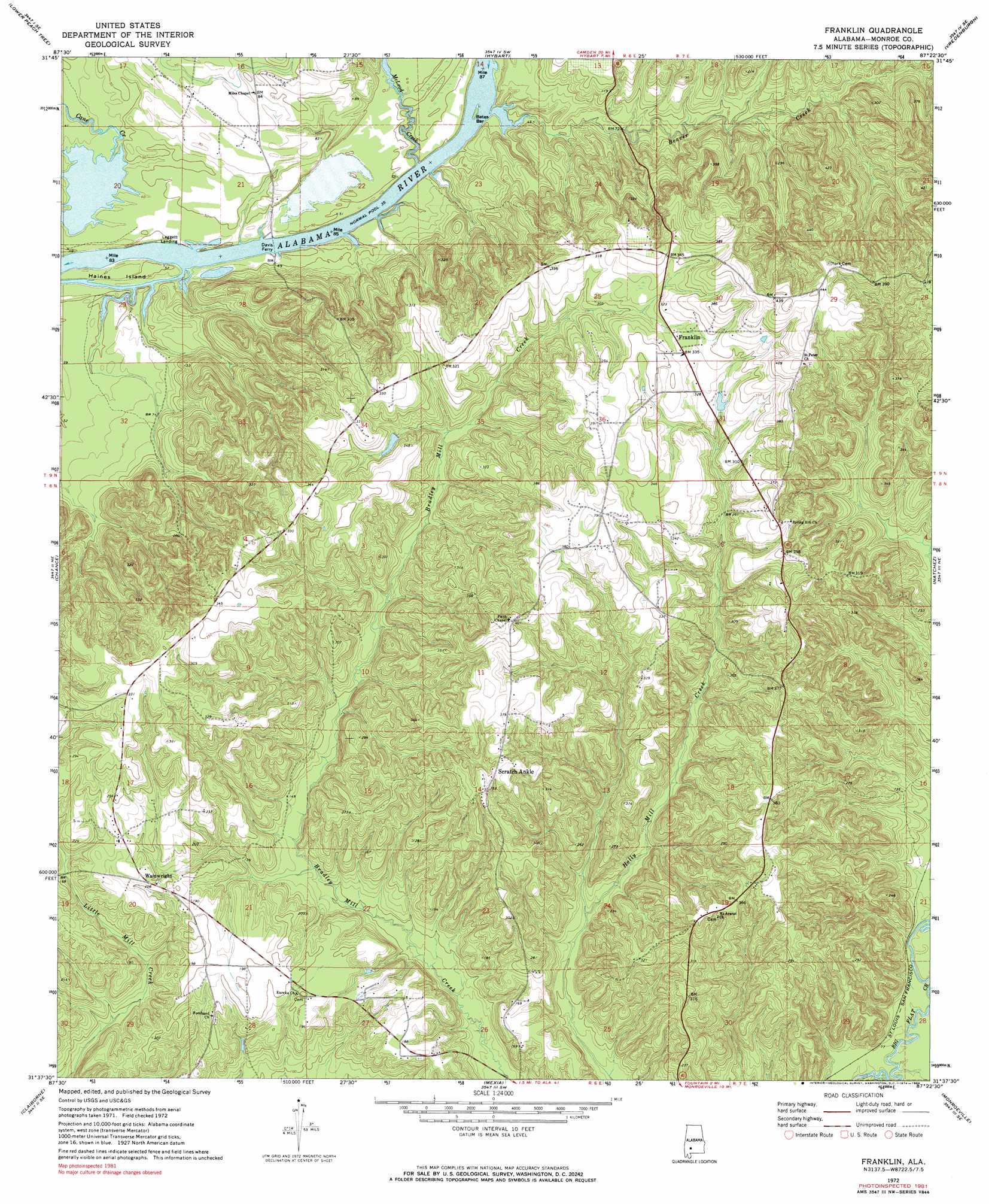
Franklin Topo Map Alabama
To zoom in, hover over the map of Franklin
USGS Topo Quad 31087f4 - 1:24,000 scale
| Topo Map Name: | Franklin |
| USGS Topo Quad ID: | 31087f4 |
| Print Size: | ca. 21 1/4" wide x 27" high |
| Southeast Coordinates: | 31.625° N latitude / 87.375° W longitude |
| Map Center Coordinates: | 31.6875° N latitude / 87.4375° W longitude |
| U.S. State: | AL |
| Filename: | o31087f4.jpg |
| Download Map JPG Image: | Franklin topo map 1:24,000 scale |
| Map Type: | Topographic |
| Topo Series: | 7.5´ |
| Map Scale: | 1:24,000 |
| Source of Map Images: | United States Geological Survey (USGS) |
| Alternate Map Versions: |
Franklin AL 1972, updated 1974 Download PDF Buy paper map Franklin AL 1972, updated 1984 Download PDF Buy paper map Franklin AL 2011 Download PDF Buy paper map Franklin AL 2014 Download PDF Buy paper map |
1:24,000 Topo Quads surrounding Franklin
Thomasville |
Pine Hill |
Coy |
Camden South |
Rosebud |
Fulton East |
Lower Peach Tree |
Hybart |
Vredenburgh |
Nadawah |
Whatley |
Chance |
Franklin |
Natchez |
Beatrice |
Suggsville |
Claiborne |
Mexia |
Monroeville |
Burnt Corn |
Gainestown |
Flynns Lake |
Frisco City |
Excel |
Repton |
> Back to 31087e1 at 1:100,000 scale
> Back to 31086a1 at 1:250,000 scale
> Back to U.S. Topo Maps home
Franklin topo map: Gazetteer
Franklin: Bars
Bates Bar elevation 11m 36′Franklin: Crossings
Davis Ferry elevation 13m 42′Franklin: Islands
Haines Island elevation 12m 39′Franklin: Parks
Haines Island Park elevation 18m 59′Franklin: Populated Places
Franklin elevation 101m 331′Scratch Ankle elevation 110m 360′
Wainwright elevation 64m 209′
Franklin: Streams
Beaver Creek elevation 11m 36′McLeod Creek elevation 16m 52′
Franklin digital topo map on disk
Buy this Franklin topo map showing relief, roads, GPS coordinates and other geographical features, as a high-resolution digital map file on DVD:
Gulf Coast (LA, MS, AL, FL) & Southwestern Georgia
Buy digital topo maps: Gulf Coast (LA, MS, AL, FL) & Southwestern Georgia
 & Southwestern Georgia map DVD")