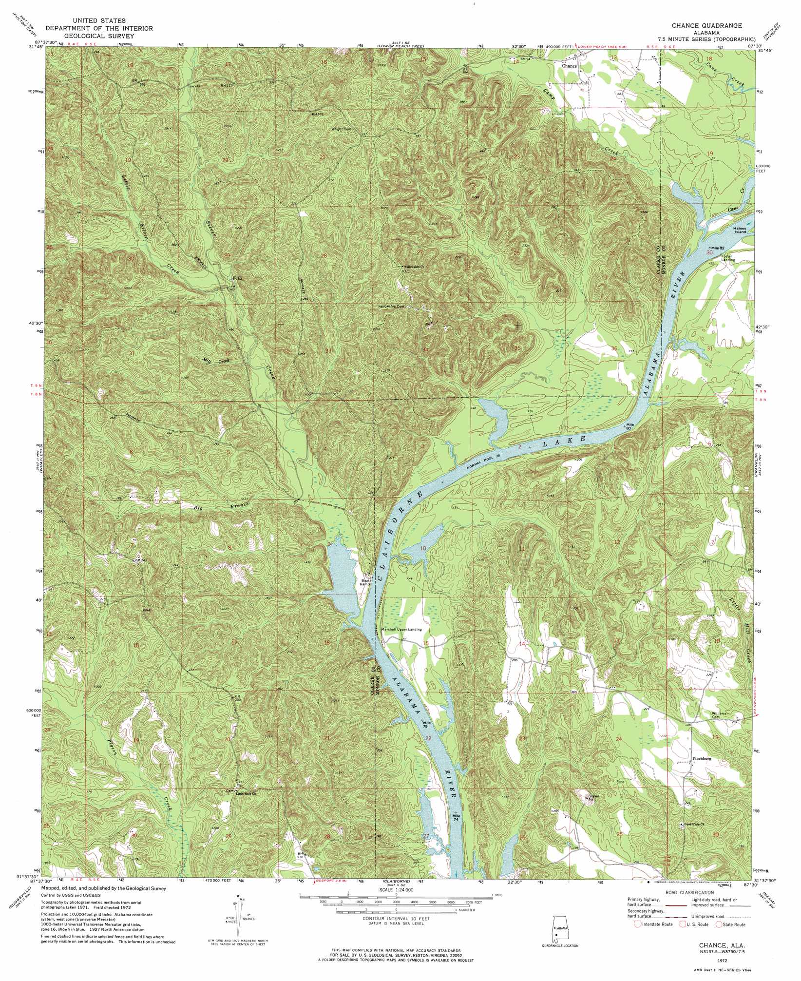
Chance Topo Map Alabama
To zoom in, hover over the map of Chance
USGS Topo Quad 31087f5 - 1:24,000 scale
| Topo Map Name: | Chance |
| USGS Topo Quad ID: | 31087f5 |
| Print Size: | ca. 21 1/4" wide x 27" high |
| Southeast Coordinates: | 31.625° N latitude / 87.5° W longitude |
| Map Center Coordinates: | 31.6875° N latitude / 87.5625° W longitude |
| U.S. State: | AL |
| Filename: | o31087f5.jpg |
| Download Map JPG Image: | Chance topo map 1:24,000 scale |
| Map Type: | Topographic |
| Topo Series: | 7.5´ |
| Map Scale: | 1:24,000 |
| Source of Map Images: | United States Geological Survey (USGS) |
| Alternate Map Versions: |
Chance AL 1972, updated 1975 Download PDF Buy paper map Chance AL 2011 Download PDF Buy paper map Chance AL 2014 Download PDF Buy paper map |
1:24,000 Topo Quads surrounding Chance
Bashi |
Thomasville |
Pine Hill |
Coy |
Camden South |
Fulton West |
Fulton East |
Lower Peach Tree |
Hybart |
Vredenburgh |
Grove Hill |
Whatley |
Chance |
Franklin |
Natchez |
Walker Springs |
Suggsville |
Claiborne |
Mexia |
Monroeville |
Choctaw Bluff |
Gainestown |
Flynns Lake |
Frisco City |
Excel |
> Back to 31087e1 at 1:100,000 scale
> Back to 31086a1 at 1:250,000 scale
> Back to U.S. Topo Maps home
Chance topo map: Gazetteer
Chance: Bars
Silver Creek Shoal elevation 11m 36′Turkey Shoals elevation 74m 242′
Chance: Dams
Williams Lake Dam elevation 23m 75′Chance: Parks
Silver Creek Park elevation 16m 52′Chance: Populated Places
Chance elevation 25m 82′Finchburg elevation 68m 223′
Chance: Reservoirs
Williams Lake elevation 23m 75′Chance: Streams
Big Branch elevation 14m 45′Camp Creek elevation 11m 36′
Cane Creek elevation 11m 36′
Isaac Creek elevation 11m 36′
Little Silver Creek elevation 31m 101′
Maiben Creek elevation 12m 39′
Mill Creek elevation 27m 88′
Silver Creek elevation 11m 36′
Chance digital topo map on disk
Buy this Chance topo map showing relief, roads, GPS coordinates and other geographical features, as a high-resolution digital map file on DVD:
Gulf Coast (LA, MS, AL, FL) & Southwestern Georgia
Buy digital topo maps: Gulf Coast (LA, MS, AL, FL) & Southwestern Georgia
 & Southwestern Georgia map DVD")