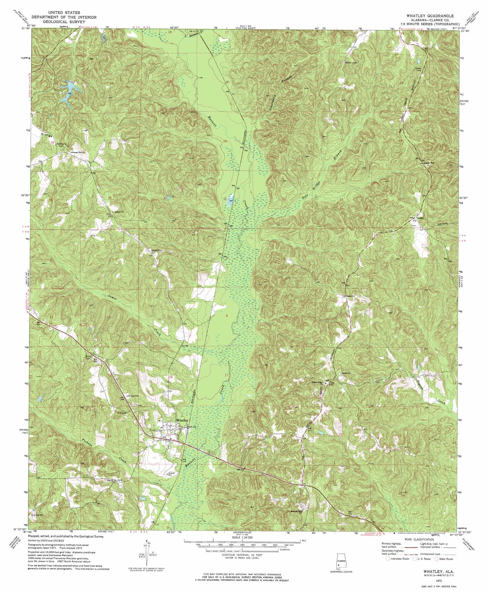
Whatley Topo Map Alabama
To zoom in, hover over the map of Whatley
USGS Topo Quad 31087f6 - 1:24,000 scale
| Topo Map Name: | Whatley |
| USGS Topo Quad ID: | 31087f6 |
| Print Size: | ca. 21 1/4" wide x 27" high |
| Southeast Coordinates: | 31.625° N latitude / 87.625° W longitude |
| Map Center Coordinates: | 31.6875° N latitude / 87.6875° W longitude |
| U.S. State: | AL |
| Filename: | o31087f6.jpg |
| Download Map JPG Image: | Whatley topo map 1:24,000 scale |
| Map Type: | Topographic |
| Topo Series: | 7.5´ |
| Map Scale: | 1:24,000 |
| Source of Map Images: | United States Geological Survey (USGS) |
| Alternate Map Versions: |
Whatley AL 1972, updated 1975 Download PDF Buy paper map Whatley AL 2011 Download PDF Buy paper map Whatley AL 2014 Download PDF Buy paper map |
1:24,000 Topo Quads surrounding Whatley
Morvin |
Bashi |
Thomasville |
Pine Hill |
Coy |
Mcentyre |
Fulton West |
Fulton East |
Lower Peach Tree |
Hybart |
Winn |
Grove Hill |
Whatley |
Chance |
Franklin |
Jackson |
Walker Springs |
Suggsville |
Claiborne |
Mexia |
Prestwick |
Choctaw Bluff |
Gainestown |
Flynns Lake |
Frisco City |
> Back to 31087e1 at 1:100,000 scale
> Back to 31086a1 at 1:250,000 scale
> Back to U.S. Topo Maps home
Whatley topo map: Gazetteer
Whatley: Dams
W D Harrigan Dam elevation 95m 311′Whatley: Parks
Andrew Jackson Memorial Park elevation 136m 446′Whatley: Populated Places
Asbury elevation 139m 456′Vashti elevation 146m 479′
Whatley elevation 47m 154′
Whatley: Reservoirs
Lake Harringan elevation 95m 311′Whatley: Streams
Fishers Creek elevation 42m 137′Graveyard Branch elevation 55m 180′
James Creek elevation 47m 154′
Little Bassett Creek elevation 61m 200′
Pole Bridge Branch elevation 63m 206′
Whatley: Summits
Orange Hill elevation 150m 492′Whatley digital topo map on disk
Buy this Whatley topo map showing relief, roads, GPS coordinates and other geographical features, as a high-resolution digital map file on DVD:
Gulf Coast (LA, MS, AL, FL) & Southwestern Georgia
Buy digital topo maps: Gulf Coast (LA, MS, AL, FL) & Southwestern Georgia
 & Southwestern Georgia map DVD")