Fulton West Topo Map Alabama
To zoom in, hover over the map of Fulton West
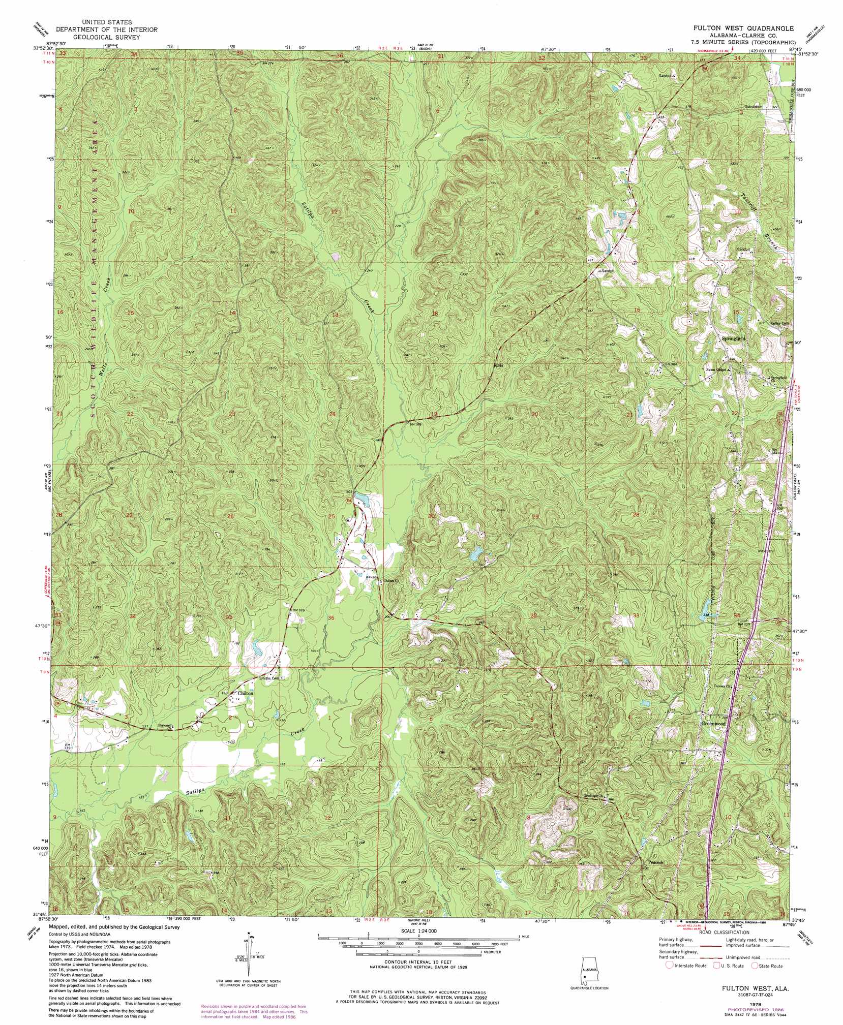
USGS Topo Quad 31087g7 - 1:24,000 scale
| Topo Map Name: | Fulton West |
| USGS Topo Quad ID: | 31087g7 |
| Print Size: | ca. 21 1/4" wide x 27" high |
| Southeast Coordinates: | 31.75° N latitude / 87.75° W longitude |
| Map Center Coordinates: | 31.8125° N latitude / 87.8125° W longitude |
| U.S. State: | AL |
| Filename: | o31087g7.jpg |
| Download Map JPG Image: | Fulton West topo map 1:24,000 scale |
| Map Type: | Topographic |
| Topo Series: | 7.5´ |
| Map Scale: | 1:24,000 |
| Source of Map Images: | United States Geological Survey (USGS) |
| Alternate Map Versions: |
Fulton West AL 1978, updated 1986 Download PDF Buy paper map Fulton West AL 2011 Download PDF Buy paper map Fulton West AL 2014 Download PDF Buy paper map |
1:24,000 Topo Quads surrounding Fulton West
Putnam |
Nanafalia |
Sweet Water |
Surginer |
Kimbrough |
Woods Bluff |
Morvin |
Bashi |
Thomasville |
Pine Hill |
Coffeeville |
Mcentyre |
Fulton West |
Fulton East |
Lower Peach Tree |
Tattlersville |
Winn |
Grove Hill |
Whatley |
Chance |
Saint Stephens |
Jackson |
Walker Springs |
Suggsville |
Claiborne |
> Back to 31087e1 at 1:100,000 scale
> Back to 31086a1 at 1:250,000 scale
> Back to U.S. Topo Maps home
Fulton West topo map: Gazetteer
Fulton West: Dams
Scotch Club Dam elevation 97m 318′Solomon Dam elevation 81m 265′
Fulton West: Populated Places
Chilton elevation 49m 160′Greenwood elevation 107m 351′
Peacock elevation 120m 393′
Springfield elevation 126m 413′
Fulton West: Reservoirs
Scotch Club Lake elevation 97m 318′Solomons Lake elevation 81m 265′
Fulton West digital topo map on disk
Buy this Fulton West topo map showing relief, roads, GPS coordinates and other geographical features, as a high-resolution digital map file on DVD:
Gulf Coast (LA, MS, AL, FL) & Southwestern Georgia
Buy digital topo maps: Gulf Coast (LA, MS, AL, FL) & Southwestern Georgia
 & Southwestern Georgia map DVD")