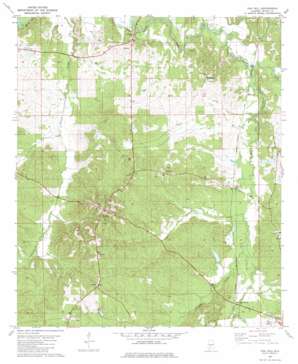
Oak Hill Topo Map Alabama
To zoom in, hover over the map of Oak Hill
USGS Topo Quad 31087h1 - 1:24,000 scale
| Topo Map Name: | Oak Hill |
| USGS Topo Quad ID: | 31087h1 |
| Print Size: | ca. 21 1/4" wide x 27" high |
| Southeast Coordinates: | 31.875° N latitude / 87° W longitude |
| Map Center Coordinates: | 31.9375° N latitude / 87.0625° W longitude |
| U.S. State: | AL |
| Filename: | o31087h1.jpg |
| Download Map JPG Image: | Oak Hill topo map 1:24,000 scale |
| Map Type: | Topographic |
| Topo Series: | 7.5´ |
| Map Scale: | 1:24,000 |
| Source of Map Images: | United States Geological Survey (USGS) |
| Alternate Map Versions: |
Oak Hill AL 1981, updated 1981 Download PDF Buy paper map Oak Hill AL 2011 Download PDF Buy paper map Oak Hill AL 2014 Download PDF Buy paper map |
1:24,000 Topo Quads surrounding Oak Hill
> Back to 31087e1 at 1:100,000 scale
> Back to 31086a1 at 1:250,000 scale
> Back to U.S. Topo Maps home
Oak Hill topo map: Gazetteer
Oak Hill: Dams
Hale Lake Dam elevation 66m 216′Lambert Bama Ranch Dam elevation 62m 203′
Oak Hill: Parks
Black Creek Park elevation 61m 200′Oak Hill: Populated Places
Allenton elevation 89m 291′Allenton Station elevation 57m 187′
Caledonia elevation 104m 341′
Hamburg elevation 77m 252′
McBrydes elevation 52m 170′
Oak Hill elevation 121m 396′
Oak Hill: Post Offices
Oakhill Post Office elevation 125m 410′Oak Hill: Reservoirs
Hale Lake elevation 66m 216′Lambert Bama Ranch Lake elevation 62m 203′
Oak Hill: Streams
Bear Creek elevation 46m 150′Blue Creek elevation 43m 141′
Callie Creek elevation 55m 180′
Halls Creek elevation 44m 144′
Little Turkey Creek elevation 61m 200′
Straight Creek elevation 57m 187′
Oak Hill digital topo map on disk
Buy this Oak Hill topo map showing relief, roads, GPS coordinates and other geographical features, as a high-resolution digital map file on DVD:
Gulf Coast (LA, MS, AL, FL) & Southwestern Georgia
Buy digital topo maps: Gulf Coast (LA, MS, AL, FL) & Southwestern Georgia


