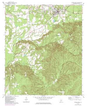
Camden South Topo Map Alabama
To zoom in, hover over the map of Camden South
USGS Topo Quad 31087h3 - 1:24,000 scale
| Topo Map Name: | Camden South |
| USGS Topo Quad ID: | 31087h3 |
| Print Size: | ca. 21 1/4" wide x 27" high |
| Southeast Coordinates: | 31.875° N latitude / 87.25° W longitude |
| Map Center Coordinates: | 31.9375° N latitude / 87.3125° W longitude |
| U.S. State: | AL |
| Filename: | o31087h3.jpg |
| Download Map JPG Image: | Camden South topo map 1:24,000 scale |
| Map Type: | Topographic |
| Topo Series: | 7.5´ |
| Map Scale: | 1:24,000 |
| Source of Map Images: | United States Geological Survey (USGS) |
| Alternate Map Versions: |
Camden South AL 1973, updated 1977 Download PDF Buy paper map Camden South AL 1973, updated 1986 Download PDF Buy paper map Camden South AL 2011 Download PDF Buy paper map Camden South AL 2014 Download PDF Buy paper map |
1:24,000 Topo Quads surrounding Camden South
> Back to 31087e1 at 1:100,000 scale
> Back to 31086a1 at 1:250,000 scale
> Back to U.S. Topo Maps home
Camden South topo map: Gazetteer
Camden South: Airports
Camden Municipal Airport elevation 43m 141′Camden South: Dams
Camden Sewage Lagoon Dam elevation 31m 101′Ernest L Dyess Dam elevation 36m 118′
Camden South: Parks
Munden Park elevation 41m 134′Camden South: Populated Places
Camden elevation 64m 209′Dry Forks elevation 105m 344′
Pebble Hill elevation 59m 193′
Rockwest elevation 39m 127′
Camden South: Reservoirs
Camden Sewage Lagoon elevation 31m 101′Ernest L Dyess Pond elevation 36m 118′
Camden South: Streams
Bones Branch elevation 15m 49′Gravel Creek elevation 15m 49′
Little Gravel Creek elevation 33m 108′
Lotties Creek elevation 34m 111′
Shoal Creek elevation 22m 72′
Camden South: Summits
Grumpton Hills elevation 135m 442′Camden South digital topo map on disk
Buy this Camden South topo map showing relief, roads, GPS coordinates and other geographical features, as a high-resolution digital map file on DVD:
Gulf Coast (LA, MS, AL, FL) & Southwestern Georgia
Buy digital topo maps: Gulf Coast (LA, MS, AL, FL) & Southwestern Georgia


