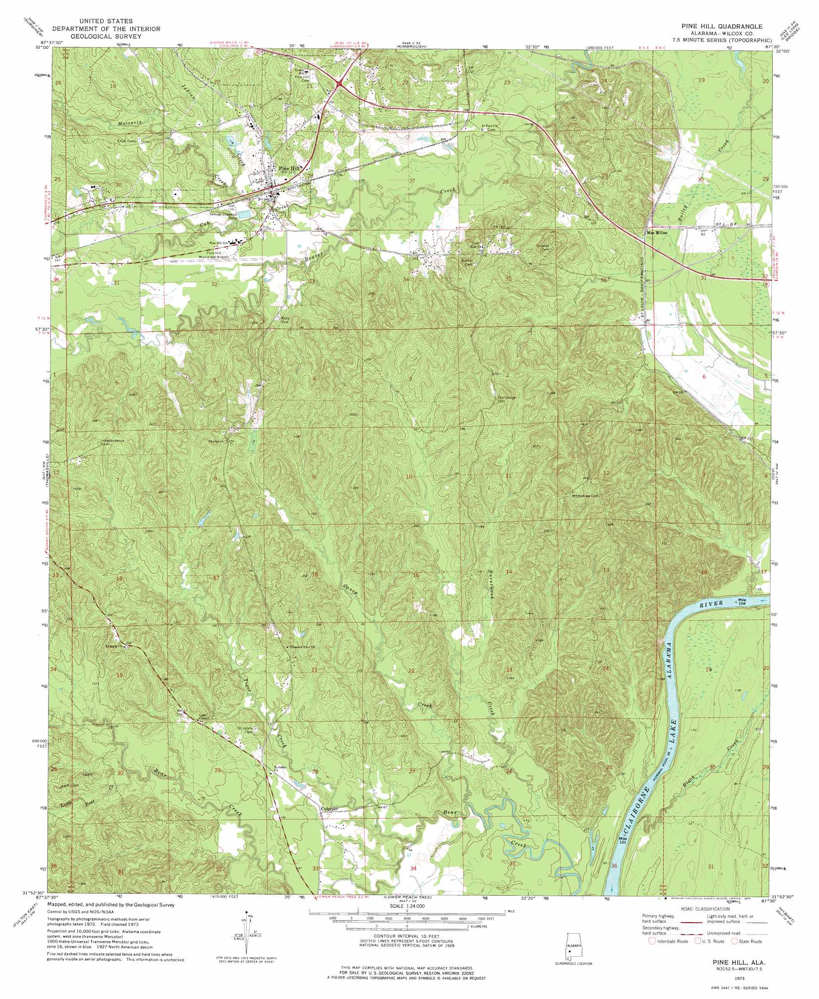
Pine Hill Topo Map Alabama
To zoom in, hover over the map of Pine Hill
USGS Topo Quad 31087h5 - 1:24,000 scale
| Topo Map Name: | Pine Hill |
| USGS Topo Quad ID: | 31087h5 |
| Print Size: | ca. 21 1/4" wide x 27" high |
| Southeast Coordinates: | 31.875° N latitude / 87.5° W longitude |
| Map Center Coordinates: | 31.9375° N latitude / 87.5625° W longitude |
| U.S. State: | AL |
| Filename: | o31087h5.jpg |
| Download Map JPG Image: | Pine Hill topo map 1:24,000 scale |
| Map Type: | Topographic |
| Topo Series: | 7.5´ |
| Map Scale: | 1:24,000 |
| Source of Map Images: | United States Geological Survey (USGS) |
| Alternate Map Versions: |
Pine Hill AL 1973, updated 1977 Download PDF Buy paper map Pine Hill AL 2011 Download PDF Buy paper map Pine Hill AL 2014 Download PDF Buy paper map |
1:24,000 Topo Quads surrounding Pine Hill
Miller |
Magnolia |
Flatwood |
Catherine |
Crumptonia |
Sweet Water |
Surginer |
Kimbrough |
Lee Long Bridge |
Camden North |
Bashi |
Thomasville |
Pine Hill |
Coy |
Camden South |
Fulton West |
Fulton East |
Lower Peach Tree |
Hybart |
Vredenburgh |
Grove Hill |
Whatley |
Chance |
Franklin |
Natchez |
> Back to 31087e1 at 1:100,000 scale
> Back to 31086a1 at 1:250,000 scale
> Back to U.S. Topo Maps home
Pine Hill topo map: Gazetteer
Pine Hill: Airports
Pine Hill Municipal Airport elevation 30m 98′Pine Hill: Cliffs
Yellow Bluff elevation 43m 141′Pine Hill: Crossings
Yellow Bluff Ferry (historical) elevation 11m 36′Pine Hill: Lakes
Sheffield Lake elevation 45m 147′Pine Hill: Populated Places
Culpeper elevation 31m 101′MacMillan elevation 29m 95′
Pine Hill elevation 34m 111′
Pine Hill: Streams
Black Creek elevation 14m 45′Burntwood Creek elevation 12m 39′
Caney Creek elevation 15m 49′
Cub Creek elevation 29m 95′
Indian Creek elevation 26m 85′
Little Bear Creek elevation 28m 91′
Moccasin Creek elevation 27m 88′
Tiger Creek elevation 15m 49′
Pine Hill digital topo map on disk
Buy this Pine Hill topo map showing relief, roads, GPS coordinates and other geographical features, as a high-resolution digital map file on DVD:
Gulf Coast (LA, MS, AL, FL) & Southwestern Georgia
Buy digital topo maps: Gulf Coast (LA, MS, AL, FL) & Southwestern Georgia
 & Southwestern Georgia map DVD")