Bashi Topo Map Alabama
To zoom in, hover over the map of Bashi
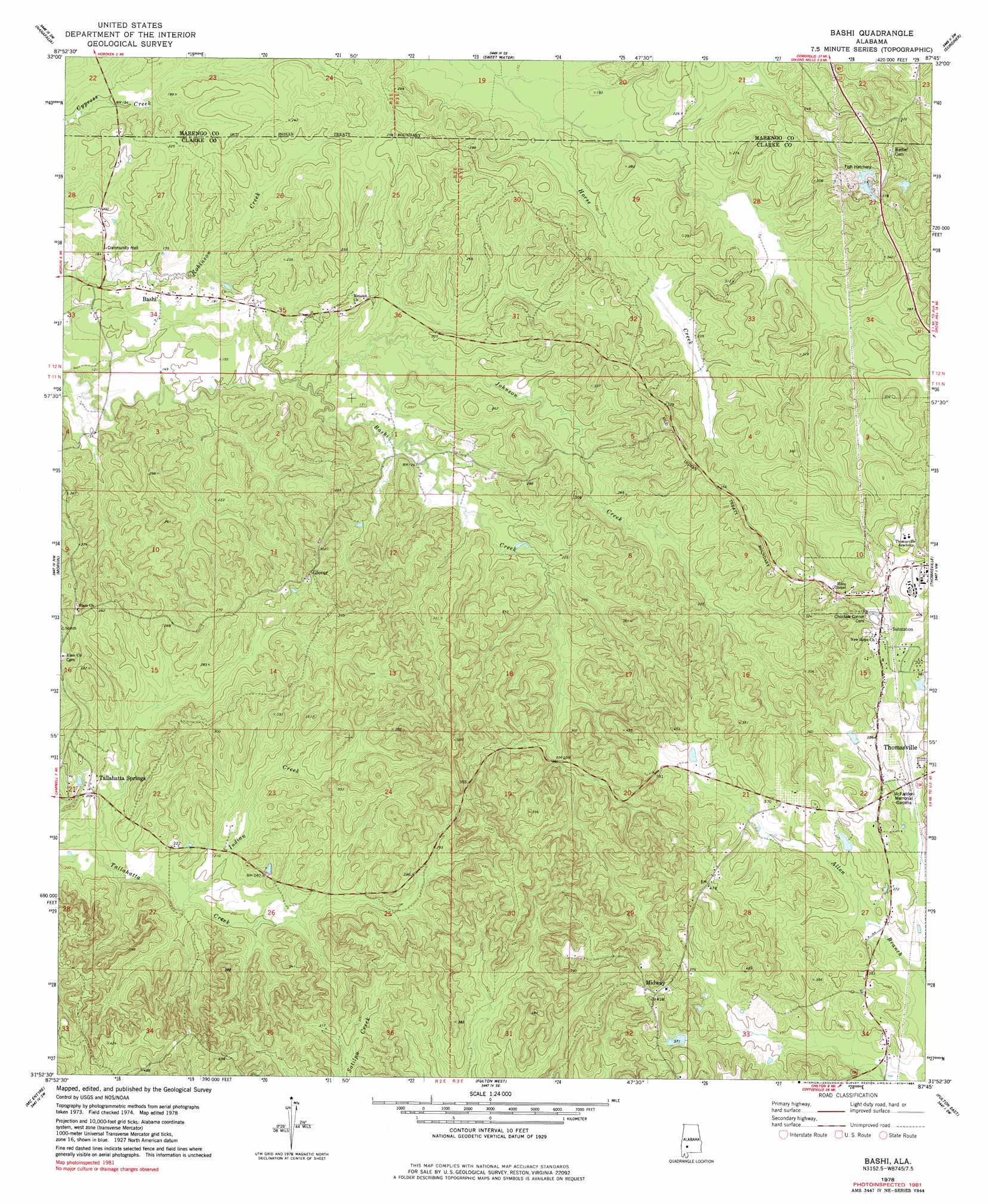
USGS Topo Quad 31087h7 - 1:24,000 scale
| Topo Map Name: | Bashi |
| USGS Topo Quad ID: | 31087h7 |
| Print Size: | ca. 21 1/4" wide x 27" high |
| Southeast Coordinates: | 31.875° N latitude / 87.75° W longitude |
| Map Center Coordinates: | 31.9375° N latitude / 87.8125° W longitude |
| U.S. State: | AL |
| Filename: | o31087h7.jpg |
| Download Map JPG Image: | Bashi topo map 1:24,000 scale |
| Map Type: | Topographic |
| Topo Series: | 7.5´ |
| Map Scale: | 1:24,000 |
| Source of Map Images: | United States Geological Survey (USGS) |
| Alternate Map Versions: |
Bashi AL 1978, updated 1984 Download PDF Buy paper map Bashi AL 2011 Download PDF Buy paper map Bashi AL 2014 Download PDF Buy paper map |
1:24,000 Topo Quads surrounding Bashi
Pennington |
Myrtlewood South |
Miller |
Magnolia |
Flatwood |
Putnam |
Nanafalia |
Sweet Water |
Surginer |
Kimbrough |
Woods Bluff |
Morvin |
Bashi |
Thomasville |
Pine Hill |
Coffeeville |
Mcentyre |
Fulton West |
Fulton East |
Lower Peach Tree |
Tattlersville |
Winn |
Grove Hill |
Whatley |
Chance |
> Back to 31087e1 at 1:100,000 scale
> Back to 31086a1 at 1:250,000 scale
> Back to U.S. Topo Maps home
Bashi topo map: Gazetteer
Bashi: Dams
J D Phillips Lake Dam elevation 114m 374′Bashi: Populated Places
Bashi elevation 53m 173′Choctaw Corner elevation 115m 377′
Glover elevation 79m 259′
Midway elevation 144m 472′
Bashi: Reservoirs
J D Phillips Lake elevation 114m 374′Bashi: Streams
Dick Mill Creek elevation 51m 167′Indian Creek elevation 57m 187′
Johnson Creek elevation 51m 167′
Johnson Creek elevation 45m 147′
Bashi digital topo map on disk
Buy this Bashi topo map showing relief, roads, GPS coordinates and other geographical features, as a high-resolution digital map file on DVD:
Gulf Coast (LA, MS, AL, FL) & Southwestern Georgia
Buy digital topo maps: Gulf Coast (LA, MS, AL, FL) & Southwestern Georgia
 & Southwestern Georgia map DVD")