Brown Town Topo Map Mississippi
To zoom in, hover over the map of Brown Town
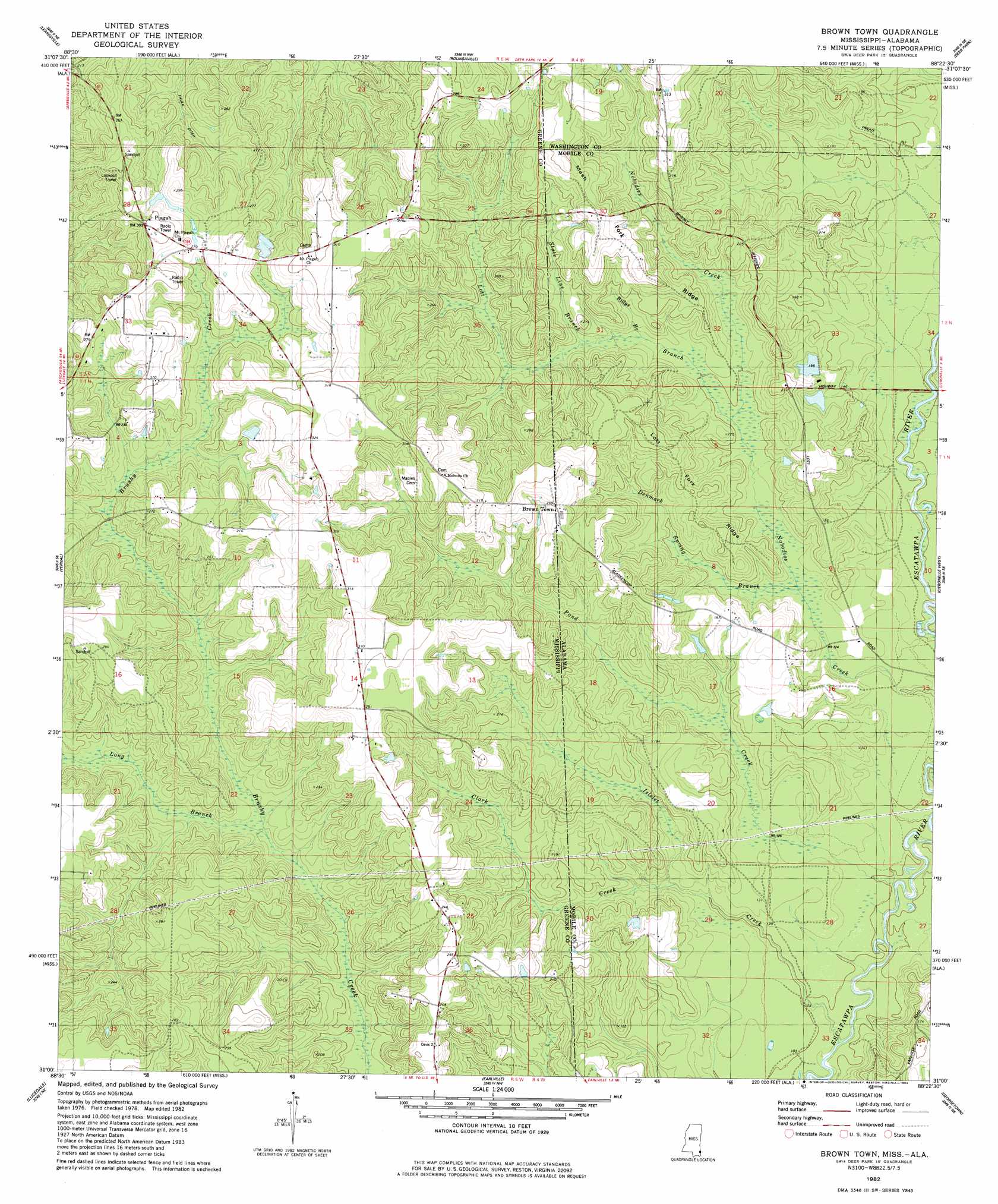
USGS Topo Quad 31088a4 - 1:24,000 scale
| Topo Map Name: | Brown Town |
| USGS Topo Quad ID: | 31088a4 |
| Print Size: | ca. 21 1/4" wide x 27" high |
| Southeast Coordinates: | 31° N latitude / 88.375° W longitude |
| Map Center Coordinates: | 31.0625° N latitude / 88.4375° W longitude |
| U.S. States: | MS, AL |
| Filename: | o31088a4.jpg |
| Download Map JPG Image: | Brown Town topo map 1:24,000 scale |
| Map Type: | Topographic |
| Topo Series: | 7.5´ |
| Map Scale: | 1:24,000 |
| Source of Map Images: | United States Geological Survey (USGS) |
| Alternate Map Versions: |
Brown Town MS 1982, updated 1982 Download PDF Buy paper map Brown Town MS 1982, updated 1984 Download PDF Buy paper map Brown Town MS 1982, updated 1984 Download PDF Buy paper map Brown Town MS 2012 Download PDF Buy paper map Brown Town MS 2015 Download PDF Buy paper map |
1:24,000 Topo Quads surrounding Brown Town
Avera |
Clark |
Fruitdale |
Vinegar Bend |
Seaboard |
Jonathan |
Leakesville |
Rounsaville |
Deer Park |
Sims Chapel |
Leakesville Sw |
Vernal |
Brown Town |
Citronelle West |
Citronelle East |
Merrill |
Lucedale |
Earlville |
Georgetown |
Chunchula |
Basin |
Agricola |
Howell |
Semmes |
Kushla |
> Back to 31088a1 at 1:100,000 scale
> Back to 31088a1 at 1:250,000 scale
> Back to U.S. Topo Maps home
Brown Town topo map: Gazetteer
Brown Town: Dams
Morgan Hicks Lake Dam elevation 80m 262′Red Nichols Dam elevation 51m 167′
Red Nichols Number One Dam elevation 50m 164′
Brown Town: Populated Places
Brown Town elevation 96m 314′Mohoba (historical) elevation 82m 269′
Pisgah elevation 86m 282′
Brown Town: Reservoirs
Red Nichols Number 2 Lake elevation 51m 167′Brown Town: Ridges
Lott Fork Ridge elevation 66m 216′Mash Fork Ridge elevation 79m 259′
Brown Town: Streams
Alligator Branch elevation 52m 170′Billys Branch elevation 53m 173′
Clark Creek elevation 39m 127′
Clark Creek elevation 37m 121′
Denmark Spring Branch elevation 40m 131′
Iselet Creek elevation 29m 95′
Islelet Creek elevation 28m 91′
Long Branch elevation 50m 164′
Lott Branch elevation 49m 160′
Lott Branch elevation 53m 173′
Pond Creek elevation 24m 78′
Pond Creek elevation 26m 85′
State Line Branch elevation 57m 187′
State Line Branch elevation 56m 183′
Brown Town digital topo map on disk
Buy this Brown Town topo map showing relief, roads, GPS coordinates and other geographical features, as a high-resolution digital map file on DVD:
Gulf Coast (LA, MS, AL, FL) & Southwestern Georgia
Buy digital topo maps: Gulf Coast (LA, MS, AL, FL) & Southwestern Georgia
 & Southwestern Georgia map DVD")