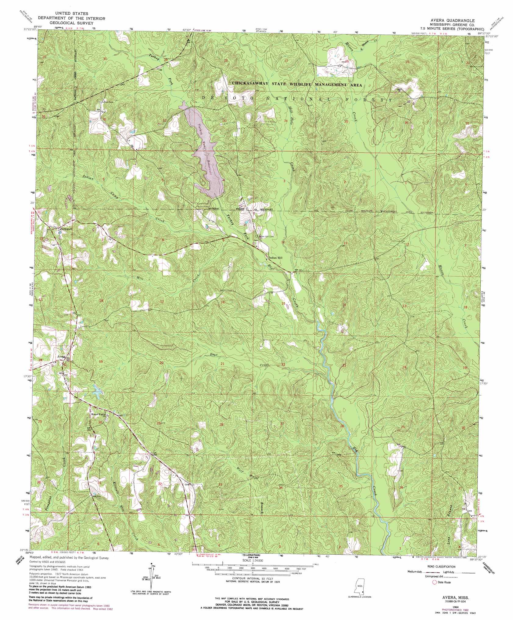
Avera Topo Map Mississippi
To zoom in, hover over the map of Avera
USGS Topo Quad 31088c6 - 1:24,000 scale
| Topo Map Name: | Avera |
| USGS Topo Quad ID: | 31088c6 |
| Print Size: | ca. 21 1/4" wide x 27" high |
| Southeast Coordinates: | 31.25° N latitude / 88.625° W longitude |
| Map Center Coordinates: | 31.3125° N latitude / 88.6875° W longitude |
| U.S. State: | MS |
| Filename: | o31088c6.jpg |
| Download Map JPG Image: | Avera topo map 1:24,000 scale |
| Map Type: | Topographic |
| Topo Series: | 7.5´ |
| Map Scale: | 1:24,000 |
| Source of Map Images: | United States Geological Survey (USGS) |
| Alternate Map Versions: |
Avera MS 1964, updated 1965 Download PDF Buy paper map Avera MS 1964, updated 1982 Download PDF Buy paper map Avera MS 1964, updated 1988 Download PDF Buy paper map Avera MS 2012 Download PDF Buy paper map Avera MS 2015 Download PDF Buy paper map |
| FStopo: | US Forest Service topo Avera is available: Download FStopo PDF Download FStopo TIF |
1:24,000 Topo Quads surrounding Avera
Strengthford |
Water Oak |
Clara |
Buckatunna |
Copeland |
Rhodes |
Mulberry |
Piave |
Knobtown |
State Line |
Richton |
Brewer |
Avera |
Clark |
Fruitdale |
Beaumont |
Neely |
Jonathan |
Leakesville |
Rounsaville |
Taylor Hill |
Mclain |
Leakesville Sw |
Vernal |
Brown Town |
> Back to 31088a1 at 1:100,000 scale
> Back to 31088a1 at 1:250,000 scale
> Back to U.S. Topo Maps home
Avera topo map: Gazetteer
Avera: Dams
Kitrell Creek Reservoir Dam elevation 59m 193′Turner Lake Dam elevation 79m 259′
Avera: Parks
Turkey Fork Recreation Site elevation 66m 216′Avera: Populated Places
Avera elevation 97m 318′Bothwell elevation 89m 291′
Carson City elevation 65m 213′
Avera: Reservoirs
Turkey Fork Reservoir elevation 59m 193′Avera: Streams
Bear Creek elevation 39m 127′East Mason Creek elevation 59m 193′
Hell Hole Creek elevation 42m 137′
Indian Camp Creek elevation 49m 160′
Mill Creek elevation 50m 164′
Turkey Fork elevation 49m 160′
Avera digital topo map on disk
Buy this Avera topo map showing relief, roads, GPS coordinates and other geographical features, as a high-resolution digital map file on DVD:
Gulf Coast (LA, MS, AL, FL) & Southwestern Georgia
Buy digital topo maps: Gulf Coast (LA, MS, AL, FL) & Southwestern Georgia
 & Southwestern Georgia map DVD")