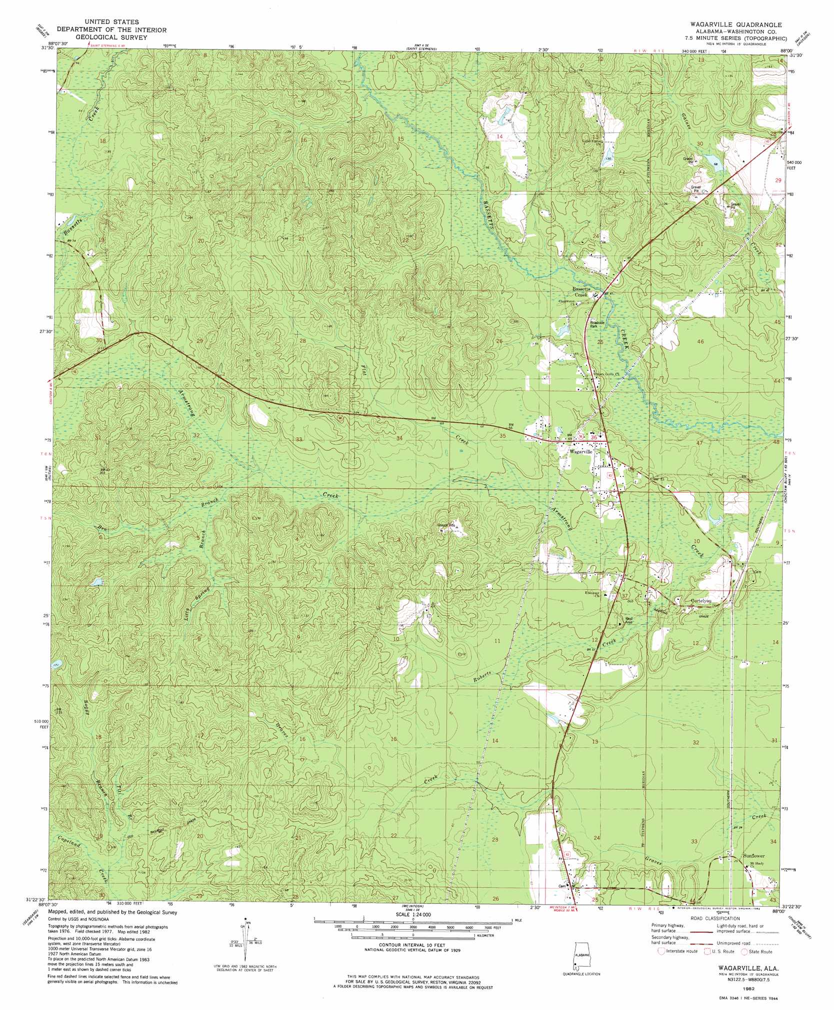
Wagarville Topo Map Alabama
To zoom in, hover over the map of Wagarville
USGS Topo Quad 31088d1 - 1:24,000 scale
| Topo Map Name: | Wagarville |
| USGS Topo Quad ID: | 31088d1 |
| Print Size: | ca. 21 1/4" wide x 27" high |
| Southeast Coordinates: | 31.375° N latitude / 88° W longitude |
| Map Center Coordinates: | 31.4375° N latitude / 88.0625° W longitude |
| U.S. State: | AL |
| Filename: | o31088d1.jpg |
| Download Map JPG Image: | Wagarville topo map 1:24,000 scale |
| Map Type: | Topographic |
| Topo Series: | 7.5´ |
| Map Scale: | 1:24,000 |
| Source of Map Images: | United States Geological Survey (USGS) |
| Alternate Map Versions: |
Wagarville AL 1982, updated 1982 Download PDF Buy paper map Wagarville AL 2011 Download PDF Buy paper map Wagarville AL 2014 Download PDF Buy paper map |
1:24,000 Topo Quads surrounding Wagarville
Millry North |
Bladon Springs |
Tattlersville |
Winn |
Grove Hill |
Millry South |
Bigbee |
Saint Stephens |
Jackson |
Walker Springs |
Chatom |
Rutan |
Wagarville |
Prestwick |
Choctaw Bluff |
Vinegar Bend |
Seaboard |
Mcintosh |
Gin House Island |
Carlton |
Deer Park |
Sims Chapel |
Calvert |
Bilbo Island |
Tensaw |
> Back to 31088a1 at 1:100,000 scale
> Back to 31088a1 at 1:250,000 scale
> Back to U.S. Topo Maps home
Wagarville topo map: Gazetteer
Wagarville: Bridges
Ben Rodgers Lee Memorial Bridge elevation 14m 45′Wagarville: Parks
Alabama Bluegrass Music Park elevation 35m 114′Wagarville: Populated Places
Bassetts Creek elevation 14m 45′Cortelyou elevation 18m 59′
Sunflower elevation 5m 16′
Wagarville elevation 18m 59′
Wagarville: Post Offices
Sunflower Post Office elevation 6m 19′Wagarville: Streams
Ben Branch elevation 20m 65′Boggy Branch elevation 28m 91′
Flat Creek elevation 19m 62′
Gordy Mill Creek elevation 21m 68′
Litty Spring Branch elevation 29m 95′
Roberts Creek elevation 12m 39′
Titi Branch elevation 29m 95′
Wagarville digital topo map on disk
Buy this Wagarville topo map showing relief, roads, GPS coordinates and other geographical features, as a high-resolution digital map file on DVD:
Gulf Coast (LA, MS, AL, FL) & Southwestern Georgia
Buy digital topo maps: Gulf Coast (LA, MS, AL, FL) & Southwestern Georgia
 & Southwestern Georgia map DVD")