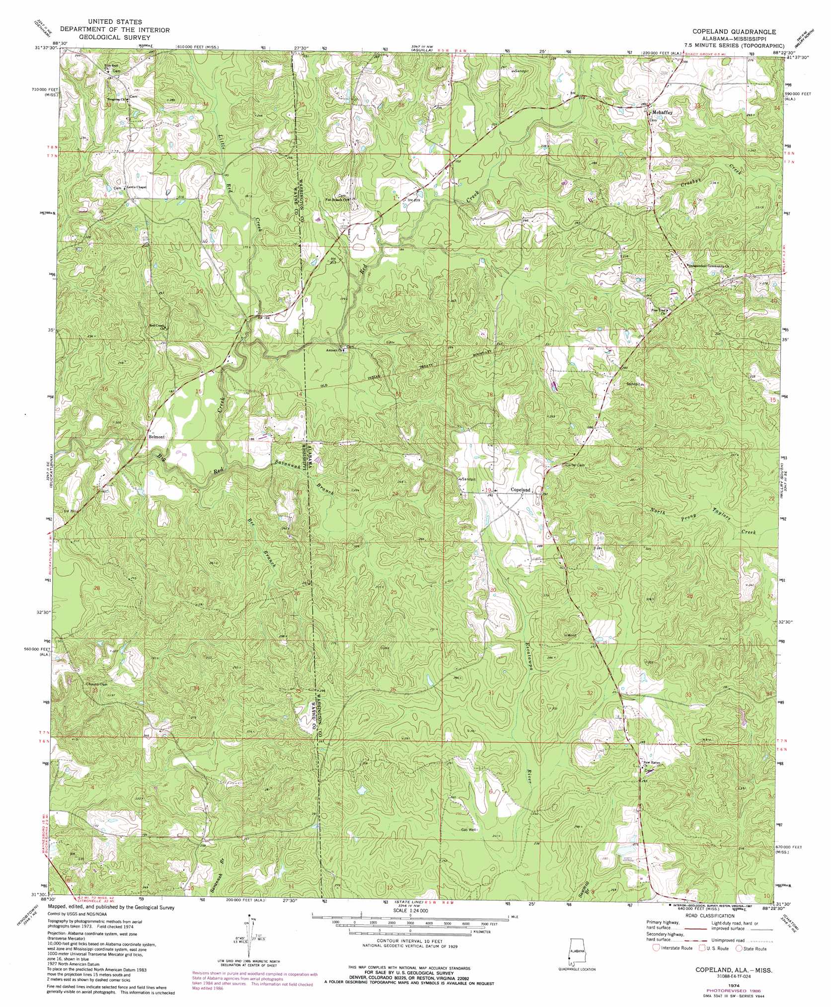
Copeland Topo Map Alabama
To zoom in, hover over the map of Copeland
USGS Topo Quad 31088e4 - 1:24,000 scale
| Topo Map Name: | Copeland |
| USGS Topo Quad ID: | 31088e4 |
| Print Size: | ca. 21 1/4" wide x 27" high |
| Southeast Coordinates: | 31.5° N latitude / 88.375° W longitude |
| Map Center Coordinates: | 31.5625° N latitude / 88.4375° W longitude |
| U.S. States: | AL, MS |
| Filename: | o31088e4.jpg |
| Download Map JPG Image: | Copeland topo map 1:24,000 scale |
| Map Type: | Topographic |
| Topo Series: | 7.5´ |
| Map Scale: | 1:24,000 |
| Source of Map Images: | United States Geological Survey (USGS) |
| Alternate Map Versions: |
Copeland AL 1974, updated 1977 Download PDF Buy paper map Copeland AL 1974, updated 1984 Download PDF Buy paper map Copeland AL 1974, updated 1987 Download PDF Buy paper map Copeland AL 2011 Download PDF Buy paper map Copeland AL 2014 Download PDF Buy paper map |
1:24,000 Topo Quads surrounding Copeland
Shubuta |
Matherville |
Isney |
Silas |
Coffeeville Lock And Dam |
Waynesboro |
Denham |
Aquilla |
Millry North |
Bladon Springs |
Clara |
Buckatunna |
Copeland |
Millry South |
Bigbee |
Piave |
Knobtown |
State Line |
Chatom |
Rutan |
Avera |
Clark |
Fruitdale |
Vinegar Bend |
Seaboard |
> Back to 31088e1 at 1:100,000 scale
> Back to 31088a1 at 1:250,000 scale
> Back to U.S. Topo Maps home
Copeland topo map: Gazetteer
Copeland: Oilfields
Copeland Gas Field elevation 79m 259′Red Creek Gas Field elevation 87m 285′
Copeland: Populated Places
Belmont elevation 54m 177′Copeland elevation 85m 278′
Mehaffey elevation 86m 282′
Copeland: Streams
Bee Branch elevation 40m 131′Little Red Creek elevation 43m 141′
Little Red Creek elevation 43m 141′
Red Creek elevation 43m 141′
Red Creek elevation 47m 154′
Savannah Branch elevation 40m 131′
Savannah Branch elevation 40m 131′
Copeland digital topo map on disk
Buy this Copeland topo map showing relief, roads, GPS coordinates and other geographical features, as a high-resolution digital map file on DVD:
Gulf Coast (LA, MS, AL, FL) & Southwestern Georgia
Buy digital topo maps: Gulf Coast (LA, MS, AL, FL) & Southwestern Georgia
 & Southwestern Georgia map DVD")