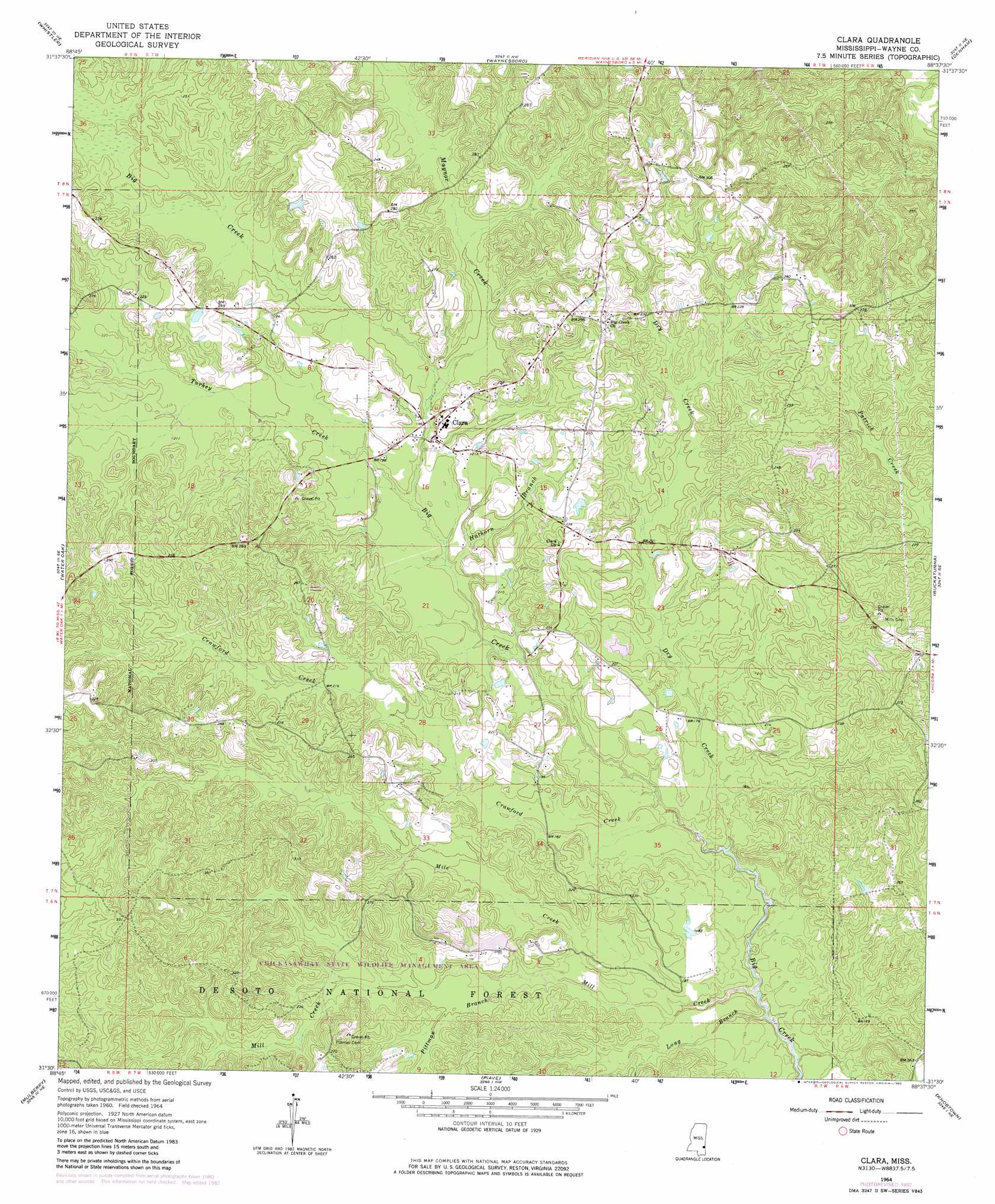
Clara Topo Map Mississippi
To zoom in, hover over the map of Clara
USGS Topo Quad 31088e6 - 1:24,000 scale
| Topo Map Name: | Clara |
| USGS Topo Quad ID: | 31088e6 |
| Print Size: | ca. 21 1/4" wide x 27" high |
| Southeast Coordinates: | 31.5° N latitude / 88.625° W longitude |
| Map Center Coordinates: | 31.5625° N latitude / 88.6875° W longitude |
| U.S. State: | MS |
| Filename: | o31088e6.jpg |
| Download Map JPG Image: | Clara topo map 1:24,000 scale |
| Map Type: | Topographic |
| Topo Series: | 7.5´ |
| Map Scale: | 1:24,000 |
| Source of Map Images: | United States Geological Survey (USGS) |
| Alternate Map Versions: |
Clara MS 1964, updated 1965 Download PDF Buy paper map Clara MS 1964, updated 1982 Download PDF Buy paper map Clara MS 2012 Download PDF Buy paper map Clara MS 2015 Download PDF Buy paper map |
| FStopo: | US Forest Service topo Clara is available: Download FStopo PDF Download FStopo TIF |
1:24,000 Topo Quads surrounding Clara
Heidelberg Sw |
Eucutta |
Shubuta |
Matherville |
Isney |
Myrick |
Whistler |
Waynesboro |
Denham |
Aquilla |
Strengthford |
Water Oak |
Clara |
Buckatunna |
Copeland |
Rhodes |
Mulberry |
Piave |
Knobtown |
State Line |
Richton |
Brewer |
Avera |
Clark |
Fruitdale |
> Back to 31088e1 at 1:100,000 scale
> Back to 31088a1 at 1:250,000 scale
> Back to U.S. Topo Maps home
Clara topo map: Gazetteer
Clara: Dams
Bazor Pond Dam elevation 71m 232′Clara: Populated Places
Clara elevation 63m 206′Clara: Streams
Crawford Creek elevation 46m 150′Dry Creek elevation 46m 150′
Hathorn Branch elevation 52m 170′
Long Branch elevation 42m 137′
Maynor Creek elevation 56m 183′
Mile Creek elevation 49m 160′
Mill Creek elevation 42m 137′
Pittman Branch elevation 56m 183′
Turkey Creek elevation 54m 177′
Clara digital topo map on disk
Buy this Clara topo map showing relief, roads, GPS coordinates and other geographical features, as a high-resolution digital map file on DVD:
Gulf Coast (LA, MS, AL, FL) & Southwestern Georgia
Buy digital topo maps: Gulf Coast (LA, MS, AL, FL) & Southwestern Georgia
 & Southwestern Georgia map DVD")