Tattlersville Topo Map Alabama
To zoom in, hover over the map of Tattlersville
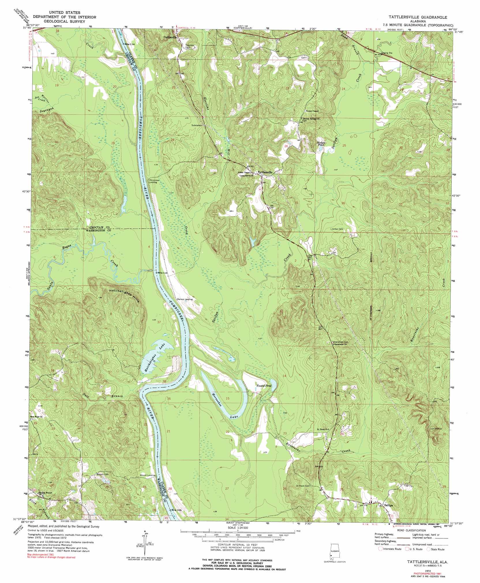
USGS Topo Quad 31088f1 - 1:24,000 scale
| Topo Map Name: | Tattlersville |
| USGS Topo Quad ID: | 31088f1 |
| Print Size: | ca. 21 1/4" wide x 27" high |
| Southeast Coordinates: | 31.625° N latitude / 88° W longitude |
| Map Center Coordinates: | 31.6875° N latitude / 88.0625° W longitude |
| U.S. State: | AL |
| Filename: | o31088f1.jpg |
| Download Map JPG Image: | Tattlersville topo map 1:24,000 scale |
| Map Type: | Topographic |
| Topo Series: | 7.5´ |
| Map Scale: | 1:24,000 |
| Source of Map Images: | United States Geological Survey (USGS) |
| Alternate Map Versions: |
Tattlersville AL 1972, updated 1975 Download PDF Buy paper map Tattlersville AL 1972, updated 1991 Download PDF Buy paper map Tattlersville AL 2011 Download PDF Buy paper map Tattlersville AL 2014 Download PDF Buy paper map |
1:24,000 Topo Quads surrounding Tattlersville
Toxey |
Ararat |
Woods Bluff |
Morvin |
Bashi |
Silas |
Coffeeville Lock And Dam |
Coffeeville |
Mcentyre |
Fulton West |
Millry North |
Bladon Springs |
Tattlersville |
Winn |
Grove Hill |
Millry South |
Bigbee |
Saint Stephens |
Jackson |
Walker Springs |
Chatom |
Rutan |
Wagarville |
Prestwick |
Choctaw Bluff |
> Back to 31088e1 at 1:100,000 scale
> Back to 31088a1 at 1:250,000 scale
> Back to U.S. Topo Maps home
Tattlersville topo map: Gazetteer
Tattlersville: Bars
Hatchitigbee Bar elevation 2m 6′Hazzards Bar elevation 2m 6′
Tattlersville: Cliffs
Rock Bluff elevation 10m 32′Tattlersville: Lakes
Hatchetigbee Lake elevation 7m 22′Hodges Pond elevation 15m 49′
Horseshoe Lake elevation 5m 16′
Round Pond elevation 5m 16′
Tattlersville: Populated Places
Salitpa elevation 52m 170′Tattlersville elevation 58m 190′
Tattlersville: Streams
Eberline Mill Creek elevation 14m 45′Kanetuche Creek elevation 17m 55′
Nail Branch elevation 2m 6′
Salitpa Creek elevation 7m 22′
Sand Branch elevation 16m 52′
Santa Bogue Creek elevation 6m 19′
Sea Warrior Creek elevation 16m 52′
Seyouyah Creek elevation 5m 16′
Tattlersville: Summits
Hatchetigbee Hills elevation 56m 183′Tattlersville digital topo map on disk
Buy this Tattlersville topo map showing relief, roads, GPS coordinates and other geographical features, as a high-resolution digital map file on DVD:
Gulf Coast (LA, MS, AL, FL) & Southwestern Georgia
Buy digital topo maps: Gulf Coast (LA, MS, AL, FL) & Southwestern Georgia
 & Southwestern Georgia map DVD")