Whistler Topo Map Mississippi
To zoom in, hover over the map of Whistler
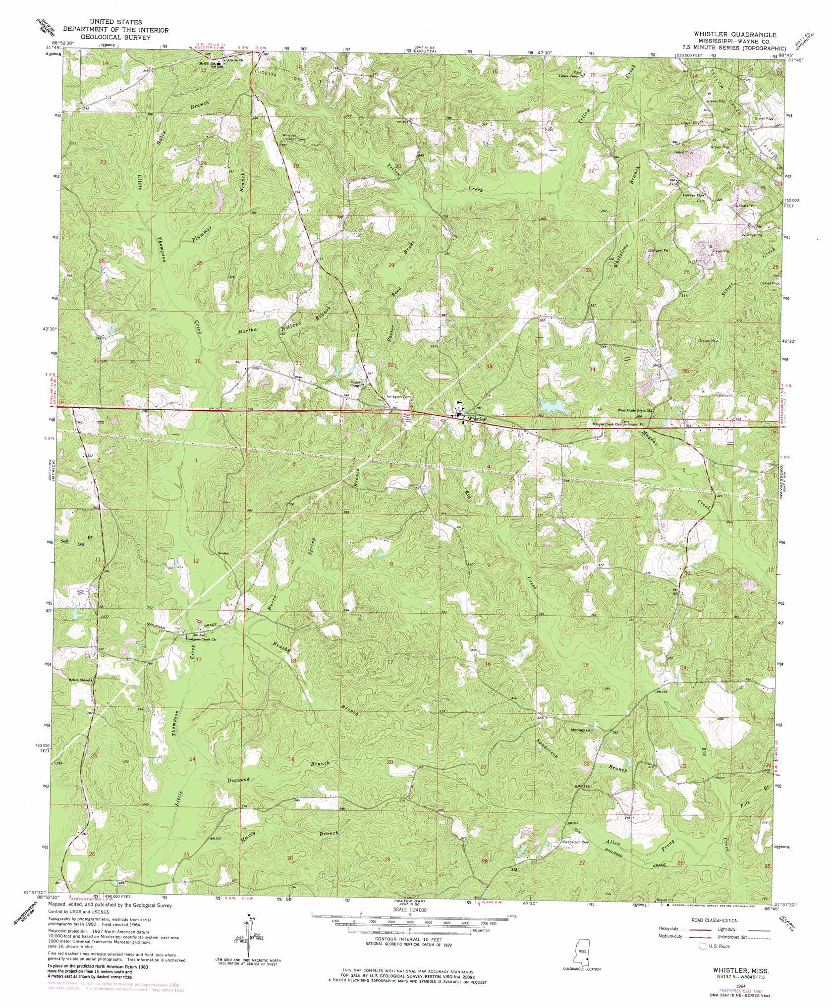
USGS Topo Quad 31088f7 - 1:24,000 scale
| Topo Map Name: | Whistler |
| USGS Topo Quad ID: | 31088f7 |
| Print Size: | ca. 21 1/4" wide x 27" high |
| Southeast Coordinates: | 31.625° N latitude / 88.75° W longitude |
| Map Center Coordinates: | 31.6875° N latitude / 88.8125° W longitude |
| U.S. State: | MS |
| Filename: | o31088f7.jpg |
| Download Map JPG Image: | Whistler topo map 1:24,000 scale |
| Map Type: | Topographic |
| Topo Series: | 7.5´ |
| Map Scale: | 1:24,000 |
| Source of Map Images: | United States Geological Survey (USGS) |
| Alternate Map Versions: |
Whistler MS 1964, updated 1965 Download PDF Buy paper map Whistler MS 1964, updated 1982 Download PDF Buy paper map Whistler MS 2012 Download PDF Buy paper map Whistler MS 2015 Download PDF Buy paper map |
1:24,000 Topo Quads surrounding Whistler
Waldrup |
Heidelberg |
Hale |
De Soto |
Carmichael |
Sandersville |
Heidelberg Sw |
Eucutta |
Shubuta |
Matherville |
Laurel East |
Myrick |
Whistler |
Waynesboro |
Denham |
Lanham |
Strengthford |
Water Oak |
Clara |
Buckatunna |
Ovett |
Rhodes |
Mulberry |
Piave |
Knobtown |
> Back to 31088e1 at 1:100,000 scale
> Back to 31088a1 at 1:250,000 scale
> Back to U.S. Topo Maps home
Whistler topo map: Gazetteer
Whistler: Dams
West Pond Dam elevation 98m 321′Williams Lake Dam elevation 96m 314′
Whistler: Oilfields
West Yellow Creek Oil Field elevation 81m 265′Whistler: Populated Places
Whistler elevation 114m 374′Whistler: Streams
Allen Prong elevation 71m 232′Brushy Branch elevation 72m 236′
Burro Spring Branch elevation 71m 232′
Dogwood Branch elevation 68m 223′
Gully Branch elevation 83m 272′
Martha Holland Branch elevation 79m 259′
Maxey Branch elevation 67m 219′
Paster Reed Brake elevation 83m 272′
Plummer Branch elevation 82m 269′
Pole Branch elevation 73m 239′
Sanderson Branch elevation 73m 239′
Whetstone Branch elevation 73m 239′
Whistler digital topo map on disk
Buy this Whistler topo map showing relief, roads, GPS coordinates and other geographical features, as a high-resolution digital map file on DVD:
Gulf Coast (LA, MS, AL, FL) & Southwestern Georgia
Buy digital topo maps: Gulf Coast (LA, MS, AL, FL) & Southwestern Georgia
 & Southwestern Georgia map DVD")