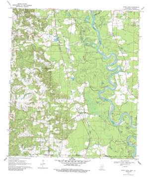
Sandy Hook Topo Map Mississippi
To zoom in, hover over the map of Sandy Hook
USGS Topo Quad 31089a7 - 1:24,000 scale
| Topo Map Name: | Sandy Hook |
| USGS Topo Quad ID: | 31089a7 |
| Print Size: | ca. 21 1/4" wide x 27" high |
| Southeast Coordinates: | 31° N latitude / 89.75° W longitude |
| Map Center Coordinates: | 31.0625° N latitude / 89.8125° W longitude |
| U.S. States: | MS, LA |
| Filename: | o31089a7.jpg |
| Download Map JPG Image: | Sandy Hook topo map 1:24,000 scale |
| Map Type: | Topographic |
| Topo Series: | 7.5´ |
| Map Scale: | 1:24,000 |
| Source of Map Images: | United States Geological Survey (USGS) |
| Alternate Map Versions: |
Sandy Hook MS 1970, updated 1972 Download PDF Buy paper map Sandy Hook MS 1970, updated 1986 Download PDF Buy paper map Sandy Hook MS 2012 Download PDF Buy paper map Sandy Hook MS 2015 Download PDF Buy paper map |
1:24,000 Topo Quads surrounding Sandy Hook
> Back to 31089a1 at 1:100,000 scale
> Back to 31088a1 at 1:250,000 scale
> Back to U.S. Topo Maps home
Sandy Hook topo map: Gazetteer
Sandy Hook: Dams
Fortenberry Lake Dam elevation 46m 150′Tolar Ponds Dam elevation 40m 131′
Willy Pittman Pond Dam elevation 107m 351′
Sandy Hook: Lakes
Black Lake elevation 30m 98′Black Lake elevation 33m 108′
Blue Lake elevation 33m 108′
Harper Lake elevation 30m 98′
Spains Lake elevation 32m 104′
Yellow Lake elevation 30m 98′
Sandy Hook: Populated Places
Fordsville (historical) elevation 37m 121′Hurricane Creek elevation 89m 291′
Saint Paul elevation 39m 127′
Sandy Hook elevation 43m 141′
Sauer elevation 46m 150′
Saxon elevation 43m 141′
Spring Cottage elevation 37m 121′
Twin elevation 37m 121′
Sandy Hook: Streams
Ball Mill Creek elevation 32m 104′Hurricane Creek elevation 29m 95′
Lower Little Creek elevation 32m 104′
Mike Tom Branch elevation 33m 108′
Rankin Mill Creek elevation 28m 91′
Rankin Mill Creek elevation 29m 95′
Rawls Creek elevation 36m 118′
Sandy Hook Creek elevation 32m 104′
Sweetwater Creek elevation 32m 104′
Sandy Hook: Swamps
Allen Bay elevation 41m 134′Rawls Bay elevation 36m 118′
Sandy Hook digital topo map on disk
Buy this Sandy Hook topo map showing relief, roads, GPS coordinates and other geographical features, as a high-resolution digital map file on DVD:
Gulf Coast (LA, MS, AL, FL) & Southwestern Georgia
Buy digital topo maps: Gulf Coast (LA, MS, AL, FL) & Southwestern Georgia


