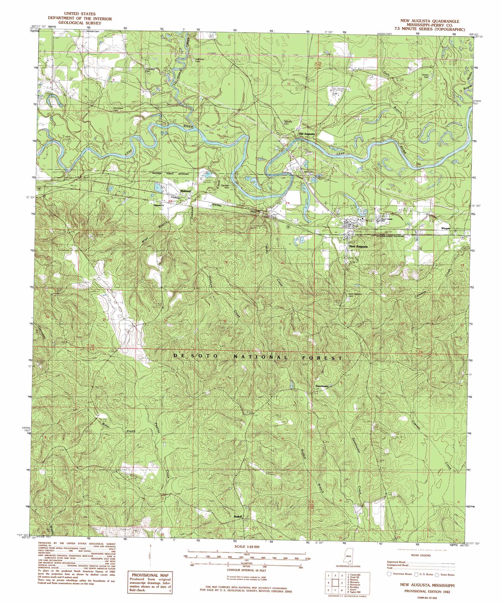
New Augusta Topo Map Mississippi
To zoom in, hover over the map of New Augusta
USGS Topo Quad 31089b1 - 1:24,000 scale
| Topo Map Name: | New Augusta |
| USGS Topo Quad ID: | 31089b1 |
| Print Size: | ca. 21 1/4" wide x 27" high |
| Southeast Coordinates: | 31.125° N latitude / 89° W longitude |
| Map Center Coordinates: | 31.1875° N latitude / 89.0625° W longitude |
| U.S. State: | MS |
| Filename: | o31089b1.jpg |
| Download Map JPG Image: | New Augusta topo map 1:24,000 scale |
| Map Type: | Topographic |
| Topo Series: | 7.5´ |
| Map Scale: | 1:24,000 |
| Source of Map Images: | United States Geological Survey (USGS) |
| Alternate Map Versions: |
New Augusta MS 1983, updated 1983 Download PDF Buy paper map New Augusta MS 2000, updated 2003 Download PDF Buy paper map New Augusta MS 2012 Download PDF Buy paper map New Augusta MS 2015 Download PDF Buy paper map |
| FStopo: | US Forest Service topo New Augusta is available: Download FStopo PDF Download FStopo TIF |
1:24,000 Topo Quads surrounding New Augusta
Eastabuchie |
Barrontown |
Ovett |
Rhodes |
Mulberry |
Hattiesburg |
Carterville |
Ovett Se |
Richton |
Brewer |
Dixie |
Mclaurin |
New Augusta |
Beaumont |
Neely |
Rock Hill |
Brooklyn |
Janice |
Taylor Hill |
Mclain |
Carnes |
Bond |
Bond Pond |
Barbara |
Avent |
> Back to 31089a1 at 1:100,000 scale
> Back to 31088a1 at 1:250,000 scale
> Back to U.S. Topo Maps home
New Augusta topo map: Gazetteer
New Augusta: Populated Places
Mahned elevation 35m 114′New Augusta elevation 34m 111′
Redhill elevation 88m 288′
Wingate elevation 35m 114′
New Augusta: Streams
Burleman Branch elevation 25m 82′Denham Creek elevation 27m 88′
Gum Branch elevation 22m 72′
Miles Branch elevation 36m 118′
Milky Creek elevation 26m 85′
Redhill Branch elevation 57m 187′
Tallahala Creek elevation 27m 88′
Water Prong elevation 63m 206′
New Augusta digital topo map on disk
Buy this New Augusta topo map showing relief, roads, GPS coordinates and other geographical features, as a high-resolution digital map file on DVD:
Gulf Coast (LA, MS, AL, FL) & Southwestern Georgia
Buy digital topo maps: Gulf Coast (LA, MS, AL, FL) & Southwestern Georgia
 & Southwestern Georgia map DVD")