Sandy Hook Nw Topo Map Mississippi
To zoom in, hover over the map of Sandy Hook Nw
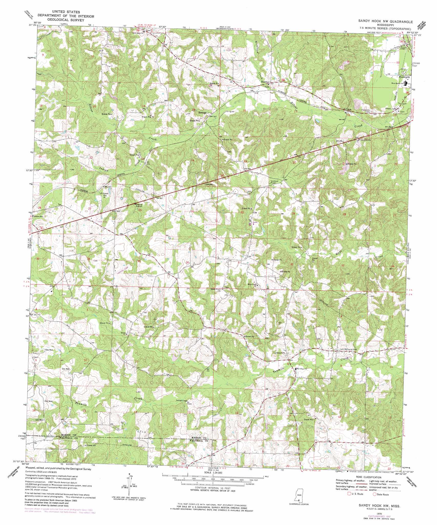
USGS Topo Quad 31089b8 - 1:24,000 scale
| Topo Map Name: | Sandy Hook Nw |
| USGS Topo Quad ID: | 31089b8 |
| Print Size: | ca. 21 1/4" wide x 27" high |
| Southeast Coordinates: | 31.125° N latitude / 89.875° W longitude |
| Map Center Coordinates: | 31.1875° N latitude / 89.9375° W longitude |
| U.S. State: | MS |
| Filename: | o31089b8.jpg |
| Download Map JPG Image: | Sandy Hook Nw topo map 1:24,000 scale |
| Map Type: | Topographic |
| Topo Series: | 7.5´ |
| Map Scale: | 1:24,000 |
| Source of Map Images: | United States Geological Survey (USGS) |
| Alternate Map Versions: |
Sandy Hook NW MS 1970, updated 1972 Download PDF Buy paper map Sandy Hook NW MS 1970, updated 1982 Download PDF Buy paper map Sandy Hook NW MS 1970, updated 1982 Download PDF Buy paper map Sandy Hook NW MS 2012 Download PDF Buy paper map Sandy Hook NW MS 2015 Download PDF Buy paper map |
1:24,000 Topo Quads surrounding Sandy Hook Nw
Topeka |
Tilton |
Oak Vale |
Bunker Hill |
Bassfield |
Jayess |
Darbun |
Morgantown |
Columbia North |
Improve |
Mesa |
Kokomo |
Sandy Hook Nw |
Columbia South |
Pinebur |
Tylertown |
Tylertown Se |
Dexter |
Sandy Hook |
Baxterville Sw |
Clifton |
Pine |
State Line |
Angie |
Fords Creek |
> Back to 31089a1 at 1:100,000 scale
> Back to 31088a1 at 1:250,000 scale
> Back to U.S. Topo Maps home
Sandy Hook Nw topo map: Gazetteer
Sandy Hook Nw: Oilfields
Knoxo Oil Field elevation 81m 265′Sandy Hook Nw: Populated Places
Hamage elevation 83m 272′New Hope elevation 73m 239′
Sumbax elevation 70m 229′
Sandy Hook Nw: Streams
Indian Creek elevation 78m 255′Richland Creek elevation 59m 193′
Sandy Hook Nw digital topo map on disk
Buy this Sandy Hook Nw topo map showing relief, roads, GPS coordinates and other geographical features, as a high-resolution digital map file on DVD:
Gulf Coast (LA, MS, AL, FL) & Southwestern Georgia
Buy digital topo maps: Gulf Coast (LA, MS, AL, FL) & Southwestern Georgia
 & Southwestern Georgia map DVD")