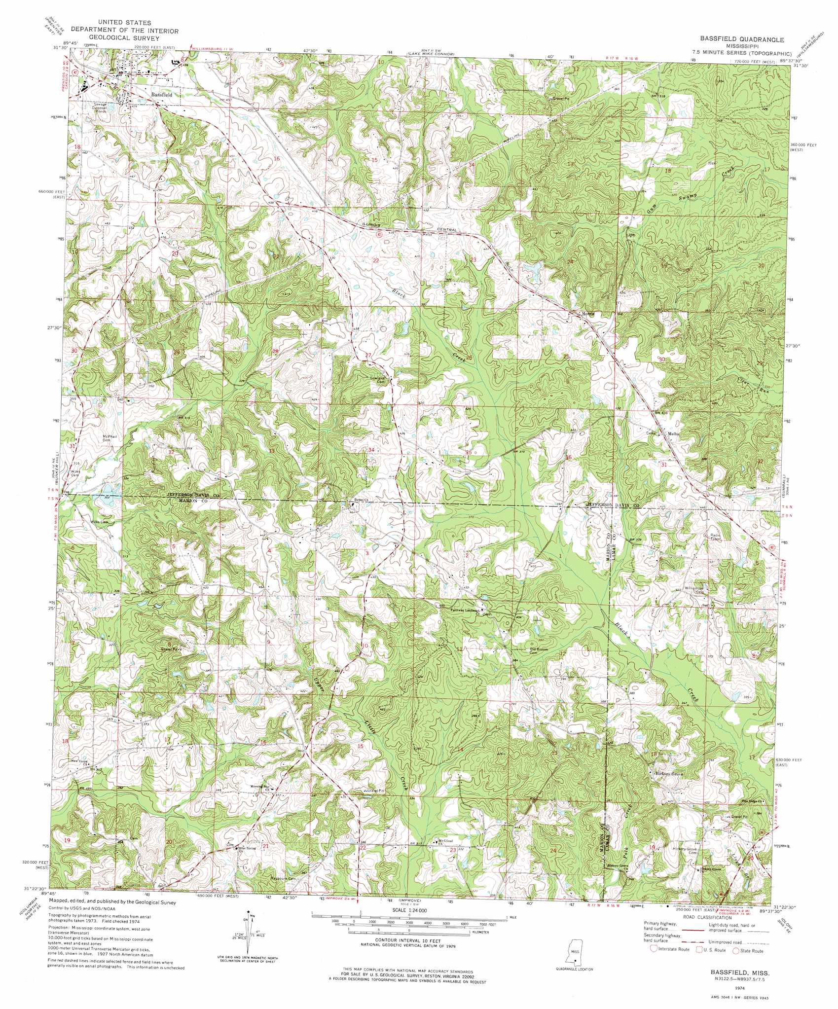
Bassfield Topo Map Mississippi
To zoom in, hover over the map of Bassfield
USGS Topo Quad 31089d6 - 1:24,000 scale
| Topo Map Name: | Bassfield |
| USGS Topo Quad ID: | 31089d6 |
| Print Size: | ca. 21 1/4" wide x 27" high |
| Southeast Coordinates: | 31.375° N latitude / 89.625° W longitude |
| Map Center Coordinates: | 31.4375° N latitude / 89.6875° W longitude |
| U.S. State: | MS |
| Filename: | o31089d6.jpg |
| Download Map JPG Image: | Bassfield topo map 1:24,000 scale |
| Map Type: | Topographic |
| Topo Series: | 7.5´ |
| Map Scale: | 1:24,000 |
| Source of Map Images: | United States Geological Survey (USGS) |
| Alternate Map Versions: |
Bassfield MS 1974, updated 1978 Download PDF Buy paper map Bassfield MS 2012 Download PDF Buy paper map Bassfield MS 2015 Download PDF Buy paper map |
1:24,000 Topo Quads surrounding Bassfield
New Hebron |
Mount Carmel |
Lone Star |
Collins |
Hot Coffee |
Prentiss West |
Prentiss East |
Lake Mike Connor |
Williamsburg |
Seminary |
Oak Vale |
Bunker Hill |
Bassfield |
Sumrall |
Sanford |
Morgantown |
Columbia North |
Improve |
Oloh |
Hattiesburg Sw |
Sandy Hook Nw |
Columbia South |
Pinebur |
Baxterville Ne |
Purvis |
> Back to 31089a1 at 1:100,000 scale
> Back to 31088a1 at 1:250,000 scale
> Back to U.S. Topo Maps home
Bassfield topo map: Gazetteer
Bassfield: Dams
Bassfield Sewage Lagoon Dam elevation 131m 429′Hubie Spights Lake Dam elevation 92m 301′
Lamar Puckett Lake Dam elevation 120m 393′
Michelle Lake Dam elevation 111m 364′
Bassfield: Populated Places
Bassfield elevation 139m 456′Bethel elevation 135m 442′
Hickory Grove elevation 138m 452′
Melba elevation 131m 429′
Morris elevation 133m 436′
New Union elevation 94m 308′
Bassfield digital topo map on disk
Buy this Bassfield topo map showing relief, roads, GPS coordinates and other geographical features, as a high-resolution digital map file on DVD:
Gulf Coast (LA, MS, AL, FL) & Southwestern Georgia
Buy digital topo maps: Gulf Coast (LA, MS, AL, FL) & Southwestern Georgia
 & Southwestern Georgia map DVD")