Lone Star Topo Map Mississippi
To zoom in, hover over the map of Lone Star
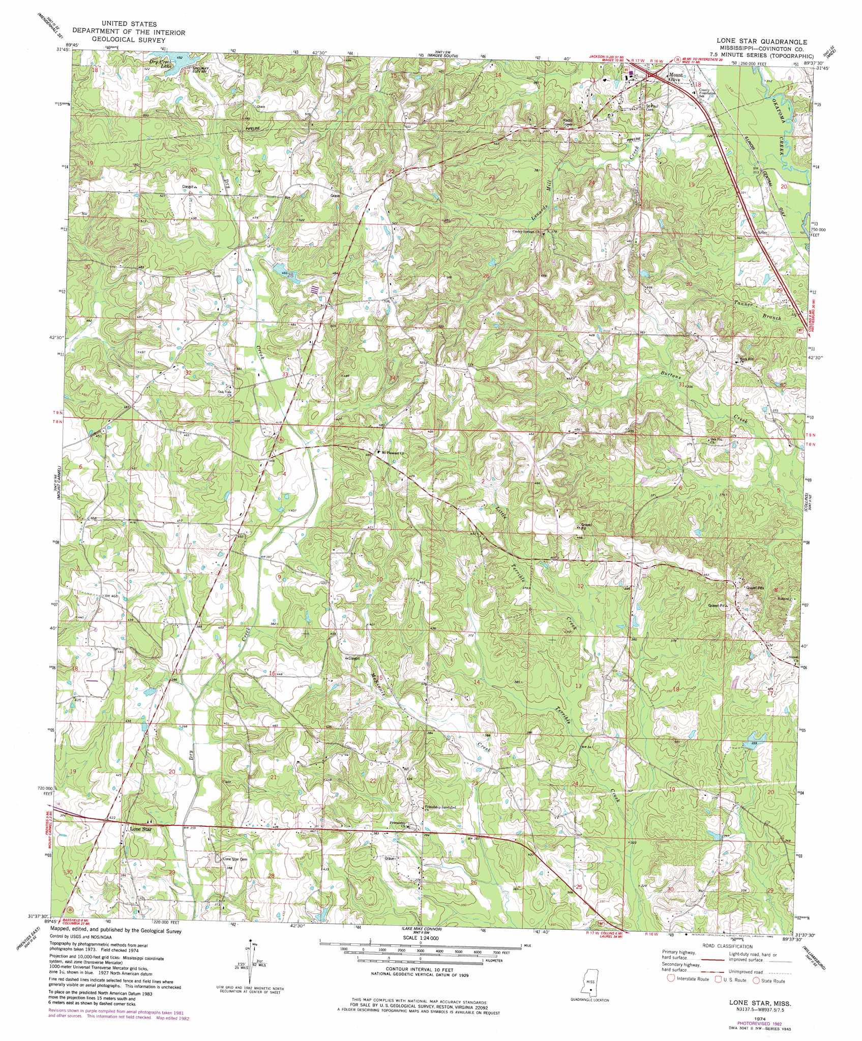
USGS Topo Quad 31089f6 - 1:24,000 scale
| Topo Map Name: | Lone Star |
| USGS Topo Quad ID: | 31089f6 |
| Print Size: | ca. 21 1/4" wide x 27" high |
| Southeast Coordinates: | 31.625° N latitude / 89.625° W longitude |
| Map Center Coordinates: | 31.6875° N latitude / 89.6875° W longitude |
| U.S. State: | MS |
| Filename: | o31089f6.jpg |
| Download Map JPG Image: | Lone Star topo map 1:24,000 scale |
| Map Type: | Topographic |
| Topo Series: | 7.5´ |
| Map Scale: | 1:24,000 |
| Source of Map Images: | United States Geological Survey (USGS) |
| Alternate Map Versions: |
Lone Star MS 1974, updated 1978 Download PDF Buy paper map Lone Star MS 1974, updated 1982 Download PDF Buy paper map Lone Star MS 2012 Download PDF Buy paper map Lone Star MS 2015 Download PDF Buy paper map |
1:24,000 Topo Quads surrounding Lone Star
Mendenhall West |
Mendenhall East |
Magee North |
Cohay |
Center Ridge |
Shivers |
Mendenhall Se |
Magee South |
Mize |
Taylorsville |
New Hebron |
Mount Carmel |
Lone Star |
Collins |
Hot Coffee |
Prentiss West |
Prentiss East |
Lake Mike Connor |
Williamsburg |
Seminary |
Oak Vale |
Bunker Hill |
Bassfield |
Sumrall |
Sanford |
> Back to 31089e1 at 1:100,000 scale
> Back to 31088a1 at 1:250,000 scale
> Back to U.S. Topo Maps home
Lone Star topo map: Gazetteer
Lone Star: Dams
Dry Creek Structure 1 Dam elevation 138m 452′Dry Creek Structure 2 Dam elevation 126m 413′
Dry Creek Watershed 4 Dam elevation 140m 459′
Robert Hall Lake Dam elevation 107m 351′
Lone Star: Populated Places
Arbo elevation 101m 331′Cooley Springs elevation 135m 442′
Friendship elevation 122m 400′
Lone Star elevation 124m 406′
Mount Pleasant elevation 149m 488′
Rock Hill elevation 120m 393′
Sunset elevation 129m 423′
Lone Star: Reservoirs
Dry Creek Lake elevation 150m 492′Lone Star: Streams
Lenards Mill Creek elevation 92m 301′Little Terrible Creek elevation 103m 337′
Lone Star digital topo map on disk
Buy this Lone Star topo map showing relief, roads, GPS coordinates and other geographical features, as a high-resolution digital map file on DVD:
Gulf Coast (LA, MS, AL, FL) & Southwestern Georgia
Buy digital topo maps: Gulf Coast (LA, MS, AL, FL) & Southwestern Georgia
 & Southwestern Georgia map DVD")