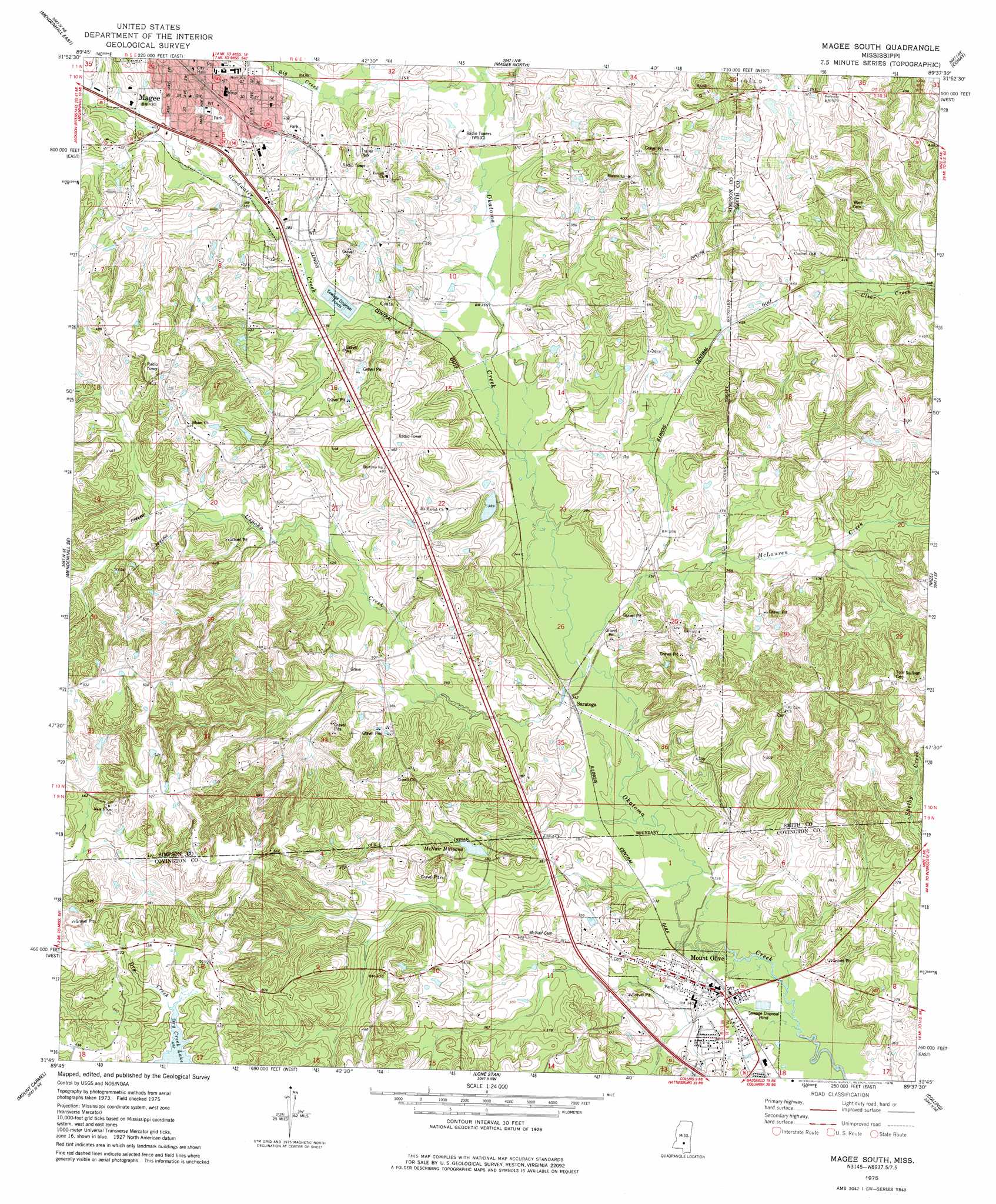
Magee South Topo Map Mississippi
To zoom in, hover over the map of Magee South
USGS Topo Quad 31089g6 - 1:24,000 scale
| Topo Map Name: | Magee South |
| USGS Topo Quad ID: | 31089g6 |
| Print Size: | ca. 21 1/4" wide x 27" high |
| Southeast Coordinates: | 31.75° N latitude / 89.625° W longitude |
| Map Center Coordinates: | 31.8125° N latitude / 89.6875° W longitude |
| U.S. State: | MS |
| Filename: | o31089g6.jpg |
| Download Map JPG Image: | Magee South topo map 1:24,000 scale |
| Map Type: | Topographic |
| Topo Series: | 7.5´ |
| Map Scale: | 1:24,000 |
| Source of Map Images: | United States Geological Survey (USGS) |
| Alternate Map Versions: |
Magee South MS 1975, updated 1978 Download PDF Buy paper map Magee South MS 2012 Download PDF Buy paper map Magee South MS 2015 Download PDF Buy paper map |
1:24,000 Topo Quads surrounding Magee South
Braxton |
Puckett |
White Oak |
Raleigh |
Louin Sw |
Mendenhall West |
Mendenhall East |
Magee North |
Cohay |
Center Ridge |
Shivers |
Mendenhall Se |
Magee South |
Mize |
Taylorsville |
New Hebron |
Mount Carmel |
Lone Star |
Collins |
Hot Coffee |
Prentiss West |
Prentiss East |
Lake Mike Connor |
Williamsburg |
Seminary |
> Back to 31089e1 at 1:100,000 scale
> Back to 31088a1 at 1:250,000 scale
> Back to U.S. Topo Maps home
Magee South topo map: Gazetteer
Magee South: Dams
Dry Creek Structure 3 Dam elevation 151m 495′Roger Parish Lake Dam elevation 106m 347′
Magee South: Oilfields
Magee Oil Field elevation 142m 465′Magee South: Populated Places
Coats elevation 119m 390′Magee elevation 132m 433′
McNair elevation 120m 393′
Merry Hell elevation 125m 410′
Mount Olive elevation 102m 334′
Saratoga elevation 103m 337′
Magee South: Post Offices
Magee Post Office elevation 131m 429′Magee South: Reservoirs
McNair Millpond elevation 116m 380′Magee South: Streams
Big Creek elevation 109m 357′Goodwater Creek elevation 106m 347′
McLauren Creek elevation 102m 334′
Uspoha Creek elevation 102m 334′
Magee South digital topo map on disk
Buy this Magee South topo map showing relief, roads, GPS coordinates and other geographical features, as a high-resolution digital map file on DVD:
Gulf Coast (LA, MS, AL, FL) & Southwestern Georgia
Buy digital topo maps: Gulf Coast (LA, MS, AL, FL) & Southwestern Georgia
 & Southwestern Georgia map DVD")