Mendenhall Se Topo Map Mississippi
To zoom in, hover over the map of Mendenhall Se
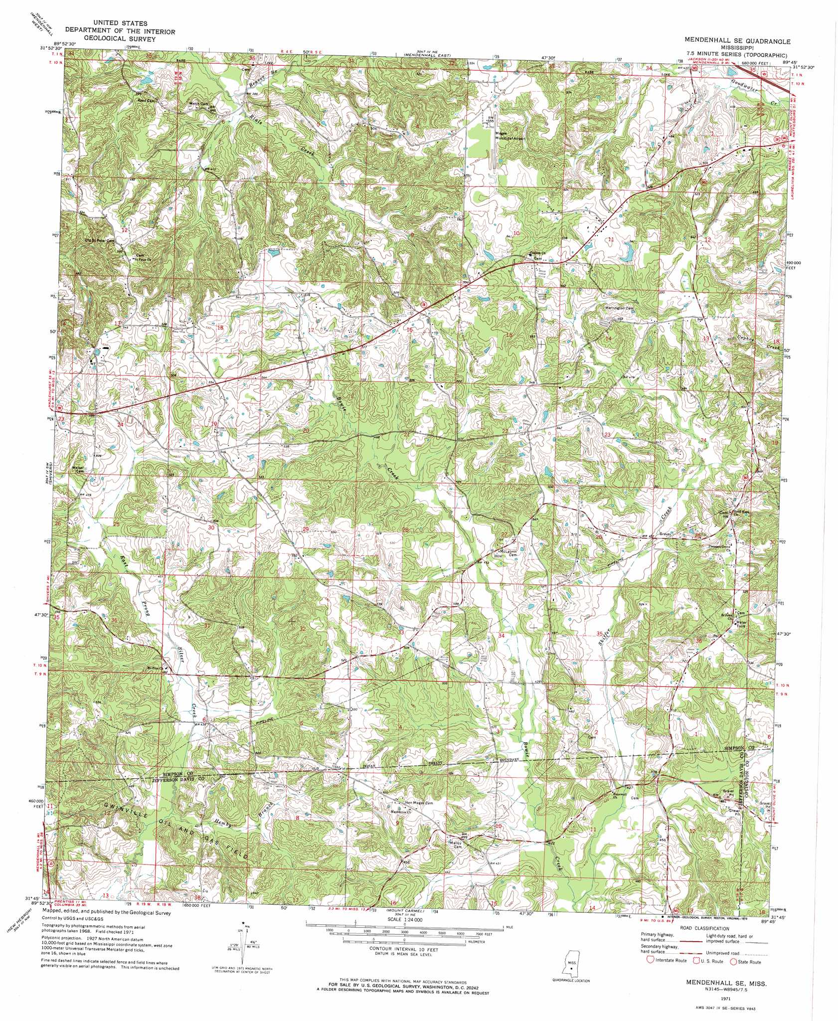
USGS Topo Quad 31089g7 - 1:24,000 scale
| Topo Map Name: | Mendenhall Se |
| USGS Topo Quad ID: | 31089g7 |
| Print Size: | ca. 21 1/4" wide x 27" high |
| Southeast Coordinates: | 31.75° N latitude / 89.75° W longitude |
| Map Center Coordinates: | 31.8125° N latitude / 89.8125° W longitude |
| U.S. State: | MS |
| Filename: | o31089g7.jpg |
| Download Map JPG Image: | Mendenhall Se topo map 1:24,000 scale |
| Map Type: | Topographic |
| Topo Series: | 7.5´ |
| Map Scale: | 1:24,000 |
| Source of Map Images: | United States Geological Survey (USGS) |
| Alternate Map Versions: |
Mendenhall SE MS 1971, updated 1973 Download PDF Buy paper map Mendenhall SE MS 2012 Download PDF Buy paper map Mendenhall SE MS 2015 Download PDF Buy paper map |
1:24,000 Topo Quads surrounding Mendenhall Se
Star |
Braxton |
Puckett |
White Oak |
Raleigh |
Harrisville |
Mendenhall West |
Mendenhall East |
Magee North |
Cohay |
Schley |
Shivers |
Mendenhall Se |
Magee South |
Mize |
Monticello Ne |
New Hebron |
Mount Carmel |
Lone Star |
Collins |
Monticello |
Prentiss West |
Prentiss East |
Lake Mike Connor |
Williamsburg |
> Back to 31089e1 at 1:100,000 scale
> Back to 31088a1 at 1:250,000 scale
> Back to U.S. Topo Maps home
Mendenhall Se topo map: Gazetteer
Mendenhall Se: Airports
Magee Municipal Airport elevation 168m 551′Mendenhall Se: Populated Places
Cyclone elevation 167m 547′Jaynesville elevation 153m 501′
Mendenhall Se: Streams
Beaver Branch elevation 114m 374′Hemby Branch elevation 127m 416′
Skiffer Creek elevation 123m 403′
Mendenhall Se digital topo map on disk
Buy this Mendenhall Se topo map showing relief, roads, GPS coordinates and other geographical features, as a high-resolution digital map file on DVD:
Gulf Coast (LA, MS, AL, FL) & Southwestern Georgia
Buy digital topo maps: Gulf Coast (LA, MS, AL, FL) & Southwestern Georgia
 & Southwestern Georgia map DVD")