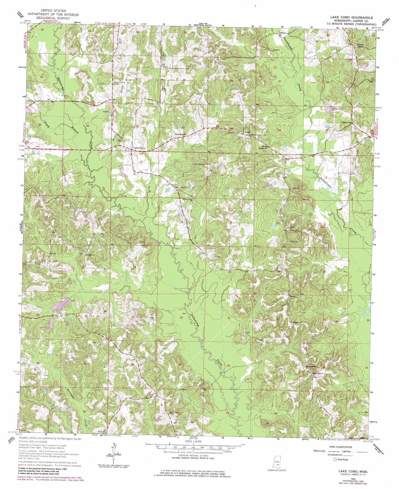
Lake Como Topo Map Mississippi
To zoom in, hover over the map of Lake Como
USGS Topo Quad 31089h2 - 1:24,000 scale
| Topo Map Name: | Lake Como |
| USGS Topo Quad ID: | 31089h2 |
| Print Size: | ca. 21 1/4" wide x 27" high |
| Southeast Coordinates: | 31.875° N latitude / 89.125° W longitude |
| Map Center Coordinates: | 31.9375° N latitude / 89.1875° W longitude |
| U.S. State: | MS |
| Filename: | o31089h2.jpg |
| Download Map JPG Image: | Lake Como topo map 1:24,000 scale |
| Map Type: | Topographic |
| Topo Series: | 7.5´ |
| Map Scale: | 1:24,000 |
| Source of Map Images: | United States Geological Survey (USGS) |
| Alternate Map Versions: |
Lake Como MS 1964, updated 1965 Download PDF Buy paper map Lake Como MS 1964, updated 1982 Download PDF Buy paper map Lake Como MS 2012 Download PDF Buy paper map Lake Como MS 2015 Download PDF Buy paper map |
1:24,000 Topo Quads surrounding Lake Como
Pineville |
Clear Springs |
Montrose North |
Hero |
Rose Hill |
Louin Sw |
Louin |
Montrose South |
Paulding |
Pachuta |
Center Ridge |
Bay Springs |
Lake Como |
Waldrup |
Heidelberg |
Taylorsville |
Soso |
Moss |
Sandersville |
Heidelberg Sw |
Hot Coffee |
Hebron |
Laurel West |
Laurel East |
Myrick |
> Back to 31089e1 at 1:100,000 scale
> Back to 31088a1 at 1:250,000 scale
> Back to U.S. Topo Maps home
Lake Como topo map: Gazetteer
Lake Como: Airports
Thigpen Field elevation 108m 354′Lake Como: Dams
Girl Scout Camp Lake Dam elevation 116m 380′Hosey Lake Dam elevation 104m 341′
Ishee Lake Dam elevation 101m 331′
M L Husband Lake Dam elevation 111m 364′
Norman Lake Dam elevation 103m 337′
Lake Como: Populated Places
Acme elevation 131m 429′Blue Ridge elevation 121m 396′
Lake Como elevation 105m 344′
Vernon elevation 125m 410′
Vrue (historical) elevation 121m 396′
Lake Como: Streams
Piney Branch elevation 92m 301′Piney Creek elevation 92m 301′
Lake Como digital topo map on disk
Buy this Lake Como topo map showing relief, roads, GPS coordinates and other geographical features, as a high-resolution digital map file on DVD:
Gulf Coast (LA, MS, AL, FL) & Southwestern Georgia
Buy digital topo maps: Gulf Coast (LA, MS, AL, FL) & Southwestern Georgia
 & Southwestern Georgia map DVD")