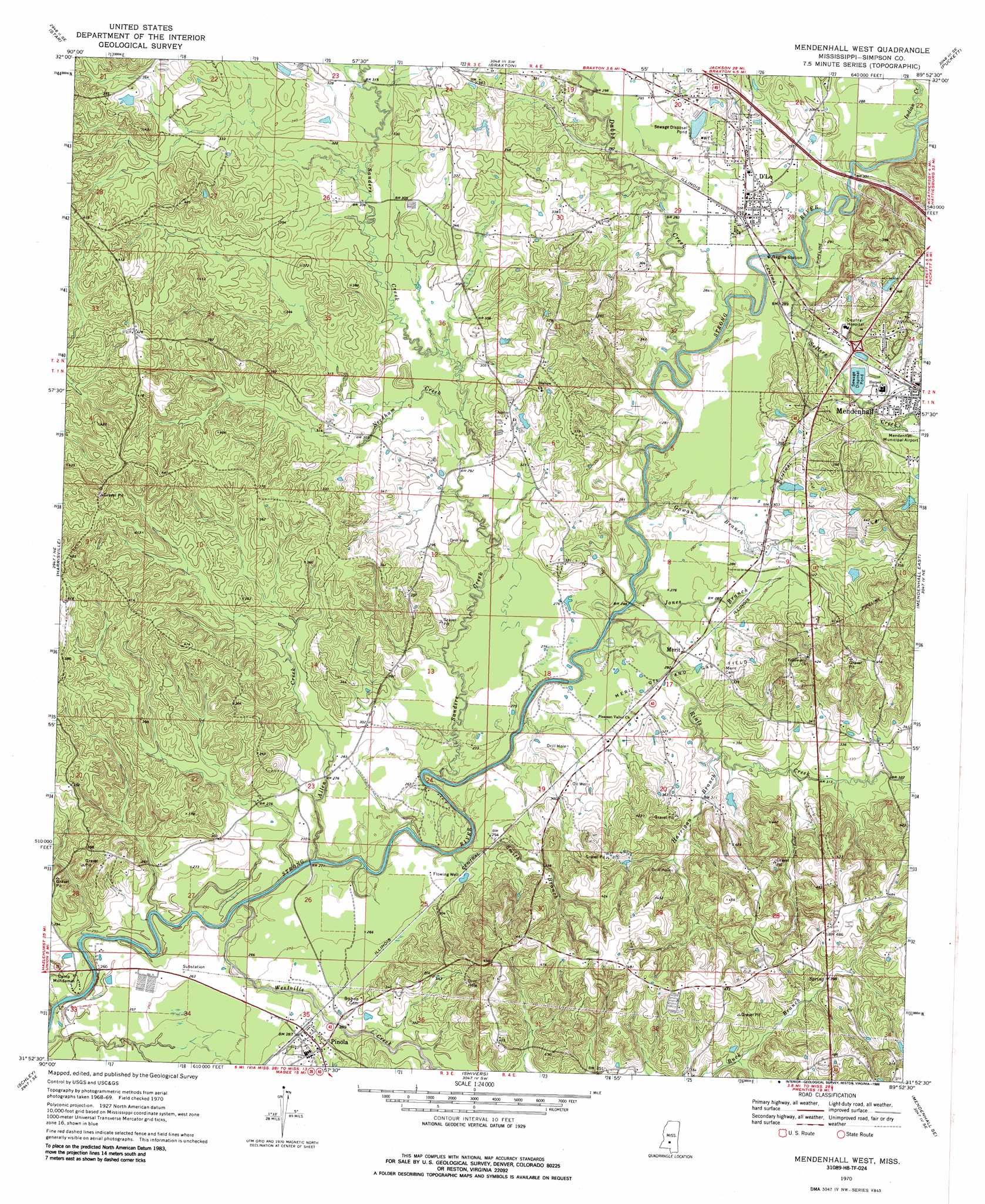
Mendenhall West Topo Map Mississippi
To zoom in, hover over the map of Mendenhall West
USGS Topo Quad 31089h8 - 1:24,000 scale
| Topo Map Name: | Mendenhall West |
| USGS Topo Quad ID: | 31089h8 |
| Print Size: | ca. 21 1/4" wide x 27" high |
| Southeast Coordinates: | 31.875° N latitude / 89.875° W longitude |
| Map Center Coordinates: | 31.9375° N latitude / 89.9375° W longitude |
| U.S. State: | MS |
| Filename: | o31089h8.jpg |
| Download Map JPG Image: | Mendenhall West topo map 1:24,000 scale |
| Map Type: | Topographic |
| Topo Series: | 7.5´ |
| Map Scale: | 1:24,000 |
| Source of Map Images: | United States Geological Survey (USGS) |
| Alternate Map Versions: |
Mendenhall West MS 1970, updated 1972 Download PDF Buy paper map Mendenhall West MS 1970, updated 1986 Download PDF Buy paper map Mendenhall West MS 2012 Download PDF Buy paper map Mendenhall West MS 2015 Download PDF Buy paper map |
1:24,000 Topo Quads surrounding Mendenhall West
Florence |
Whitfield |
Puckett Nw |
Johns |
Polkville |
Whites |
Star |
Braxton |
Puckett |
White Oak |
Hopewell |
Harrisville |
Mendenhall West |
Mendenhall East |
Magee North |
Georgetown |
Schley |
Shivers |
Mendenhall Se |
Magee South |
Oma |
Monticello Ne |
New Hebron |
Mount Carmel |
Lone Star |
> Back to 31089e1 at 1:100,000 scale
> Back to 31088a1 at 1:250,000 scale
> Back to U.S. Topo Maps home
Mendenhall West topo map: Gazetteer
Mendenhall West: Bridges
Cable Bridge elevation 72m 236′Scotts Bridge elevation 77m 252′
Mendenhall West: Dams
Adams Egg Farm Lagoon Dam elevation 79m 259′Gullage Lake Dam elevation 89m 291′
Mississippi No Name 35 Dam elevation 91m 298′
Mendenhall West: Oilfields
Merit Oil and Gas Field elevation 89m 291′Mendenhall West: Populated Places
D'Lo elevation 91m 298′Merit elevation 89m 291′
Pinola elevation 95m 311′
Mendenhall West: Streams
Allen Creek elevation 75m 246′Boggan Branch elevation 107m 351′
Dabbs Creek elevation 77m 252′
Gowan Branch elevation 77m 252′
Harrigan Branch elevation 88m 288′
Indian Creek elevation 81m 265′
Jones Branch elevation 77m 252′
Needham Creek elevation 87m 285′
Rials Creek elevation 77m 252′
Sanders Creek elevation 74m 242′
Sellers Creek elevation 80m 262′
Smith Branch elevation 74m 242′
Tanyard Creek elevation 85m 278′
Westville Creek elevation 71m 232′
Mendenhall West digital topo map on disk
Buy this Mendenhall West topo map showing relief, roads, GPS coordinates and other geographical features, as a high-resolution digital map file on DVD:
Gulf Coast (LA, MS, AL, FL) & Southwestern Georgia
Buy digital topo maps: Gulf Coast (LA, MS, AL, FL) & Southwestern Georgia
 & Southwestern Georgia map DVD")