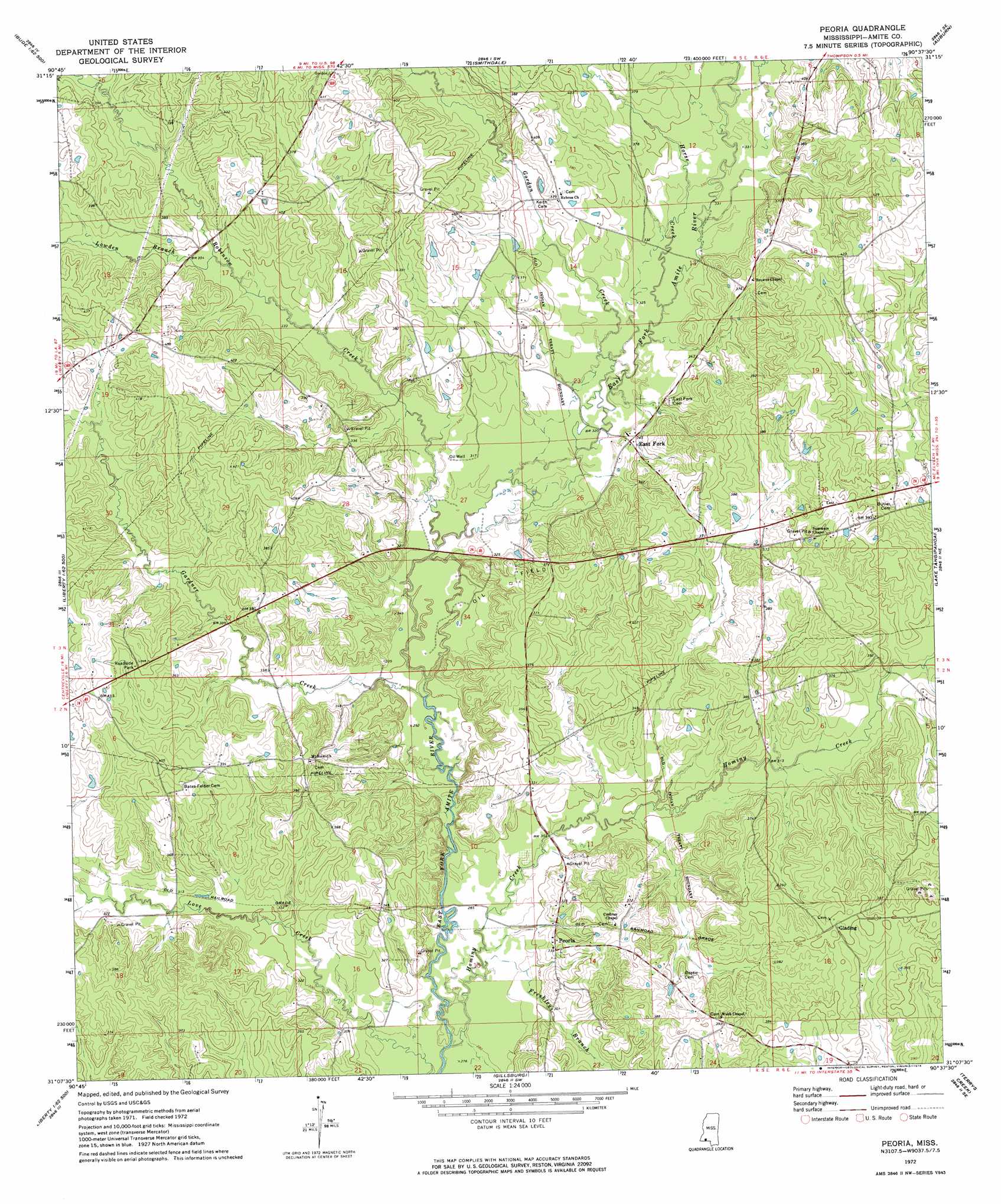
Peoria Topo Map Mississippi
To zoom in, hover over the map of Peoria
USGS Topo Quad 31090b6 - 1:24,000 scale
| Topo Map Name: | Peoria |
| USGS Topo Quad ID: | 31090b6 |
| Print Size: | ca. 21 1/4" wide x 27" high |
| Southeast Coordinates: | 31.125° N latitude / 90.625° W longitude |
| Map Center Coordinates: | 31.1875° N latitude / 90.6875° W longitude |
| U.S. State: | MS |
| Filename: | o31090b6.jpg |
| Download Map JPG Image: | Peoria topo map 1:24,000 scale |
| Map Type: | Topographic |
| Topo Series: | 7.5´ |
| Map Scale: | 1:24,000 |
| Source of Map Images: | United States Geological Survey (USGS) |
| Alternate Map Versions: |
Peoria MS 1972, updated 1974 Download PDF Buy paper map Peoria MS 2012 Download PDF Buy paper map Peoria MS 2015 Download PDF Buy paper map |
1:24,000 Topo Quads surrounding Peoria
Meadville |
Bude |
Little Springs |
West Lincoln |
Bogue Chitto |
Homochitto |
Busy Corner |
Smithdale |
Auburn |
Mccomb North |
Bewelcome |
Liberty |
Peoria |
Lake Tangipahoa |
Mccomb South |
Berwick |
Street |
Gillsburg |
Terrys Creek |
Osyka |
Woodland |
Chipola |
Liverpool |
Kentwood |
Spring Creek |
> Back to 31090a1 at 1:100,000 scale
> Back to 31090a1 at 1:250,000 scale
> Back to U.S. Topo Maps home
Peoria topo map: Gazetteer
Peoria: Bridges
Bates Mill Bridge (historical) elevation 86m 282′Peoria: Populated Places
East Fork elevation 104m 341′Glading elevation 124m 406′
Hebron elevation 113m 370′
Peoria elevation 103m 337′
Peoria: Streams
Freshley Branch elevation 85m 278′Gardner Creek elevation 88m 288′
Gordon Creek elevation 94m 308′
Hominy Creek elevation 81m 265′
Horse Creek elevation 97m 318′
Lowden Branch elevation 104m 341′
Robinson Creek elevation 91m 298′
Peoria digital topo map on disk
Buy this Peoria topo map showing relief, roads, GPS coordinates and other geographical features, as a high-resolution digital map file on DVD: