Monticello Topo Map Mississippi
To zoom in, hover over the map of Monticello
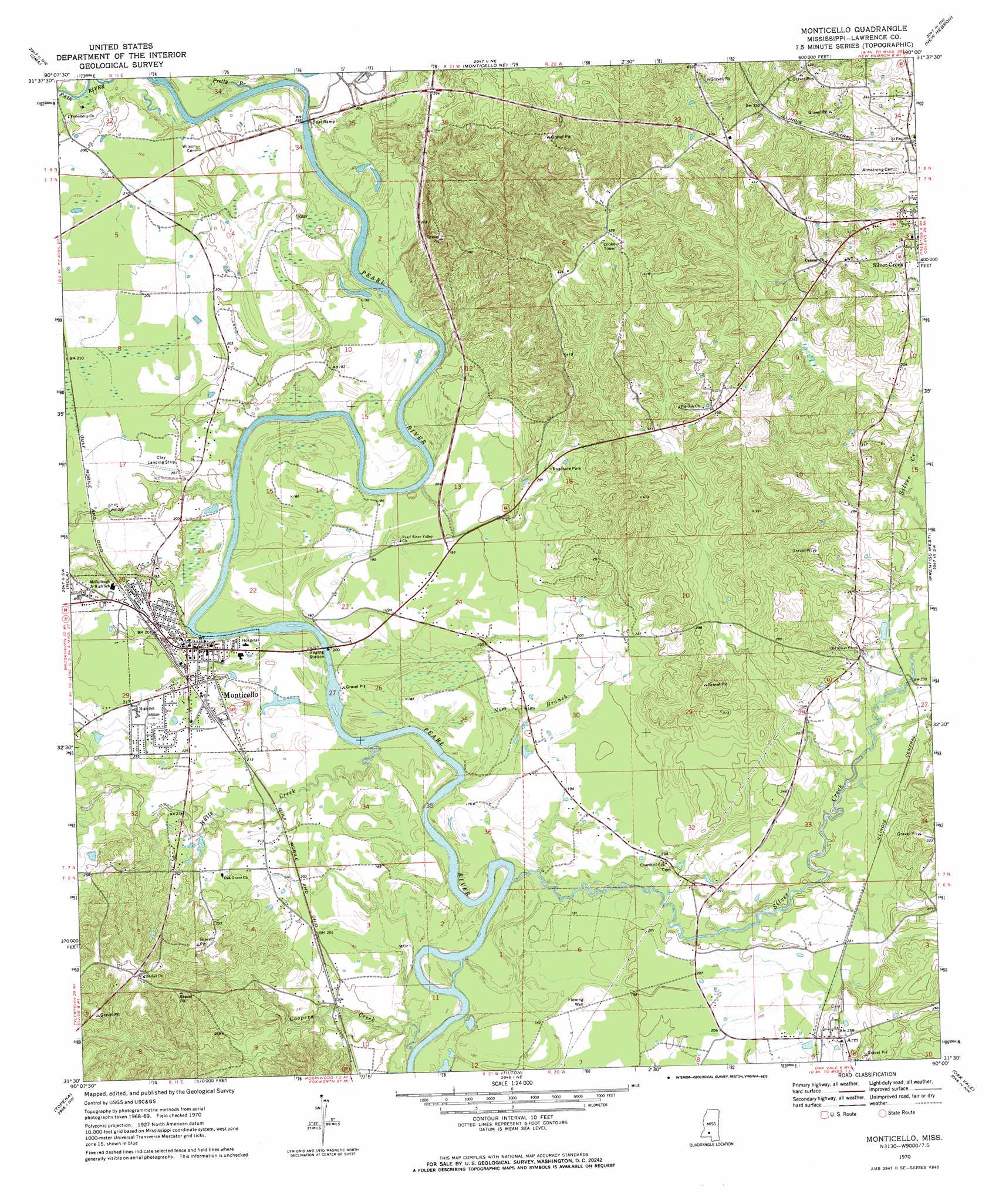
USGS Topo Quad 31090e1 - 1:24,000 scale
| Topo Map Name: | Monticello |
| USGS Topo Quad ID: | 31090e1 |
| Print Size: | ca. 21 1/4" wide x 27" high |
| Southeast Coordinates: | 31.5° N latitude / 90° W longitude |
| Map Center Coordinates: | 31.5625° N latitude / 90.0625° W longitude |
| U.S. State: | MS |
| Filename: | o31090e1.jpg |
| Download Map JPG Image: | Monticello topo map 1:24,000 scale |
| Map Type: | Topographic |
| Topo Series: | 7.5´ |
| Map Scale: | 1:24,000 |
| Source of Map Images: | United States Geological Survey (USGS) |
| Alternate Map Versions: |
Monticello MS 1970, updated 1972 Download PDF Buy paper map Monticello MS 2012 Download PDF Buy paper map Monticello MS 2015 Download PDF Buy paper map |
1:24,000 Topo Quads surrounding Monticello
Shady Grove |
Georgetown |
Schley |
Shivers |
Mendenhall Se |
Stronghope |
Oma |
Monticello Ne |
New Hebron |
Mount Carmel |
Fair Oak Springs |
Nola |
Monticello |
Prentiss West |
Prentiss East |
Ruth |
Topeka |
Tilton |
Oak Vale |
Bunker Hill |
Pricedale |
Jayess |
Darbun |
Morgantown |
Columbia North |
> Back to 31090e1 at 1:100,000 scale
> Back to 31090a1 at 1:250,000 scale
> Back to U.S. Topo Maps home
Monticello topo map: Gazetteer
Monticello: Airports
Clay Airport elevation 61m 200′Monticello: Dams
Fortenberry Pond Dam elevation 70m 229′Saint Regis Paper Holding Reservoir elevation 59m 193′
Monticello: Populated Places
Arm elevation 74m 242′Hardscrabble (historical) elevation 71m 232′
Monticello elevation 60m 196′
Monticello: Streams
Coopers Creek elevation 51m 167′Fair River elevation 52m 170′
Halls Creek elevation 50m 164′
Nim Branch elevation 53m 173′
Pretty Branch elevation 55m 180′
Silver Creek elevation 48m 157′
Monticello digital topo map on disk
Buy this Monticello topo map showing relief, roads, GPS coordinates and other geographical features, as a high-resolution digital map file on DVD: