Nola Topo Map Mississippi
To zoom in, hover over the map of Nola
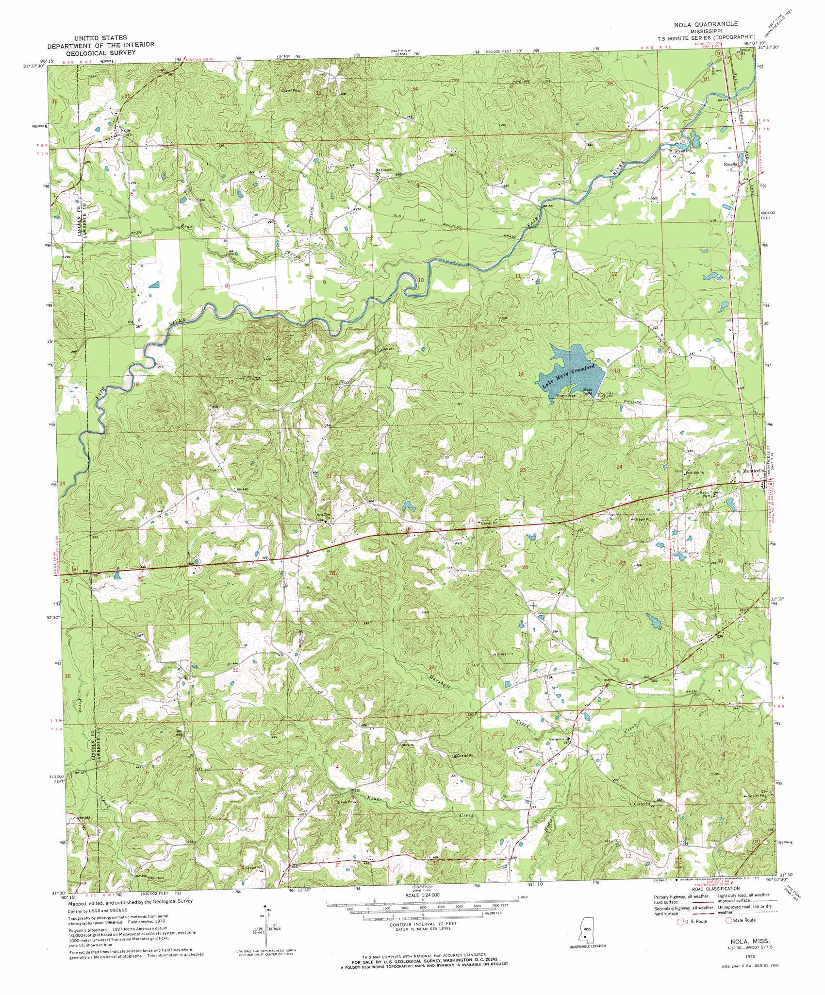
USGS Topo Quad 31090e2 - 1:24,000 scale
| Topo Map Name: | Nola |
| USGS Topo Quad ID: | 31090e2 |
| Print Size: | ca. 21 1/4" wide x 27" high |
| Southeast Coordinates: | 31.5° N latitude / 90.125° W longitude |
| Map Center Coordinates: | 31.5625° N latitude / 90.1875° W longitude |
| U.S. State: | MS |
| Filename: | o31090e2.jpg |
| Download Map JPG Image: | Nola topo map 1:24,000 scale |
| Map Type: | Topographic |
| Topo Series: | 7.5´ |
| Map Scale: | 1:24,000 |
| Source of Map Images: | United States Geological Survey (USGS) |
| Alternate Map Versions: |
Nola MS 1970, updated 1972 Download PDF Buy paper map Nola MS 2012 Download PDF Buy paper map Nola MS 2015 Download PDF Buy paper map |
1:24,000 Topo Quads surrounding Nola
Hazlehurst |
Shady Grove |
Georgetown |
Schley |
Shivers |
Wesson |
Stronghope |
Oma |
Monticello Ne |
New Hebron |
Brookhaven |
Fair Oak Springs |
Nola |
Monticello |
Prentiss West |
Bogue Chitto |
Ruth |
Topeka |
Tilton |
Oak Vale |
Mccomb North |
Pricedale |
Jayess |
Darbun |
Morgantown |
> Back to 31090e1 at 1:100,000 scale
> Back to 31090a1 at 1:250,000 scale
> Back to U.S. Topo Maps home
Nola topo map: Gazetteer
Nola: Dams
Mary Crawford Lake Dam elevation 76m 249′Sasser Pond Dam elevation 117m 383′
Wilson Lake Dam elevation 85m 278′
Nola: Populated Places
Nola elevation 98m 321′Rosella elevation 65m 213′
Nola: Reservoirs
Lake Mary Crawford elevation 78m 255′Nola: Springs
Joseph Neylans Spring elevation 76m 249′Nola: Streams
Bear Creek elevation 67m 219′Kings Creek elevation 75m 246′
Marshall Creek elevation 72m 236′
Maxwells Branch elevation 81m 265′
Nola digital topo map on disk
Buy this Nola topo map showing relief, roads, GPS coordinates and other geographical features, as a high-resolution digital map file on DVD: