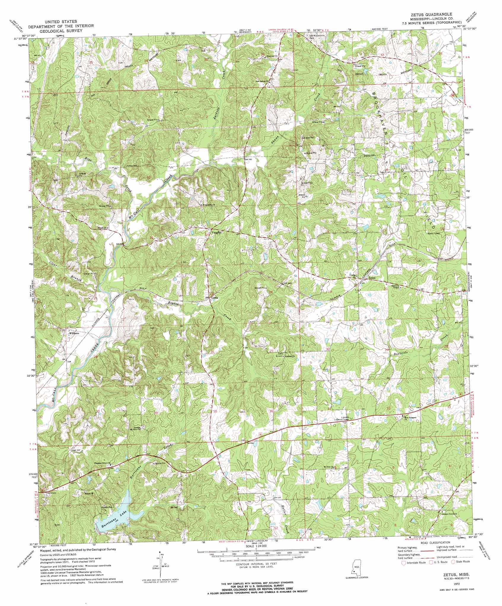
Zetus Topo Map Mississippi
To zoom in, hover over the map of Zetus
USGS Topo Quad 31090e5 - 1:24,000 scale
| Topo Map Name: | Zetus |
| USGS Topo Quad ID: | 31090e5 |
| Print Size: | ca. 21 1/4" wide x 27" high |
| Southeast Coordinates: | 31.5° N latitude / 90.5° W longitude |
| Map Center Coordinates: | 31.5625° N latitude / 90.5625° W longitude |
| U.S. State: | MS |
| Filename: | o31090e5.jpg |
| Download Map JPG Image: | Zetus topo map 1:24,000 scale |
| Map Type: | Topographic |
| Topo Series: | 7.5´ |
| Map Scale: | 1:24,000 |
| Source of Map Images: | United States Geological Survey (USGS) |
| Alternate Map Versions: |
Zetus MS 1972, updated 1974 Download PDF Buy paper map Zetus MS 2012 Download PDF Buy paper map Zetus MS 2015 Download PDF Buy paper map |
1:24,000 Topo Quads surrounding Zetus
Mcbride |
Barlow |
Smyrna |
Hazlehurst |
Shady Grove |
Union Church |
Caseyville |
Midway |
Wesson |
Stronghope |
Eddicetown |
Mccall Creek |
Zetus |
Brookhaven |
Fair Oak Springs |
Bude |
Little Springs |
West Lincoln |
Bogue Chitto |
Ruth |
Busy Corner |
Smithdale |
Auburn |
Mccomb North |
Pricedale |
> Back to 31090e1 at 1:100,000 scale
> Back to 31090a1 at 1:250,000 scale
> Back to U.S. Topo Maps home
Zetus topo map: Gazetteer
Zetus: Dams
Foster Lake Dam elevation 143m 469′Hurricane Lake Dam elevation 112m 367′
Zetus: Oilfields
Brookhaven Oil Field elevation 146m 479′Zetus: Populated Places
Cobbs elevation 122m 400′Vaughn elevation 143m 469′
Williams elevation 113m 370′
Zetus elevation 146m 479′
Zetus: Reservoirs
Hurricane Lake elevation 112m 367′Zetus: Streams
Beaver Creek elevation 99m 324′Blue Creek elevation 102m 334′
Clear Branch elevation 99m 324′
Hog Branch elevation 113m 370′
Jackson Creek elevation 108m 354′
Shaws Creek elevation 108m 354′
Zetus digital topo map on disk
Buy this Zetus topo map showing relief, roads, GPS coordinates and other geographical features, as a high-resolution digital map file on DVD: