Wesson Topo Map Mississippi
To zoom in, hover over the map of Wesson
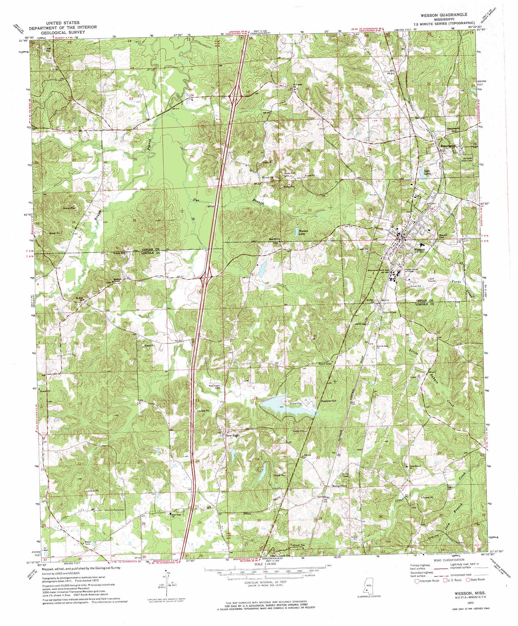
USGS Topo Quad 31090f4 - 1:24,000 scale
| Topo Map Name: | Wesson |
| USGS Topo Quad ID: | 31090f4 |
| Print Size: | ca. 21 1/4" wide x 27" high |
| Southeast Coordinates: | 31.625° N latitude / 90.375° W longitude |
| Map Center Coordinates: | 31.6875° N latitude / 90.4375° W longitude |
| U.S. State: | MS |
| Filename: | o31090f4.jpg |
| Download Map JPG Image: | Wesson topo map 1:24,000 scale |
| Map Type: | Topographic |
| Topo Series: | 7.5´ |
| Map Scale: | 1:24,000 |
| Source of Map Images: | United States Geological Survey (USGS) |
| Alternate Map Versions: |
Wesson MS 1972, updated 1974 Download PDF Buy paper map Wesson MS 1972, updated 1974 Download PDF Buy paper map Wesson MS 2012 Download PDF Buy paper map Wesson MS 2015 Download PDF Buy paper map |
1:24,000 Topo Quads surrounding Wesson
Dentville Nw |
Dentville |
Gallman |
Crystal Springs |
Hopewell |
Barlow |
Smyrna |
Hazlehurst |
Shady Grove |
Georgetown |
Caseyville |
Midway |
Wesson |
Stronghope |
Oma |
Mccall Creek |
Zetus |
Brookhaven |
Fair Oak Springs |
Nola |
Little Springs |
West Lincoln |
Bogue Chitto |
Ruth |
Topeka |
> Back to 31090e1 at 1:100,000 scale
> Back to 31090a1 at 1:250,000 scale
> Back to U.S. Topo Maps home
Wesson topo map: Gazetteer
Wesson: Crossings
Interchange 48 elevation 107m 351′Interchange 51 elevation 110m 360′
Wesson: Dams
Bahala Creek Watershed Structure 3 Dam elevation 115m 377′Bahala Creek Watershed Structure 4 Dam elevation 110m 360′
Burgess Lake Dam elevation 107m 351′
Louie Entrican Lake Dam elevation 128m 419′
Stradheim Lake Dam elevation 140m 459′
Wesson Lake Dam elevation 120m 393′
Williams Lake Dam elevation 117m 383′
Wesson: Populated Places
Beauregard elevation 141m 462′Montgomery elevation 148m 485′
New Sight elevation 136m 446′
Wesson elevation 142m 465′
Wesson: Reservoirs
Lake Little elevation 130m 426′Wesson Lake elevation 110m 360′
Wesson: Streams
Dye Branch elevation 92m 301′Isom Branch elevation 107m 351′
Wesson digital topo map on disk
Buy this Wesson topo map showing relief, roads, GPS coordinates and other geographical features, as a high-resolution digital map file on DVD: