Georgetown Topo Map Mississippi
To zoom in, hover over the map of Georgetown
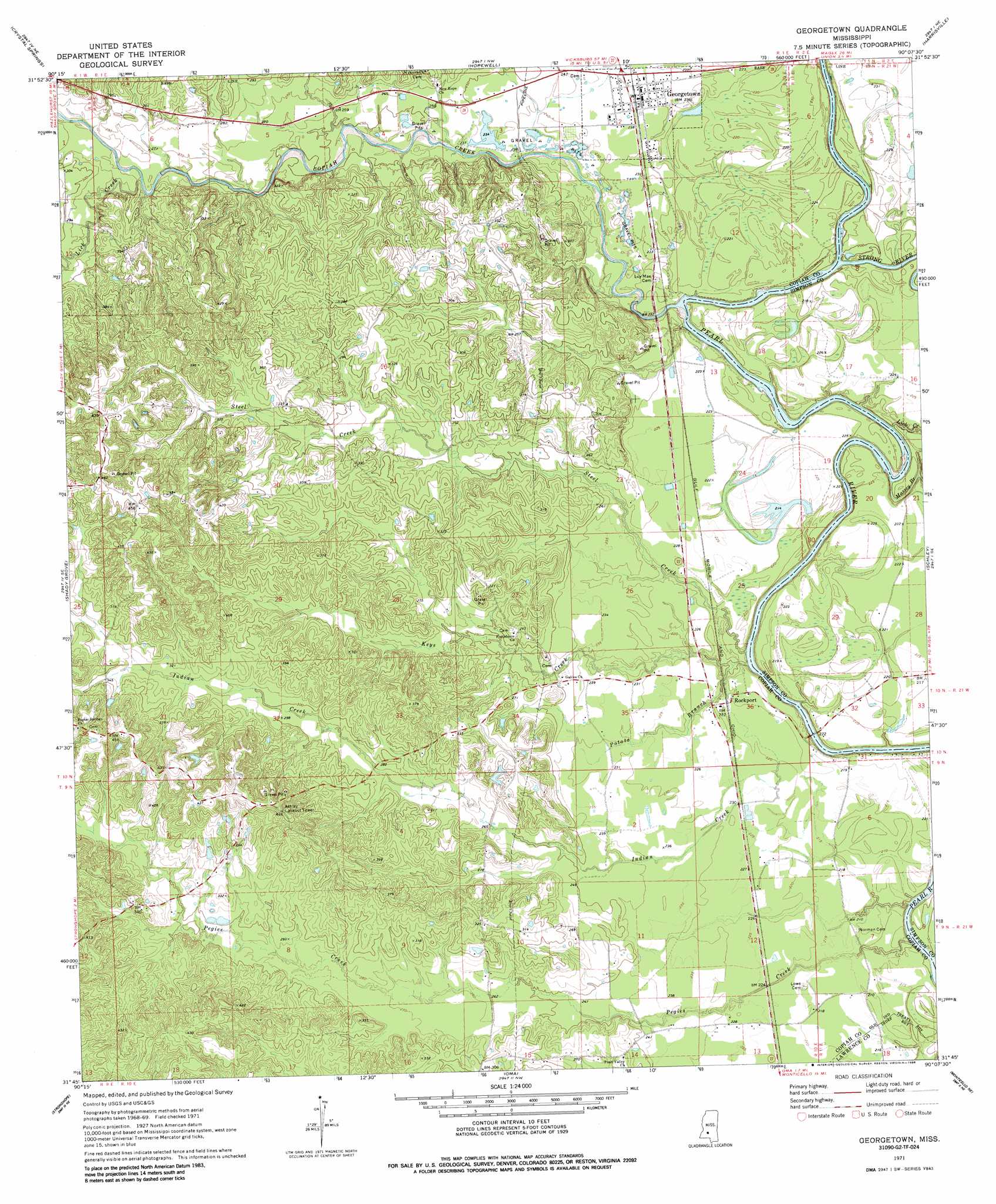
USGS Topo Quad 31090g2 - 1:24,000 scale
| Topo Map Name: | Georgetown |
| USGS Topo Quad ID: | 31090g2 |
| Print Size: | ca. 21 1/4" wide x 27" high |
| Southeast Coordinates: | 31.75° N latitude / 90.125° W longitude |
| Map Center Coordinates: | 31.8125° N latitude / 90.1875° W longitude |
| U.S. State: | MS |
| Filename: | o31090g2.jpg |
| Download Map JPG Image: | Georgetown topo map 1:24,000 scale |
| Map Type: | Topographic |
| Topo Series: | 7.5´ |
| Map Scale: | 1:24,000 |
| Source of Map Images: | United States Geological Survey (USGS) |
| Alternate Map Versions: |
Georgetown MS 1971, updated 1973 Download PDF Buy paper map Georgetown MS 1971, updated 1979 Download PDF Buy paper map Georgetown MS 1971, updated 1988 Download PDF Buy paper map Georgetown MS 2012 Download PDF Buy paper map Georgetown MS 2015 Download PDF Buy paper map |
1:24,000 Topo Quads surrounding Georgetown
Dabney Crossroads |
Terry |
Whites |
Star |
Braxton |
Gallman |
Crystal Springs |
Hopewell |
Harrisville |
Mendenhall West |
Hazlehurst |
Shady Grove |
Georgetown |
Schley |
Shivers |
Wesson |
Stronghope |
Oma |
Monticello Ne |
New Hebron |
Brookhaven |
Fair Oak Springs |
Nola |
Monticello |
Prentiss West |
> Back to 31090e1 at 1:100,000 scale
> Back to 31090a1 at 1:250,000 scale
> Back to U.S. Topo Maps home
Georgetown topo map: Gazetteer
Georgetown: Bridges
Rockport Bridge elevation 57m 187′Georgetown: Dams
Durr Farm Pond Dam elevation 91m 298′Georgetown: Populated Places
Coaler (historical) elevation 70m 229′Cowanville elevation 71m 232′
Georgetown elevation 73m 239′
Kinnaird (historical) elevation 70m 229′
Old Georgetown (historical) elevation 67m 219′
Rockport elevation 67m 219′
Georgetown: Streams
Copiah Creek elevation 59m 193′Indian Creek elevation 58m 190′
Keys Creek elevation 59m 193′
Lick Creek elevation 79m 259′
Lick Creek elevation 60m 196′
Massey Branch elevation 59m 193′
Pegies Creek elevation 57m 187′
Potato Branch elevation 63m 206′
Steel Creek elevation 57m 187′
Strong River elevation 60m 196′
Georgetown digital topo map on disk
Buy this Georgetown topo map showing relief, roads, GPS coordinates and other geographical features, as a high-resolution digital map file on DVD: