Gallman Topo Map Mississippi
To zoom in, hover over the map of Gallman
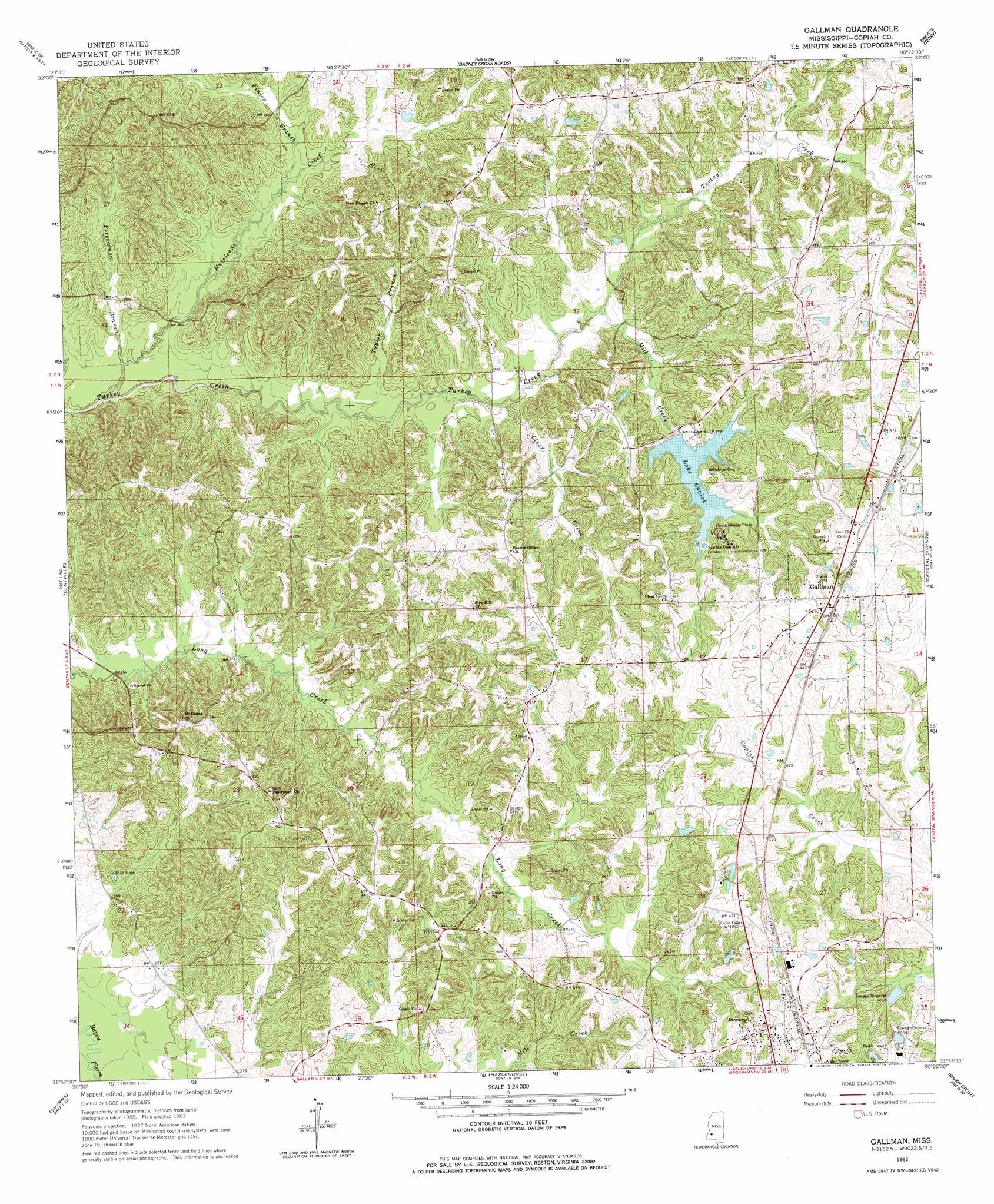
USGS Topo Quad 31090h4 - 1:24,000 scale
| Topo Map Name: | Gallman |
| USGS Topo Quad ID: | 31090h4 |
| Print Size: | ca. 21 1/4" wide x 27" high |
| Southeast Coordinates: | 31.875° N latitude / 90.375° W longitude |
| Map Center Coordinates: | 31.9375° N latitude / 90.4375° W longitude |
| U.S. State: | MS |
| Filename: | o31090h4.jpg |
| Download Map JPG Image: | Gallman topo map 1:24,000 scale |
| Map Type: | Topographic |
| Topo Series: | 7.5´ |
| Map Scale: | 1:24,000 |
| Source of Map Images: | United States Geological Survey (USGS) |
| Alternate Map Versions: |
Gallman MS 1963, updated 1964 Download PDF Buy paper map Gallman MS 1963, updated 1978 Download PDF Buy paper map Gallman MS 1963, updated 1978 Download PDF Buy paper map Gallman MS 2012 Download PDF Buy paper map Gallman MS 2015 Download PDF Buy paper map |
1:24,000 Topo Quads surrounding Gallman
Cayuga |
Learned |
Terry Nw |
New Byram |
Florence |
Utica West |
Utica East |
Dabney Crossroads |
Terry |
Whites |
Dentville Nw |
Dentville |
Gallman |
Crystal Springs |
Hopewell |
Barlow |
Smyrna |
Hazlehurst |
Shady Grove |
Georgetown |
Caseyville |
Midway |
Wesson |
Stronghope |
Oma |
> Back to 31090e1 at 1:100,000 scale
> Back to 31090a1 at 1:250,000 scale
> Back to U.S. Topo Maps home
Gallman topo map: Gazetteer
Gallman: Crossings
Interchange 65 elevation 137m 449′Interchange 68 elevation 120m 393′
Gallman: Dams
Lake Copiah Dam elevation 123m 403′Gallman: Populated Places
Gallman elevation 144m 472′Tillman elevation 134m 439′
Gallman: Post Offices
Gallman Post Office elevation 146m 479′Gallman: Reservoirs
Lake Copiah elevation 110m 360′Gallman: Streams
Clear Creek elevation 88m 288′Finley Branch elevation 85m 278′
Hurricane Creek elevation 71m 232′
Mill Creek elevation 92m 301′
Persimmon Branch elevation 75m 246′
Taylor Branch elevation 82m 269′
Gallman digital topo map on disk
Buy this Gallman topo map showing relief, roads, GPS coordinates and other geographical features, as a high-resolution digital map file on DVD: