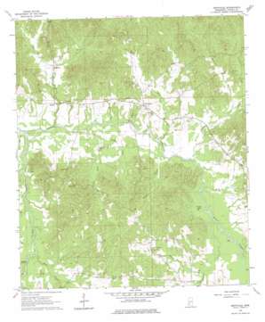
Dentville Topo Map Mississippi
To zoom in, hover over the map of Dentville
USGS Topo Quad 31090h5 - 1:24,000 scale
| Topo Map Name: | Dentville |
| USGS Topo Quad ID: | 31090h5 |
| Print Size: | ca. 21 1/4" wide x 27" high |
| Southeast Coordinates: | 31.875° N latitude / 90.5° W longitude |
| Map Center Coordinates: | 31.9375° N latitude / 90.5625° W longitude |
| U.S. State: | MS |
| Filename: | o31090h5.jpg |
| Download Map JPG Image: | Dentville topo map 1:24,000 scale |
| Map Type: | Topographic |
| Topo Series: | 7.5´ |
| Map Scale: | 1:24,000 |
| Source of Map Images: | United States Geological Survey (USGS) |
| Alternate Map Versions: |
Dentville MS 1963, updated 1964 Download PDF Buy paper map Dentville MS 1963, updated 1976 Download PDF Buy paper map Dentville MS 1963, updated 1976 Download PDF Buy paper map Dentville MS 2012 Download PDF Buy paper map Dentville MS 2015 Download PDF Buy paper map |
1:24,000 Topo Quads surrounding Dentville
> Back to 31090e1 at 1:100,000 scale
> Back to 31090a1 at 1:250,000 scale
> Back to U.S. Topo Maps home
Dentville topo map: Gazetteer
Dentville: Dams
Andrew Jackson Boy Scout Lake Dam elevation 73m 239′Dentville: Lakes
Causey Lake elevation 65m 213′Dentville: Populated Places
Dentville elevation 81m 265′Hoodtown elevation 78m 255′
Willing elevation 63m 206′
Dentville: Post Offices
Mount Washington Post Office (historical) elevation 84m 275′Dentville: Streams
Anderson Branch elevation 67m 219′Bell Branch elevation 50m 164′
Boggy Bayou elevation 57m 187′
Choctaw Creek elevation 51m 167′
Dry Creek elevation 58m 190′
Foster Creek elevation 51m 167′
Halls Creek elevation 60m 196′
Holcomb Creek elevation 64m 209′
Horsepen Creek elevation 60m 196′
King Branch elevation 55m 180′
Latimore Branch elevation 70m 229′
Long Creek elevation 64m 209′
Martin Branch elevation 60m 196′
Mill Creek elevation 58m 190′
Sugar Creek elevation 59m 193′
Turkey Creek elevation 61m 200′
Whisky Creek elevation 72m 236′
Yellow Sand Creek elevation 55m 180′
Dentville digital topo map on disk
Buy this Dentville topo map showing relief, roads, GPS coordinates and other geographical features, as a high-resolution digital map file on DVD:


