Slocum Topo Map Louisiana
To zoom in, hover over the map of Slocum
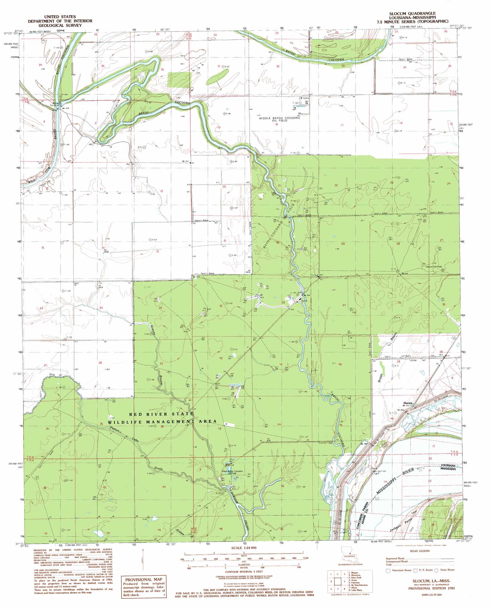
USGS Topo Quad 31091c6 - 1:24,000 scale
| Topo Map Name: | Slocum |
| USGS Topo Quad ID: | 31091c6 |
| Print Size: | ca. 21 1/4" wide x 27" high |
| Southeast Coordinates: | 31.25° N latitude / 91.625° W longitude |
| Map Center Coordinates: | 31.3125° N latitude / 91.6875° W longitude |
| U.S. States: | LA, MS |
| Filename: | o31091c6.jpg |
| Download Map JPG Image: | Slocum topo map 1:24,000 scale |
| Map Type: | Topographic |
| Topo Series: | 7.5´ |
| Map Scale: | 1:24,000 |
| Source of Map Images: | United States Geological Survey (USGS) |
| Alternate Map Versions: |
Slocum LA 1983, updated 1984 Download PDF Buy paper map Slocum LA 1983, updated 1984 Download PDF Buy paper map Slocum LA 2012 Download PDF Buy paper map Slocum LA 2015 Download PDF Buy paper map |
1:24,000 Topo Quads surrounding Slocum
Walters |
Jonesville South |
Frogmore |
Ferriday South |
Natchez |
Larto Lake North |
Mayna |
Monterey |
Deer Park |
Sibley |
Larto Lake South |
Acme |
Slocum |
Fairview |
Buck Island |
Lac Sainte Agnes |
Ile Natchitoches |
Shaw |
Lake Mary |
Lessley |
Moreauville |
Big Bend |
Turnbull Island |
Fort Adams |
Pinckneyville |
> Back to 31091a1 at 1:100,000 scale
> Back to 31090a1 at 1:250,000 scale
> Back to U.S. Topo Maps home
Slocum topo map: Gazetteer
Slocum: Capes
Jackson Point elevation 15m 49′Slocum: Oilfields
Bayou Cocodrie Oil Field elevation 11m 36′Dobbs Bay Oil Field elevation 10m 32′
Greens Bayou Oil Field elevation 12m 39′
Middle Bayou Cocodrie Oil Field elevation 12m 39′
Slocum Oil Field elevation 12m 39′
South Slocum Oil Field elevation 12m 39′
West Bayou Cocodrie Oil Field elevation 11m 36′
West Slocum Oil Field elevation 12m 39′
Slocum: Parks
Red River State Wildlife Management Area elevation 11m 36′Slocum: Populated Places
Bougere elevation 15m 49′Slocum elevation 18m 59′
Slocum: Streams
Boggy Bayou elevation 13m 42′Greens Bayou elevation 9m 29′
Patton Lake Drain elevation 9m 29′
Slocum: Swamps
Muddy Swamp (historical) elevation 12m 39′Slocum digital topo map on disk
Buy this Slocum topo map showing relief, roads, GPS coordinates and other geographical features, as a high-resolution digital map file on DVD: