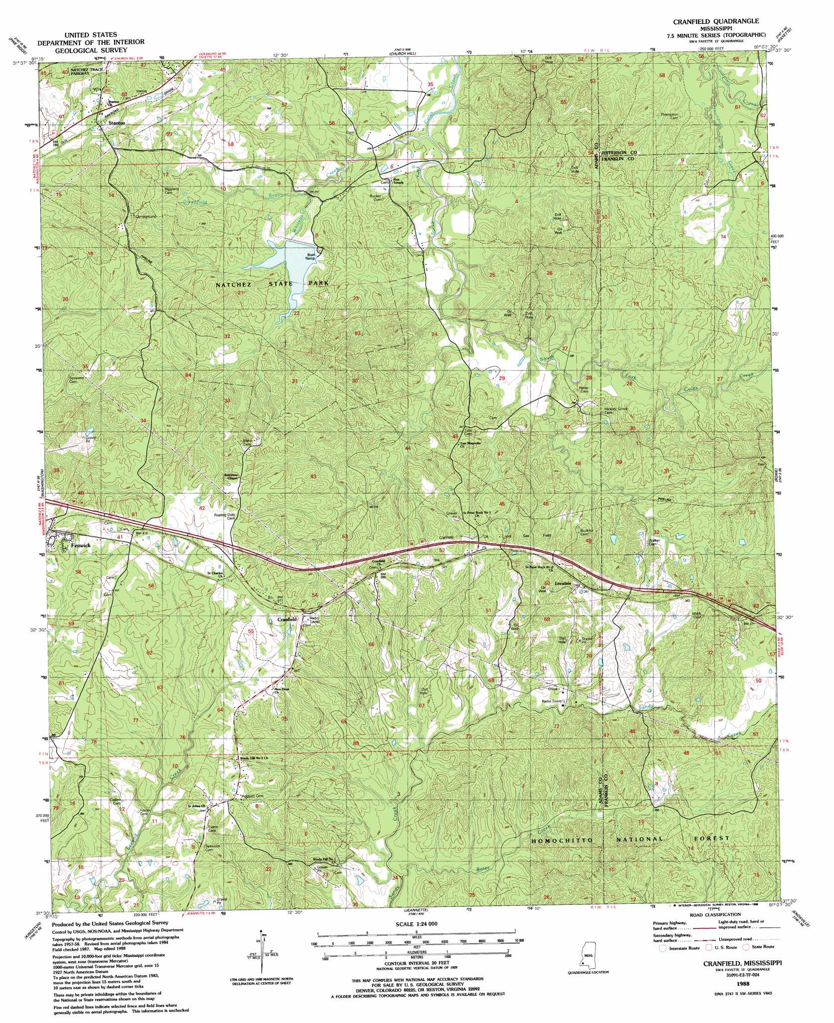
Cranfield Topo Map Mississippi
To zoom in, hover over the map of Cranfield
USGS Topo Quad 31091e2 - 1:24,000 scale
| Topo Map Name: | Cranfield |
| USGS Topo Quad ID: | 31091e2 |
| Print Size: | ca. 21 1/4" wide x 27" high |
| Southeast Coordinates: | 31.5° N latitude / 91.125° W longitude |
| Map Center Coordinates: | 31.5625° N latitude / 91.1875° W longitude |
| U.S. State: | MS |
| Filename: | o31091e2.jpg |
| Download Map JPG Image: | Cranfield topo map 1:24,000 scale |
| Map Type: | Topographic |
| Topo Series: | 7.5´ |
| Map Scale: | 1:24,000 |
| Source of Map Images: | United States Geological Survey (USGS) |
| Alternate Map Versions: |
Cranfield MS 1988, updated 1988 Download PDF Buy paper map Cranfield MS 2012 Download PDF Buy paper map Cranfield MS 2015 Download PDF Buy paper map |
| FStopo: | US Forest Service topo Cranfield is available: Download FStopo PDF Download FStopo TIF |
1:24,000 Topo Quads surrounding Cranfield
Waterproof |
Chamblee |
Rodney |
Lorman |
Red Lick |
Spokane |
Pine Ridge |
Church Hill |
Fayette |
Gin Branch |
Natchez |
Washington |
Cranfield |
Roxie |
Kirby |
Sibley |
Kingston |
Jeannette |
Knoxville |
Meadville |
Buck Island |
Doloroso |
Garden City |
Crosby |
Homochitto |
> Back to 31091e1 at 1:100,000 scale
> Back to 31090a1 at 1:250,000 scale
> Back to U.S. Topo Maps home
Cranfield topo map: Gazetteer
Cranfield: Oilfields
Cranfield Oil and Gas Field elevation 101m 331′Fenwick Oil Field elevation 97m 318′
Forest Home Oil Field elevation 86m 282′
Galilee Oil Field elevation 101m 331′
Moss Grove Oil Field elevation 90m 295′
Southwest Cranfield Oil Field elevation 112m 367′
Cranfield: Parks
Natchez State Park elevation 73m 239′Cranfield: Populated Places
Cranfield elevation 122m 400′Fenwick elevation 128m 419′
Leesdale elevation 117m 383′
Stanton elevation 94m 308′
Cranfield: Streams
Bates Creek elevation 61m 200′Greenfield Bayou elevation 60m 196′
Sandy Bayou elevation 89m 291′
Thompson Creek elevation 61m 200′
Whitens Creek elevation 52m 170′
Cranfield digital topo map on disk
Buy this Cranfield topo map showing relief, roads, GPS coordinates and other geographical features, as a high-resolution digital map file on DVD: