Lorman Topo Map Mississippi
To zoom in, hover over the map of Lorman
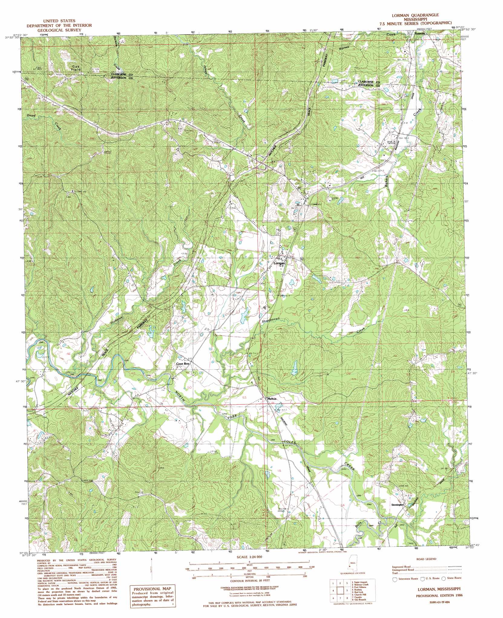
USGS Topo Quad 31091g1 - 1:24,000 scale
| Topo Map Name: | Lorman |
| USGS Topo Quad ID: | 31091g1 |
| Print Size: | ca. 21 1/4" wide x 27" high |
| Southeast Coordinates: | 31.75° N latitude / 91° W longitude |
| Map Center Coordinates: | 31.8125° N latitude / 91.0625° W longitude |
| U.S. State: | MS |
| Filename: | o31091g1.jpg |
| Download Map JPG Image: | Lorman topo map 1:24,000 scale |
| Map Type: | Topographic |
| Topo Series: | 7.5´ |
| Map Scale: | 1:24,000 |
| Source of Map Images: | United States Geological Survey (USGS) |
| Alternate Map Versions: |
Lorman MS 1986, updated 1986 Download PDF Buy paper map Lorman MS 2012 Download PDF Buy paper map Lorman MS 2015 Download PDF Buy paper map |
1:24,000 Topo Quads surrounding Lorman
Saranac |
Newellton |
Grand Gulf |
Willows |
Carlisle |
Lake Bruin |
Saint Joseph |
Widows Creek |
Port Gibson |
Hermanville |
Chamblee |
Rodney |
Lorman |
Red Lick |
Mcbride |
Pine Ridge |
Church Hill |
Fayette |
Gin Branch |
Union Church |
Washington |
Cranfield |
Roxie |
Kirby |
Eddicetown |
> Back to 31091e1 at 1:100,000 scale
> Back to 31090a1 at 1:250,000 scale
> Back to U.S. Topo Maps home
Lorman topo map: Gazetteer
Lorman: Dams
C L Huff Lake Dam elevation 57m 187′C L Huff Lake Dam elevation 55m 180′
Katherine Street Lake Dam elevation 60m 196′
Sam Fonda Lake Dam elevation 58m 190′
Lorman: Oilfields
Russum Oil Field elevation 77m 252′Lorman: Populated Places
Clifton elevation 85m 278′Lorman elevation 66m 216′
Melton elevation 55m 180′
North Fork (historical) elevation 68m 223′
Shankstown (historical) elevation 85m 278′
Stonington elevation 67m 219′
Lorman: Streams
Barnes Creek elevation 44m 144′Bolls Creek elevation 49m 160′
Hickman Creek elevation 37m 121′
Shankstown Creek elevation 43m 141′
Lorman digital topo map on disk
Buy this Lorman topo map showing relief, roads, GPS coordinates and other geographical features, as a high-resolution digital map file on DVD: