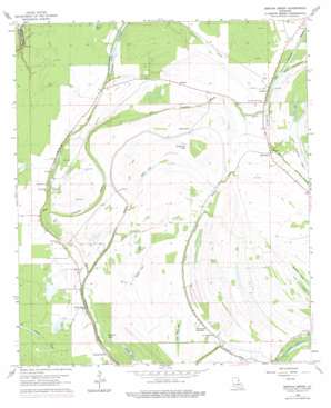
Gretna Green Topo Map Louisiana
To zoom in, hover over the map of Gretna Green
USGS Topo Quad 31091h4 - 1:24,000 scale
| Topo Map Name: | Gretna Green |
| USGS Topo Quad ID: | 31091h4 |
| Print Size: | ca. 21 1/4" wide x 27" high |
| Southeast Coordinates: | 31.875° N latitude / 91.375° W longitude |
| Map Center Coordinates: | 31.9375° N latitude / 91.4375° W longitude |
| U.S. State: | LA |
| Filename: | o31091h4.jpg |
| Download Map JPG Image: | Gretna Green topo map 1:24,000 scale |
| Map Type: | Topographic |
| Topo Series: | 7.5´ |
| Map Scale: | 1:24,000 |
| Source of Map Images: | United States Geological Survey (USGS) |
| Alternate Map Versions: |
Gretna Green LA 1963, updated 1964 Download PDF Buy paper map Gretna Green LA 1963, updated 1977 Download PDF Buy paper map Gretna Green LA 1998, updated 2002 Download PDF Buy paper map Gretna Green LA 2012 Download PDF Buy paper map Gretna Green LA 2015 Download PDF Buy paper map |
1:24,000 Topo Quads surrounding Gretna Green
> Back to 31091e1 at 1:100,000 scale
> Back to 31090a1 at 1:250,000 scale
> Back to U.S. Topo Maps home
Gretna Green topo map: Gazetteer
Gretna Green: Guts
Crooked Bayou elevation 18m 59′Gretna Green: Lakes
Broad Lake (historical) elevation 17m 55′Brushy Lake elevation 16m 52′
Bryland Lake elevation 19m 62′
Lake Black Dog elevation 19m 62′
Lake Formosa elevation 15m 49′
Levi Lake elevation 19m 62′
Mackey Lake elevation 18m 59′
Miller Lake elevation 15m 49′
Skeeter Lake elevation 18m 59′
Snodgrass Lake elevation 18m 59′
Turkey Lake elevation 18m 59′
Wilson Lake elevation 18m 59′
Gretna Green: Oilfields
Chamblee Gas Field elevation 20m 65′Hard Bargin Gas Field elevation 20m 65′
Helena Oil Field elevation 18m 59′
Holly Ridge Gas and Oil Field elevation 19m 62′
North Holly Ridge Oil Field elevation 18m 59′
Sundown Oil Field elevation 19m 62′
Gretna Green: Populated Places
Ashland elevation 22m 72′Cooter Point elevation 20m 65′
Dixie (historical) elevation 20m 65′
Gretna Green elevation 20m 65′
Holly Ridge elevation 20m 65′
Justina elevation 20m 65′
Mayflower elevation 20m 65′
Shady Grove elevation 20m 65′
Gretna Green: Streams
Dickard Bayou elevation 13m 42′Little Choctaw Bayou elevation 14m 45′
Gretna Green: Swamps
Long Lake elevation 18m 59′Pecan Brake elevation 16m 52′
Gretna Green digital topo map on disk
Buy this Gretna Green topo map showing relief, roads, GPS coordinates and other geographical features, as a high-resolution digital map file on DVD:


