Enterprise Topo Map Louisiana
To zoom in, hover over the map of Enterprise
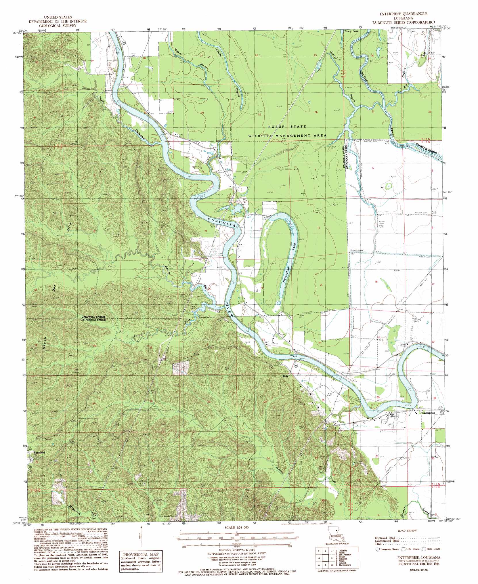
USGS Topo Quad 31091h8 - 1:24,000 scale
| Topo Map Name: | Enterprise |
| USGS Topo Quad ID: | 31091h8 |
| Print Size: | ca. 21 1/4" wide x 27" high |
| Southeast Coordinates: | 31.875° N latitude / 91.875° W longitude |
| Map Center Coordinates: | 31.9375° N latitude / 91.9375° W longitude |
| U.S. State: | LA |
| Filename: | o31091h8.jpg |
| Download Map JPG Image: | Enterprise topo map 1:24,000 scale |
| Map Type: | Topographic |
| Topo Series: | 7.5´ |
| Map Scale: | 1:24,000 |
| Source of Map Images: | United States Geological Survey (USGS) |
| Alternate Map Versions: |
Enterprise LA 1984, updated 1985 Download PDF Buy paper map Enterprise LA 2012 Download PDF Buy paper map Enterprise LA 2015 Download PDF Buy paper map |
1:24,000 Topo Quads surrounding Enterprise
Blankston |
Riverton |
Hebert |
Liddieville |
Winnsboro |
Clark |
Columbia |
Mason |
Fort Necessity |
Gilbert |
Olla East |
Holum |
Enterprise |
Extension |
Wisner |
Summerville |
Nickel |
Aimwell |
Harrisonburg |
Sicily Island |
Jena West |
Jena East |
Manifest |
Jonesville North |
Dunbarton |
> Back to 31091e1 at 1:100,000 scale
> Back to 31090a1 at 1:250,000 scale
> Back to U.S. Topo Maps home
Enterprise topo map: Gazetteer
Enterprise: Dams
S B Harrelson Pond Dam elevation 16m 52′Enterprise: Guts
Sandy Bayou elevation 17m 55′Enterprise: Lakes
Horseshoe Lake elevation 18m 59′Lively Lake elevation 12m 39′
Enterprise: Populated Places
Duty elevation 23m 75′Enterprise elevation 18m 59′
Rosefield elevation 89m 291′
Enterprise: Post Offices
Enterprise Post Office elevation 19m 62′Enterprise: Streams
Bayou Calamus elevation 11m 36′Bayou Dan elevation 10m 32′
Bayou Wade elevation 10m 32′
Big Grassy Bayou elevation 12m 39′
Grassy Bayou elevation 12m 39′
South Fork Bayou Dan elevation 10m 32′
Enterprise: Summits
Bayou Dan Hills elevation 37m 121′Rocky Hill elevation 83m 272′
Enterprise digital topo map on disk
Buy this Enterprise topo map showing relief, roads, GPS coordinates and other geographical features, as a high-resolution digital map file on DVD: