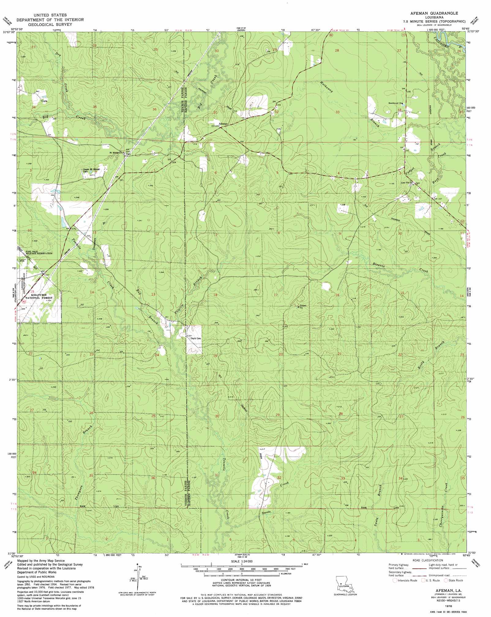
Afeman Topo Map Louisiana
To zoom in, hover over the map of Afeman
USGS Topo Quad 31092a7 - 1:24,000 scale
| Topo Map Name: | Afeman |
| USGS Topo Quad ID: | 31092a7 |
| Print Size: | ca. 21 1/4" wide x 27" high |
| Southeast Coordinates: | 31° N latitude / 92.75° W longitude |
| Map Center Coordinates: | 31.0625° N latitude / 92.8125° W longitude |
| U.S. State: | LA |
| Filename: | o31092a7.jpg |
| Download Map JPG Image: | Afeman topo map 1:24,000 scale |
| Map Type: | Topographic |
| Topo Series: | 7.5´ |
| Map Scale: | 1:24,000 |
| Source of Map Images: | United States Geological Survey (USGS) |
| Alternate Map Versions: |
Leander SE LA 1954, updated 1959 Download PDF Buy paper map Afeman LA 2003, updated 2005 Download PDF Buy paper map Afeman LA 2012 Download PDF Buy paper map Afeman LA 2015 Download PDF Buy paper map |
| FStopo: | US Forest Service topo Afeman is available: Download FStopo PDF Download FStopo TIF |
1:24,000 Topo Quads surrounding Afeman
Simpson North |
Temple |
Jericho |
Gardner |
Rapides |
Simpson South |
Lacamp |
Sieper |
Elmer |
Woodworth West |
Birds Creek |
Fullerton Lake |
Afeman |
Melder |
Forest Hill |
Sugrue |
Pitkin |
Steep Gully |
Pawnee |
Glenmora |
Sugartown |
Grant |
Elizabeth |
Oakdale |
Beaver |
> Back to 31092a1 at 1:100,000 scale
> Back to 31092a1 at 1:250,000 scale
> Back to U.S. Topo Maps home
Afeman topo map: Gazetteer
Afeman: Populated Places
Afeman elevation 69m 226′Cora elevation 72m 236′
Afeman: Streams
Bay Branch elevation 58m 190′Dry Creek elevation 61m 200′
Hathaway Branch elevation 45m 147′
Mill Creek elevation 46m 150′
Pilgrim Branch elevation 56m 183′
Swetz Creek elevation 49m 160′
Templeton Branch elevation 62m 203′
Afeman digital topo map on disk
Buy this Afeman topo map showing relief, roads, GPS coordinates and other geographical features, as a high-resolution digital map file on DVD: