Jericho Topo Map Louisiana
To zoom in, hover over the map of Jericho
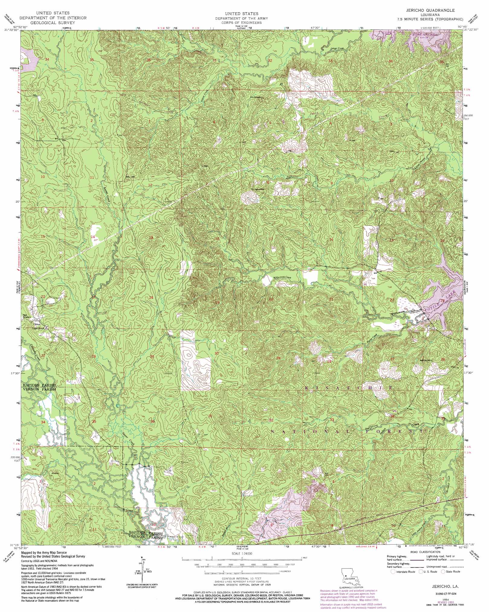
USGS Topo Quad 31092c7 - 1:24,000 scale
| Topo Map Name: | Jericho |
| USGS Topo Quad ID: | 31092c7 |
| Print Size: | ca. 21 1/4" wide x 27" high |
| Southeast Coordinates: | 31.25° N latitude / 92.75° W longitude |
| Map Center Coordinates: | 31.3125° N latitude / 92.8125° W longitude |
| U.S. State: | LA |
| Filename: | o31092c7.jpg |
| Download Map JPG Image: | Jericho topo map 1:24,000 scale |
| Map Type: | Topographic |
| Topo Series: | 7.5´ |
| Map Scale: | 1:24,000 |
| Source of Map Images: | United States Geological Survey (USGS) |
| Alternate Map Versions: |
Jericho LA 1954, updated 1959 Download PDF Buy paper map Jericho LA 1954, updated 1977 Download PDF Buy paper map Jericho LA 1954, updated 1986 Download PDF Buy paper map Jericho LA 1954, updated 1993 Download PDF Buy paper map Jericho LA 2003, updated 2005 Download PDF Buy paper map Jericho LA 2012 Download PDF Buy paper map Jericho LA 2015 Download PDF Buy paper map |
| FStopo: | US Forest Service topo Jericho is available: Download FStopo PDF Download FStopo TIF |
1:24,000 Topo Quads surrounding Jericho
Natchitoches South |
Cloutierville |
Aloha |
Colfax |
Dry Prong |
Bayou Livrogne |
Gorum |
Lena |
Boyce |
Rock Hill |
Simpson North |
Temple |
Jericho |
Gardner |
Rapides |
Simpson South |
Lacamp |
Sieper |
Elmer |
Woodworth West |
Birds Creek |
Fullerton Lake |
Afeman |
Melder |
Forest Hill |
> Back to 31092a1 at 1:100,000 scale
> Back to 31092a1 at 1:250,000 scale
> Back to U.S. Topo Maps home
Jericho topo map: Gazetteer
Jericho: Populated Places
Clifton elevation 72m 236′Jericho elevation 62m 203′
Odom (historical) elevation 54m 177′
Jericho: Streams
Campbell Creek elevation 33m 108′Canal Bayou elevation 29m 95′
Dry Prong elevation 37m 121′
Little Indian Creek elevation 38m 124′
Rocky Creek elevation 31m 101′
Williamson Creek elevation 33m 108′
Jericho: Summits
Dough Hills elevation 71m 232′Jericho digital topo map on disk
Buy this Jericho topo map showing relief, roads, GPS coordinates and other geographical features, as a high-resolution digital map file on DVD: